Old City of Ahmedabad
This is preliminary research for creating my next pop-up card.
According to the UNESCO website, India has 44 World Heritage Sites (as of March 2026). There are so many that I’m not sure where to start, but this time I’ve chosen “The Historic City of Ahmedabad” from among them.
The name Ahmedabad is derived from Ahmad Shah I (
?–1443), who established his capital here in 1411. He was the ruler of the Gujarat Sultanate, an Islamic dynasty that existed in western India.
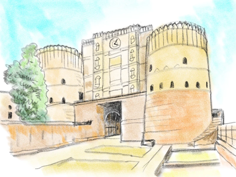
The sketch above depicts Bhadra Fort, built by Ahmad Shah.
Let’s take a look at a map of old Ahmedabad.
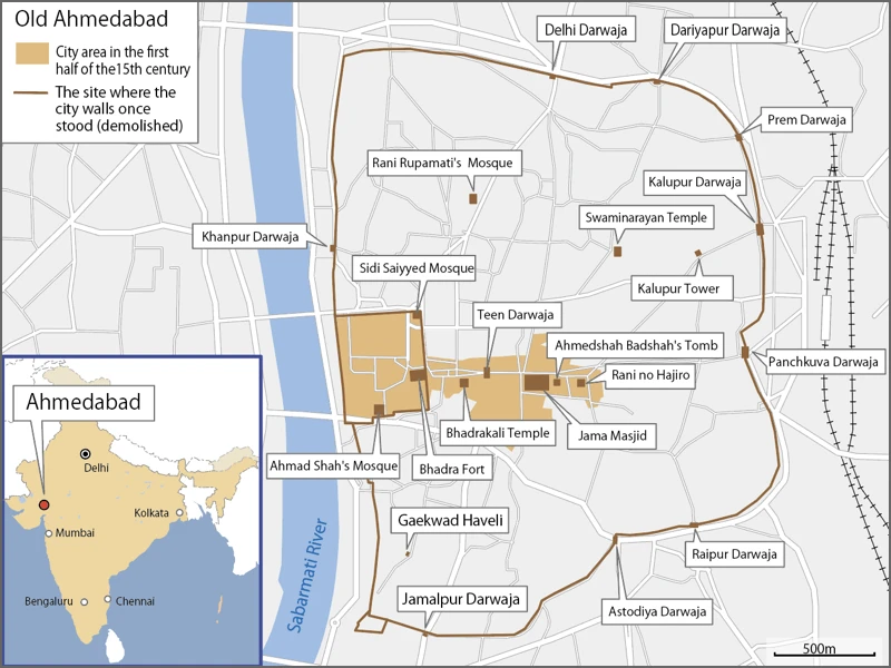
Ahmad Shah I began construction of Bhadra Fort on the east bank of the Sabarmati River in 1411. The fort was enclosed by rectangular walls (shown as the inner, smaller walls on the map) and was completed in 1413. As mosques and residences were built within the fort and to its east, the city gradually developed.
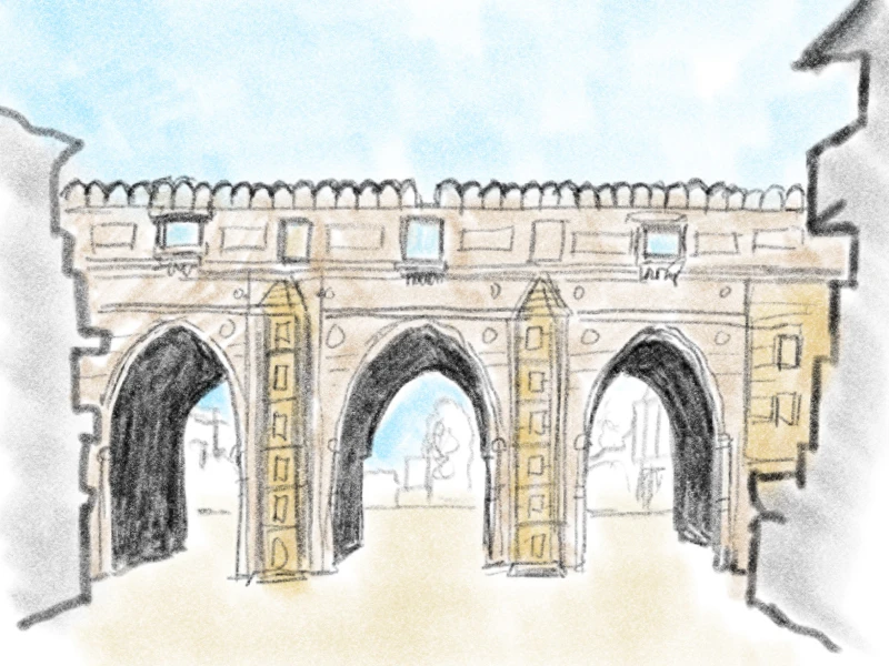
This is the Teen Gate (Teen Darwaza), built in 1415.
The gate still stands today on the road extending east from Bhadra Fort.
Further east of the gate stands the Jama Masjid, Ahmedabad’s largest mosque. It was founded in 1424.
The area shaded in brown on the map above represents the city’s boundaries around the first half of the 15th century.
As the city continued to expand, Ahmad Shah’s grandson, Mahmoud Shah I (?–1511), constructed a 10-kilometer-long outer wall in 1487, featuring 12 gates and 189 bastions, thereby expanding the scale of the fortified city.
However, the walls were largely dismantled in later periods, and only the gates remain today. The map above shows the gates that can be viewed via Google Street View.
As time passed, in 1573, Ahmedabad was conquered by the Mughal Empire and became the capital of the state of Gujarat.
Later, in the 18th century, the Mughal Empire and the Maratha Kingdom fought over control of the city, and in 1757, an alliance between the Maratha Kingdom and the Gaikwad dynasty (the Maratha Confederacy) brought the city under their control.
In 1818, the city came under British colonial rule.
Due to several changes in rulers, the area within and around the city walls features not only medieval residences and mosques but also religious sites belonging to Hinduism, Jainism, Christianity, Judaism, and Zoroastrianism. As an example of multicultural coexistence and for preserving architectural heritage spanning several centuries, the Old City of Ahmedabad was inscribed as a World Heritage Site in 2017.
Now, regarding the pop-up cards, I plan to select a few buildings from the map above to create them. I will update the main website once they are complete, so please bear with me for a little while.
[Reference]
"Historic City of Ahmadabad" (UNESCO official website)