Tazawa-bashi Bridge
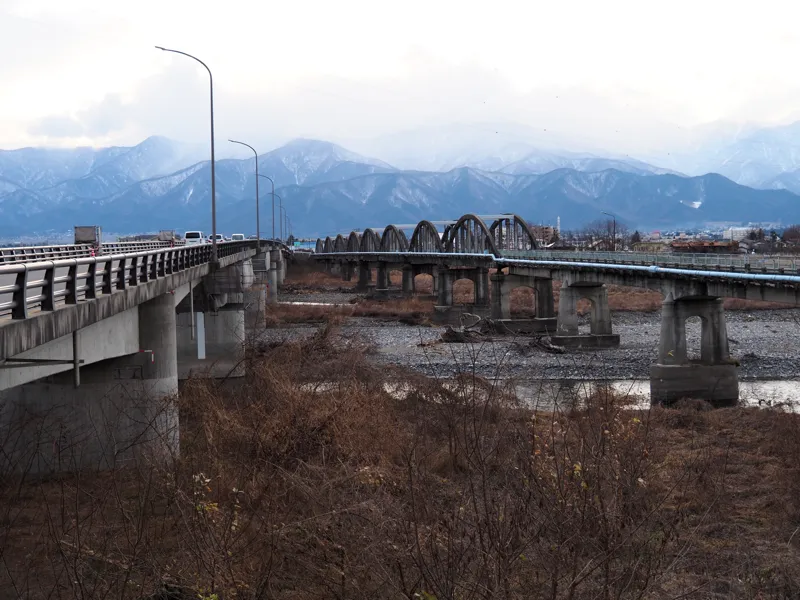
Driving east from the Azumino Interchange on the Nagano Expressway, there are bridges across the Saigawa River.
These are two bridges, one for cars and the other for pedestrians.
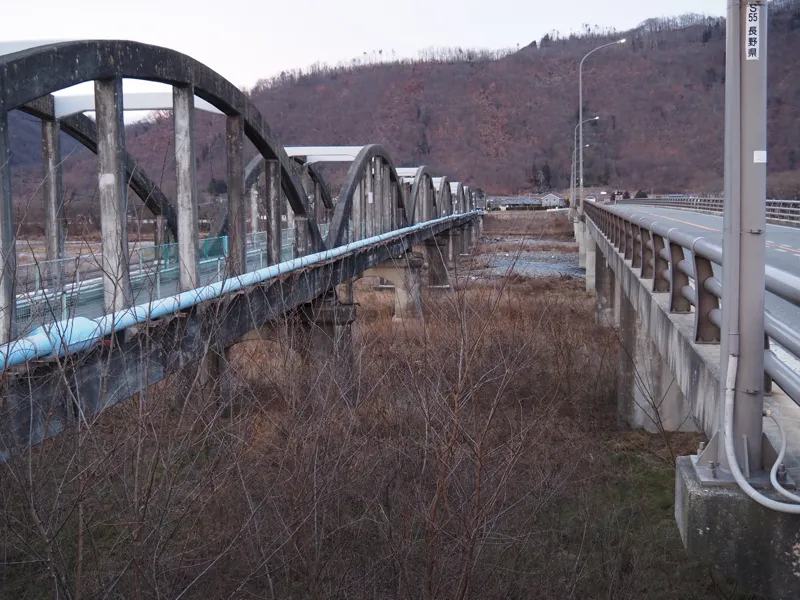
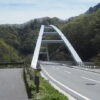
The right one is for cars and the left one is for pedestrians.
Every time I drove by the bridge, I was always curious about the old bridge next to it, but I always just passed it by.
The other day, I finally walked across this bridge, so I will introduce it by posting some photos.
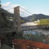
As you can see, the bridge on the left is older and the one on the right is newer, but both are called Tazawa-bashi Bridge.
The old bridge was originally for cars and switched to pedestrian use, but not abolished, so I think the name has been retained.
The old Tazawa-bashi was completed in March 1955, and the current automobile bridge was completed in March 1980.
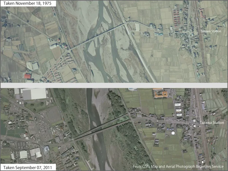
The two aerial photos taken in different years are shown in the above and below for comparison; the 1975 photo shows only one bridge.
Let’s walk across the bridge.
This is the west side of the bridge. There is a yellow pole in the center of the bridge to keep cars out.
I did not measure the width properly, but I guess it is about 3.5 meters. It seems impossible for cars to pass each other.
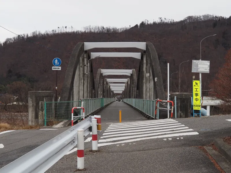
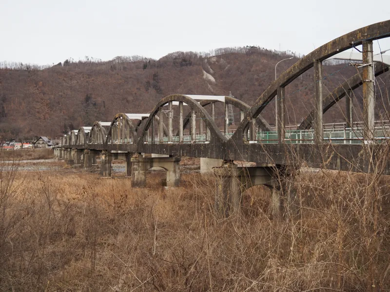
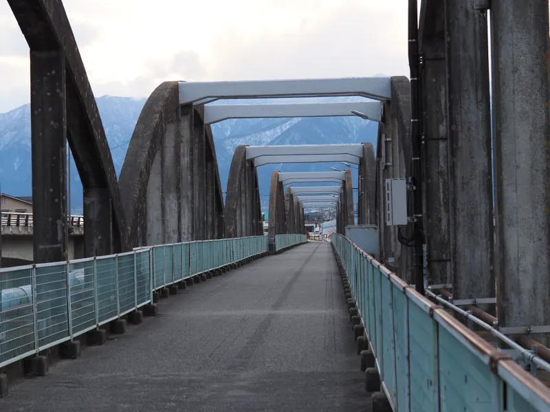
The bridge is a reinforced concrete Lohse bridge with eight arches in a row, and there is a reinforced concrete Gerber girder section further to the east.
Some communication cables run through the bridge, occupancy permit plates for NTT East, KDDI, and Azumino TV were posted.
The fences on both sides were probably added when they switched to pedestrian use.
The gray part on the left is the cable case, and the light blue pipe on the right is the water supply.
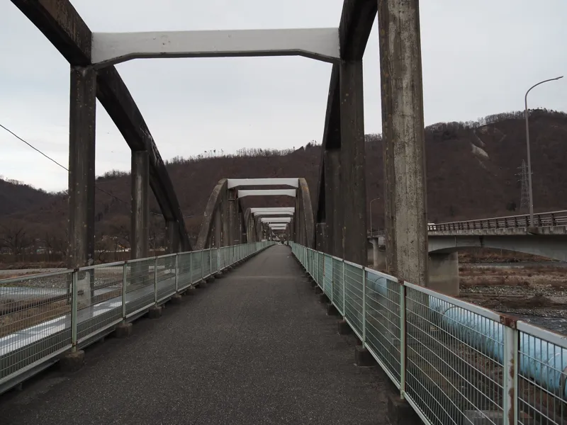
Can you see in this picture?
The width of the bridge is a little different.
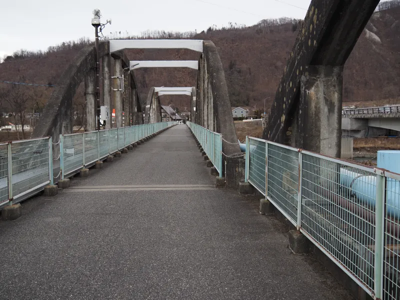
I walked up to the arch connection in the photo above, turned around, and took this photo.
Counting from the west, the fifth and sixth arches are slightly wider.
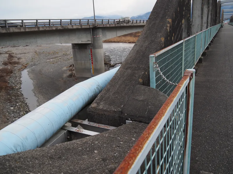
Does this mean that the arches were made a little wider so that cars can pass each other in the center?
It would be difficult for today’s cars to pass each other, but cars in the 1960s might have been able to pass each other here.
The arch section was ended, and the rest was a series of five Gerber girders.
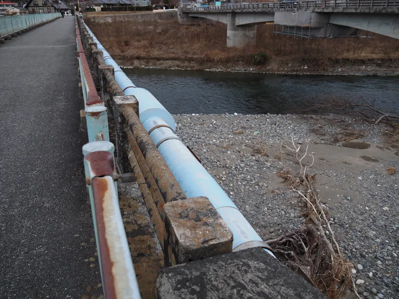
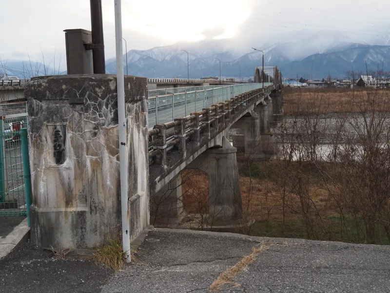
I reached the east bank.
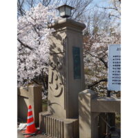
On the newel was written “Tazawa-bashi” and on the other newel, “Completed in March, 1965″.
I went down to the riverbank and took this photo.

From the east side, the two bridges, old and new, were photographed together.
Then I walked the bridge again and returned to the west bank.
I wonder if this picture is more revealing of the fact that the bridge was built wider in the middle part.
Now, what kind of bridge existed before this bridge was built?
It seems that in the early Meiji Era, boat bridges were the mainstream on the Saigawa and Chikuma-gawa Rivers. Around 1890s, wooden bridges were replaced on the Chikuma River.
In the Azumino region, discussions about building a bridge began around 1901, and the Tazawa-bashi Bridge was completed in July 1907. Records show that it was 365 m long and 3.6 m wide.
The wooden bridge was washed away by heavy rain in 1927. The two center spans of the bridge were said to have washed away, so it must have been restored after that, but I could not find any record of it.
As for the bridge I crossed today, it seems that construction began in 1951.
Finally, let me quote from an article written about the completion of the automobile bridge.
The citation is from the May 1980 issue of the magazine “Road".
“The Tazawa-bashi Bridge on the Aiya-cho to Tazawa Station Route, which has been under construction by Nagano Prefecture since 1972, was completed and opened to traffic on April 4. The old bridge was too narrow to accommodate the daily lives of the local residents, and the smooth flow of traffic was hindered because of alternating traffic due to the narrow width of the old bridge. The opening of the bridge is expected to improve the safety and smoothness of traffic."
It says that the bridge is 361.4 m long and 8 m wide.
As written here, the old bridge was narrow, so it was used for alternating traffic. I think that the wide part in the center must have been a place for cars to pass each other.
[Reference]
"Ten Years of Prefectural Government” (Nagano Prefectural Printing Office/1957)
"Shinano-gawa River 100 Year History” (edited by Hokuriku Regional Construction Bureau, Ministry of Construction / Hokuriku Kensetsu Kosaikai / 1979)
"Road" May 1980 (Japan Highway Association/1980)
Discussion
New Comments
No comments yet. Be the first one!