Rindo-bashi Bridge (2)
I came to the Rindo Bridge. There is a parking lot on the west side of the bridge, so I parked my car there and started to look around the bridge.
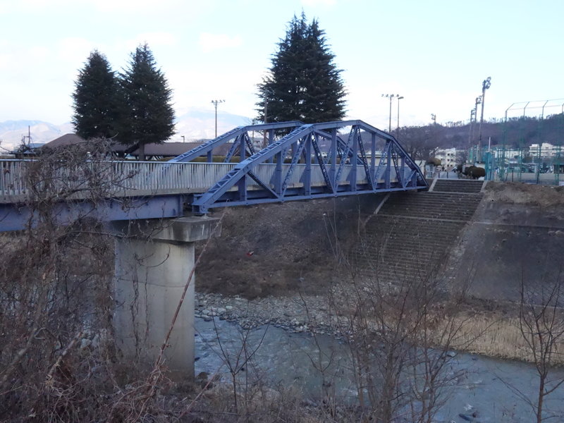
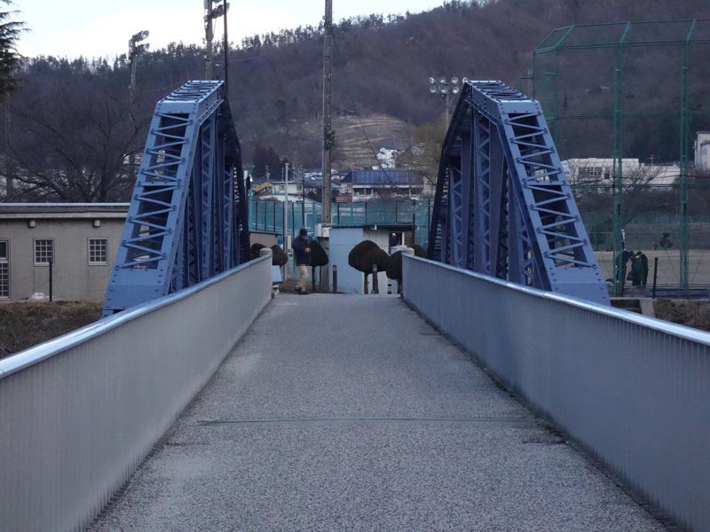
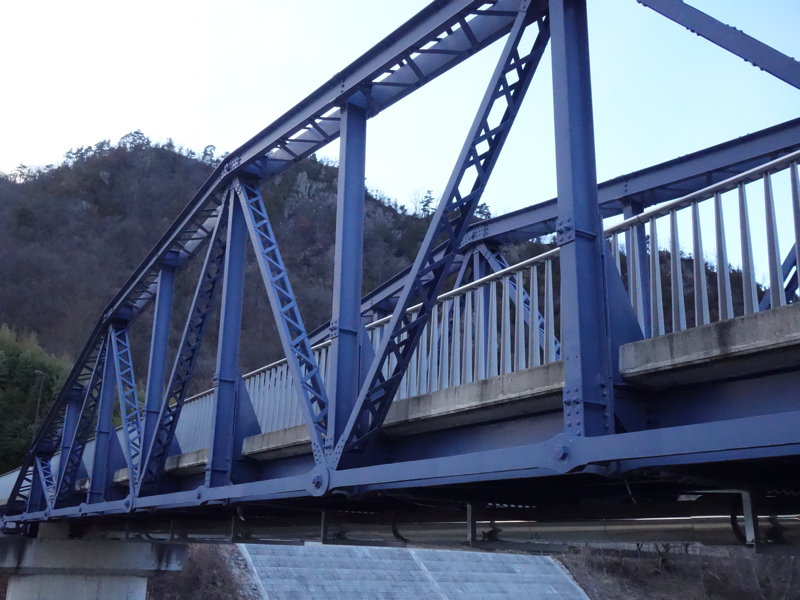
First, I took a picture of the bridge from the sidewalk in front of the parking lot.
On the other side of the bridge, there are tennis courts, Maruko General Sports Ground and Maruko General Gymnasium.
A map of the area around the Rindo-bashi Bridge is shown below.
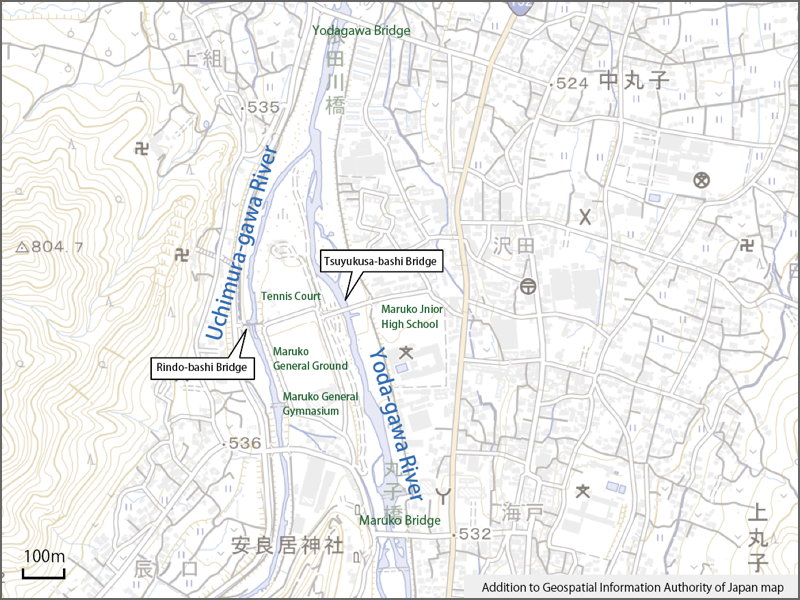
The Maruko General Gymnasium and the grounds are located between the Yoda-gawa and Uchimura-gawa Rivers, and automobiles can only enter from the south.
Although I did not check with my own eyes on this day, the Tsuyukusa-bashi Bridge (completed in March 1999) on the east side is also a pedestrian bridge and not accessible to cars.
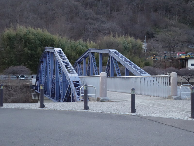
There are two bridges crossing the Yoda-gawa River, Maruko Bridge on the upstream side and Yodagawa Bridge on the downstream side, but they are 1.1 km apart. The Uchimura Bridge is only 1 km upstream from the Yodagawa Bridge on the downstream side.
Although it is a pedestrian bridge, the location of the Rindo-bashi Bridge makes sense because it connects the east bank of the Yoda-gawa River and the west bank of the Uchimura-gawa River.
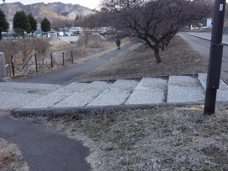
Me wandering on the sidewalk before crossing. There are stairs leading down from the roadway to the bridge. The steps are small, and if the need arises, it is not impossible for vehicles to pass. (Actually, they are planning to put steel plates and so on.)
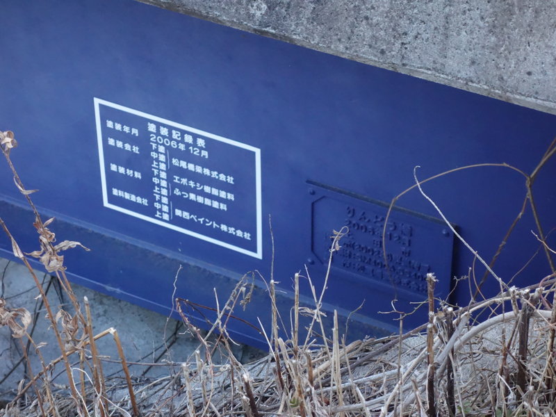
Then, I checked the side of the bridge. There is an indication that the bridge was built in December 2006 (on the right) and a painting record (on the left).
Now let’s cross. This is the only width of the bridge.
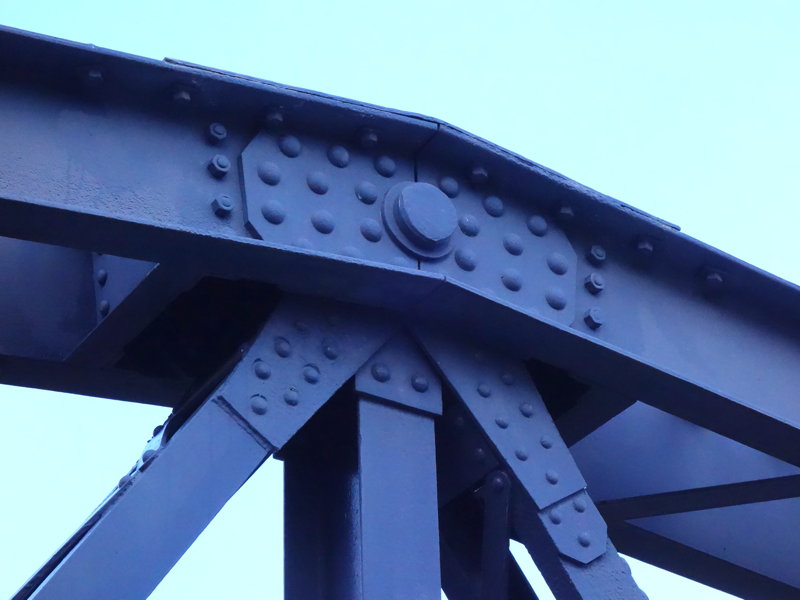
A close-up of the top of the truss. I wonder if the big round thing is a pin to be inserted when assembling.
After crossing the bridge, I came to the east bank.
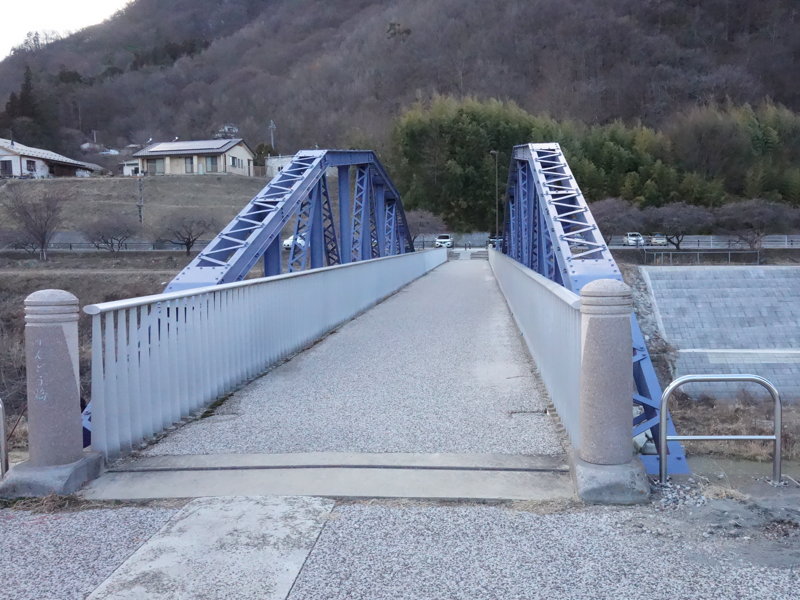
On the east bank, I looked for the nameplate of the bridge.
It was on the south side.
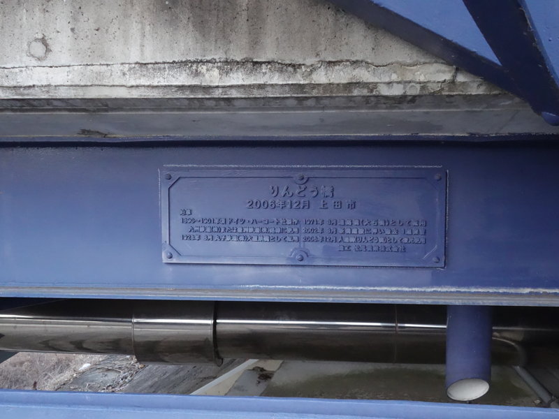
It reads “Rindo-bashi Bridge, Ueda City, December 2006″.
The history of the bridge is also written, mostly what I wrote in my previous article, but there are a difference.
After it was imported in the Meiji era, it was used in Kyushu.
The namepalte says, “It was used on the lines of Kyushu Railway Co. or Hoshu Railway Co."
I didn’t see the name “Hoshu Railway" mentioned in the lecture.
Hoshu Railway was apparently a railroad company headquartered in Fukuoka Prefecture (present-day Yukuhashi City), with lines running from Fukuoka to Oita.
I searched the National Library Digital Collections and found it listed under the word “Hoshu Railway,” but for some reason I found a disturbing article first…
“The Collapse of the Hoshu Railway. The railroad has already completed its trial operation, but recent heavy rains caused the ground to loosen in a ditch about 100 meters west of Yusuhara, and about 2,600 square meters of it suddenly collapsed on the 12th of last month. More than 40 workers were buried under the ground, and although they were rescued immediately, 14 were killed instantly, 21 were seriously injured, and six or seven were lucky to be alive."
(“Koutsu", No. 110, July 1895, Kotsu-Zasshi-Sha)
By this month, it probably mean July 1895, but before it opened, a ground collapse killed men.
The Hoshu Railway opened for business in August after that accident, but six years later, in 1901, it was merged with the Kyushu Railway.
As for the railway bridge, it is not known exactly where it was used, so they must have decided that it could have been part of the Hoshu Railway line.
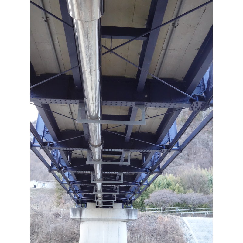
I also went under the bridge.
There is a thick pipe running through it. In the lecture, someone said that the bridge was designed to allow water and sewage to pass through in case of a disaster.
Because I was told that there were stamps of the manufacturer, Harcourt, and the Yawata Steel Works, which made the repair parts, on the bridge, so I looked for them.
I found the stamp of Yawata Steel Works.
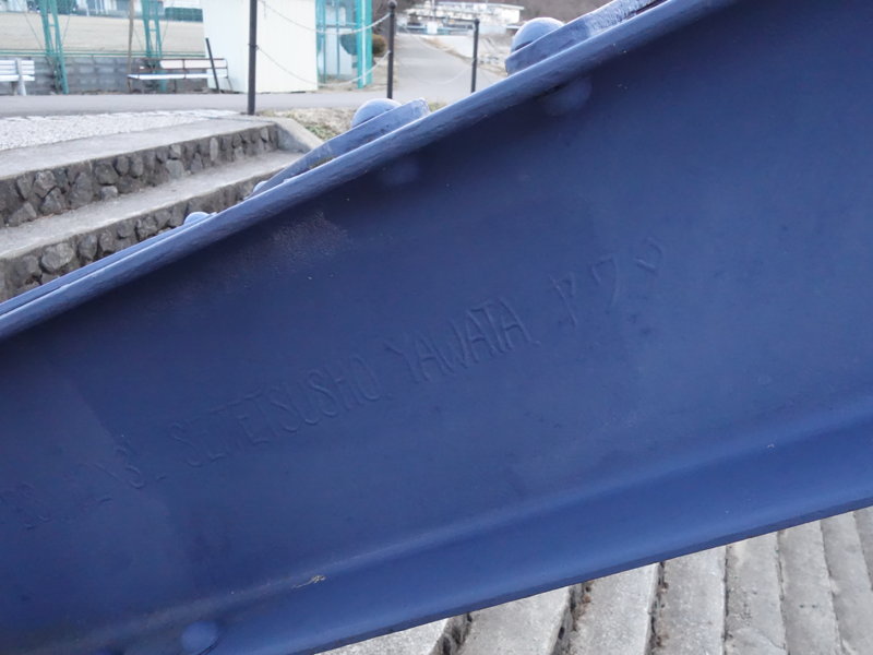
It is inscribed “SEITETUSHO YAWATA (alphabet) YAWATA (katakana)".
It is said that this member may have been a replacement for a missing member when the Chikumagawa Bridge was rebuilt in 1928, but the detailed circumstances are said to be unknown.
Or it is also possible that the steel frame was replenished when the bridge was used in Kyushu, once it was rebuilt.
And I found another engraving, which reads “A.H.A.V.”. The letter “F” is written sideways down on either side, but this appears to have been placed as a decoration rather than a letter.
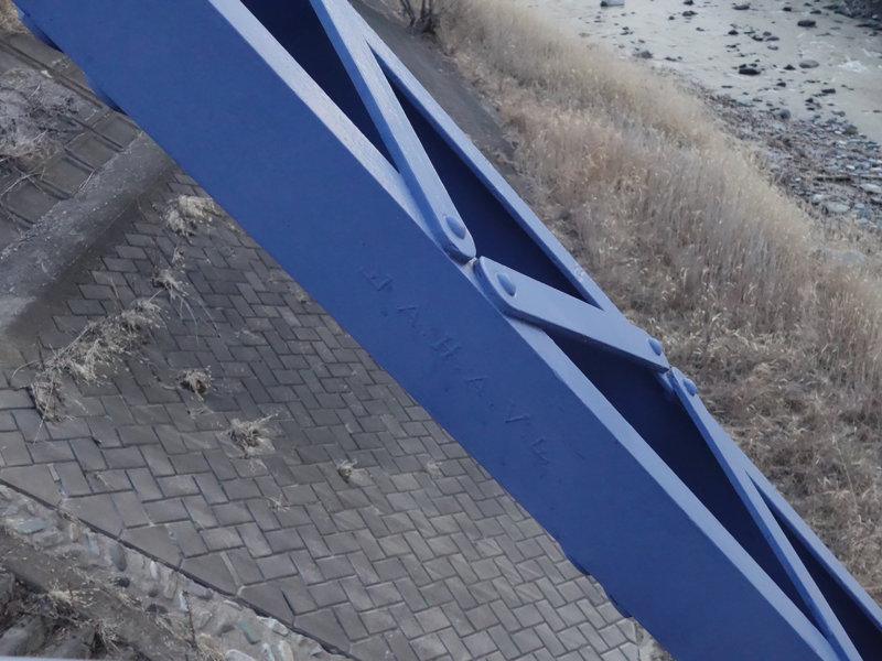
I later looked it up and found the answer in “Introduction to a Case Study of the Restoration of a borstring Truss” (Kiyoshi Kinoshita / Lectures on the History of Civil Engineering Vol.28 / 2008).
“A.H.A.V" is an acronym for “Aachener Hütten-Aktien-Verein”.
I looked for it on Wikipedia and found it in the Luxembourgish version.
Aachener Hütten-Aktien-Verein is apparently the name of a German steel plant that was in operation from the mid-19th century. I couldn’t translate the name well with the automatic translation, but I think (not sure) that “Aachen Ironworks Co. Ltd.” is close in a meaning, separating the words and translating them.
The plant was closed in 1926, but apparently the administration building and the factory building still exist.
The above information about the Hoshu Railway and the Aachen Ironworks was researched at the stage of writing this article.
On the day of the tour, I was unaware of such things and was just happy to find and photograph the marking I was looking for. Having found the markings of Japanese and German ironworks, I finished my tour of the bridge.
I hope that the Rindo-bashi Bridge will continue to be used by many people at this location and that it will pass on its history.
[Reference] (written in Japanese)
“Introduction of a case study of the restoration of a bowstring truss” (Kiyoshi Kinoshita / Lectures on the History of Civil Engineering Vol.28 / 2008)