Oami Power Station
A short walk from the Odokorogawa Power Station, you will see a suspension bridge. This is the road to the Oami Power Station.
I am in Niigata Prefecture on the west side of the Himekawa River, and the other side of the bridge is in Nagano Prefecture.
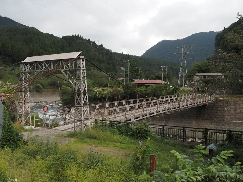
I will cross on foot, but the bridge is open to cars.
I came to the front of the bridge. There is a sign indicating that the weight limit is 3.5 tons.
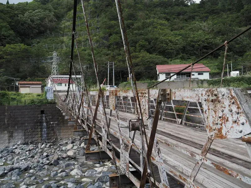
The bridge is constructed with steel frames and covered with planks. The paint is peeling off the steel frame, and rust is starting to show.
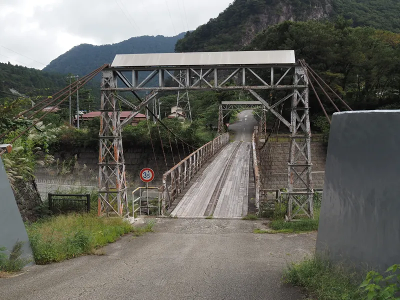
After crossing the bridge, I turned around and took this photo.
I forgot to check the nameplate of the bridge, which says “Oami Power Plant Suspension Bridge” on Google Maps, but that is not the official name, is it?
When I looked back at the photos I had taken, I could not find anything that looked like a nameplate.
A few meters away from the shore was a stone monument. It reads, “Monument for Reconstruction".
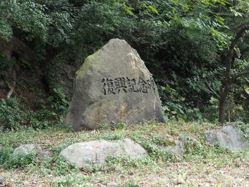
On the back of the monument, there is an explanation.
“On July 11, 1995, a rainy season front that began to dump torrential rains in the early hours of the morning transformed the appearance of a peaceful mountain village with lush greenery overnight. The entire Himekawa River basin was struck by an unprecedented disaster, with mountainsides collapsing, roads cut off, mudslides, and many villages isolated.
The torrential rains, with a maximum hourly rainfall of 48 mm and a continuous rainfall of 409 mm, caused the Himekawa River tributary to overflow and wash away, destroying 28 houses and causing extensive damage to National Route 148 along the Himekawa River and the JR Oito Line.
Nagano Prefecture, Niigata Prefecture, the Ministry of Construction, the Forestry Agency, and JR West made concerted efforts for reconstruction.
The “Himekawa Disaster Reconstruction Memorial Monument” was erected to keep the memory of this disaster alive for future generations.
March, 1998”.
It was a reconstruction memorial monument about the torrential rain disaster in July 1995. The monument was erected two years and eight months after the disaster.
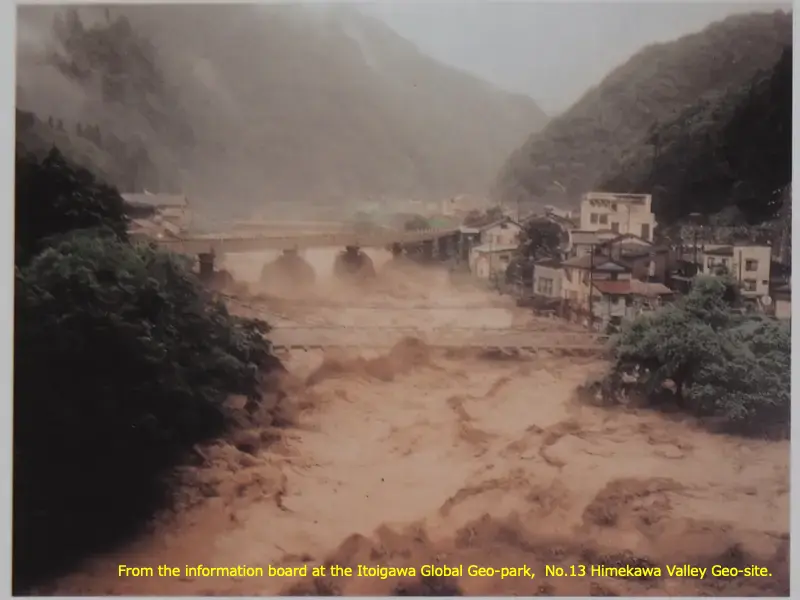
The following photo was taken at a different location (near the Niigata-Nagano border on National Route 148), and was posted on the explanation board of the Himekawa Valley Geo-site.
It is titled “Himekawa River During the Flood and Today (Near Hirakawa)".
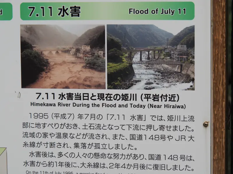
The description is..
“On the 11th of July 1995, a massive flood caused landslides and debris flows throughout the Himekawa Gorge, destroying houses and hot spring resorts along the river. The JR Oito Line and Route 148 were both cut by collapsed bridges, leaving communities stranded.
Following the disaster, many people toiled tirelessly, repairing Route 148 in about one year and restoring service to the Oito Line within 2 years and 4 months."
Looking at the photo on the right, I recognized the location where this photo was taken. It was taken from a little downstream of the suspension bridge where I am now. The railroad bridge of the Oito Line can be seen behind it. The large white building on the right side of the bridge is the Odokorogawa Power Station.
From the photo above, only the left side was enlarged.
The suspension bridge is only slightly visible just above the water. The piers of the railway bridge in the back are splashing with water.
Now, to get to the power station, we have to go to the left after crossing the suspension bridge.
But when I turn left, I saw “No Trespassing” signs on both sides of the road.
I am not sure if this is referring to the property on either side of the road or if the road is off-limits as well.
As a result, I decided not to go in and look at the power station from the other side.
Crossing the suspension bridge again, I proceeded a little north on Prefectural Route 375 to merge with National Route 148.
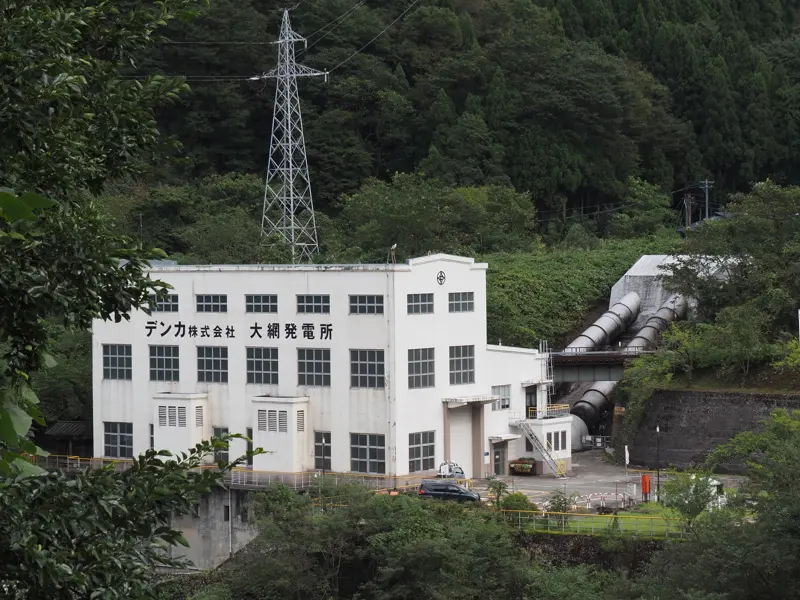
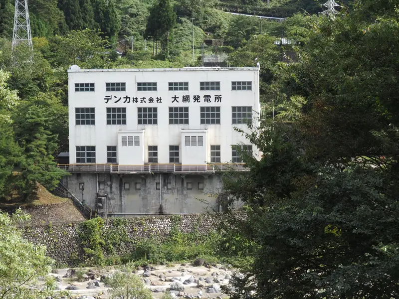
The national road is a little higher than the river, so the power station can be seen from the sidewalk
This is a photo taken from the sidewalk.
The main building of the Oami Power Station, the hydraulic iron pipes, and the substation were visible.
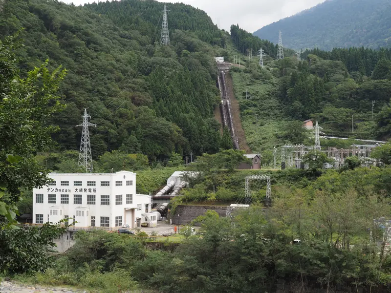
Please refer to the map to see where the water to the iron pipes comes from.
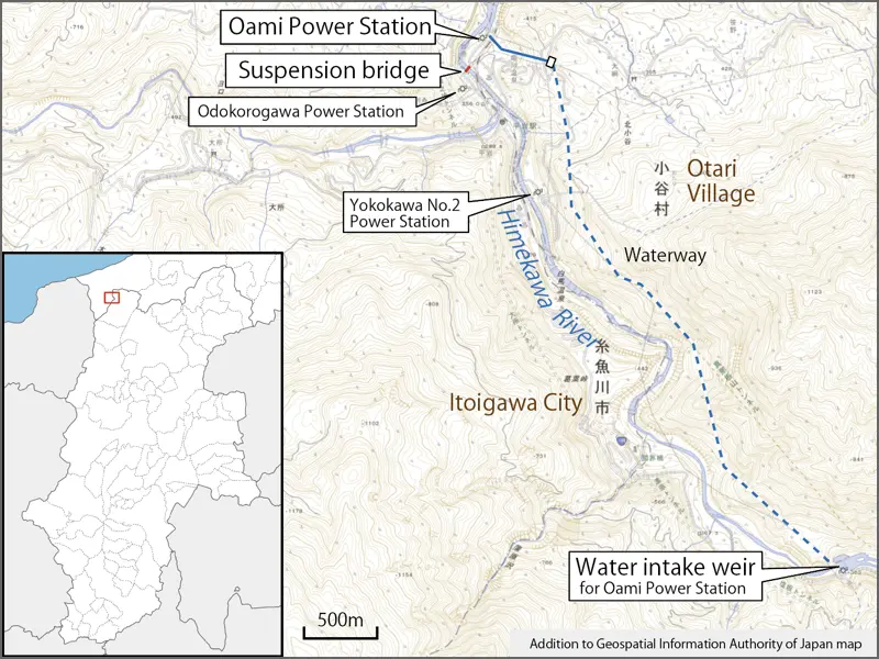
The water is taken from the Himekawa River, about 4.2 km upstream in a straight line. The water is drawn in through a waterway without building a dam, and it flows from a water tank to the power plant through a water hydraulic pipe. This method is called a “flow-in power station", which can be constructed at a lower cost than a dam.
All of the power station owned by DENKA are flow-in power stations.
Construction of the Oami Power Station began in August 1936 and was completed in February 1938. The maximum output is 24,400 kW.
The purpose of the plant was to transmit power to Denki Kagaku Kogyo’s Aomi Plant, but the plant was not ready to receive power immediately after its completion, and the power was supplied to the Nippon Electric Power Company until the end of March 1939.
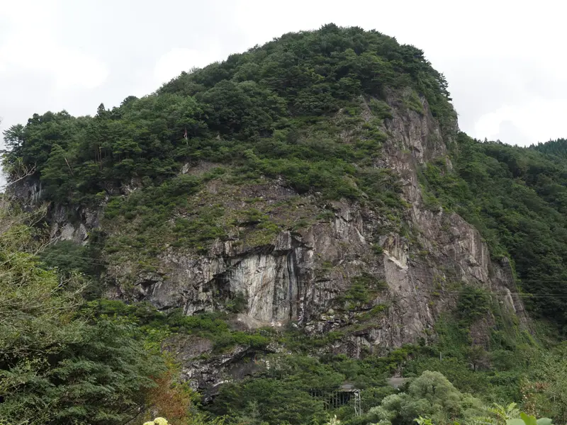
Although not shown in the photo above, there is a large rocky hill next to the building. This terrain is scary.
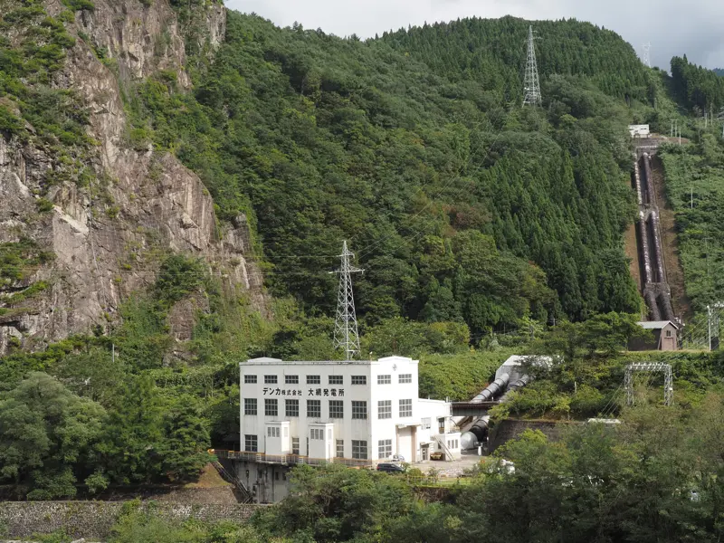
A view of that rock pile. The JR Oito line runs through here, although a rock shed is slightly visible between the trees in the lower center.
Before the World War II, there was an accident at this power station.
On December 20, 1940, The generator No.1 was destroyed with a loud bang, leaving no trace of its original shape.
They was involved in the investigation of the cause with the generator manufacturer, and it was found that a part of the generator had cracked due to heat. And when another generator part was examined, the part was found to be insufficiently strong.
They said it was not due to operational negligence.
The generator manufacturer took care of the problem and the plant resumed operation in April 1942.
I didn’t know this on the day of the tour because I looked it up later, but they opened a hydroelectric museum in the Oami Power Station in 2018. It is mentioned in the company’s report, but I am not sure if it is open to the public.
If we are allowed to visit the museum, it would be nice if there is an information sign for the museum at the suspension bridge.
I’ll change the topic from Oami Power Station.
DENKA Corporation currently owns 17 power stations (including those owned by joint companies). About 40% of the electricity used by the company is supplied by hydroelectric power (FY2020 results).
The Kotakigawa Power Station, which started operation in 1921, has been in operation for over 100 years, but the wooden building is said to be as it was when it was built. If I have a chance, I would like to go see it. I guess it’s off-limits, though.
[Reference]
“35 years’ history of Denki Kagaku Kogyo" (35 years’ history of Denki Kagaku Kogyo Editorial Committee / Denki Kagaku Kogyo / 1952)
“DENKA Report 2018 – Integrated Report" (DENKA Corporation / 2018)