Miwa Dam (1)
Mid-April. After seeing the cherry blossoms at Takato Castle Ruins Park, I decided to head for Miwa Dam.
I walked to the parking lot where I had parked my car and drove south on Route 152.
After crossing the Takato Ohashi Bridge, I turned left and drove about 2.5 km, when I saw the embankment of the dam from the road. It was the Miwa Dam.
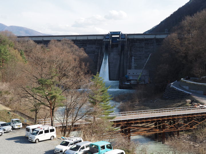
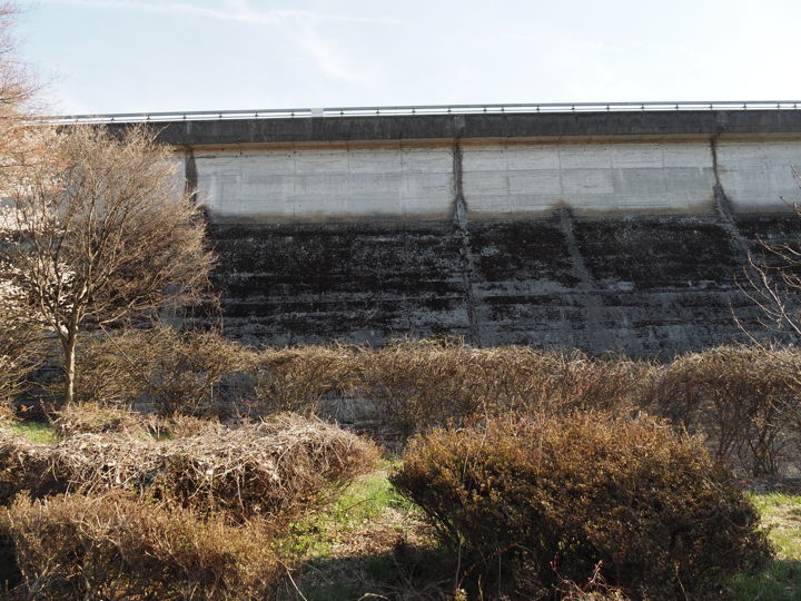
There was a space where I could park my car on the side of the road, so I left my car there and took this photo from the sidewalk.
It looked like some kind of construction work was being done.
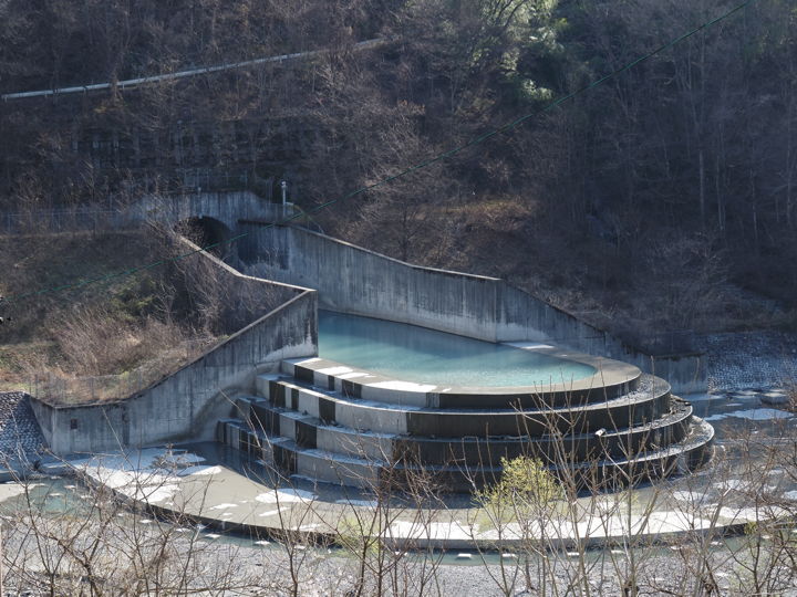
A short distance away from the dam’s embankment, to the right of the dam in the photo above, there was what looked like a drainage outlet. What is that? (I will write about that next time).
Zoom in on the embankment. Well, let’s go there now.

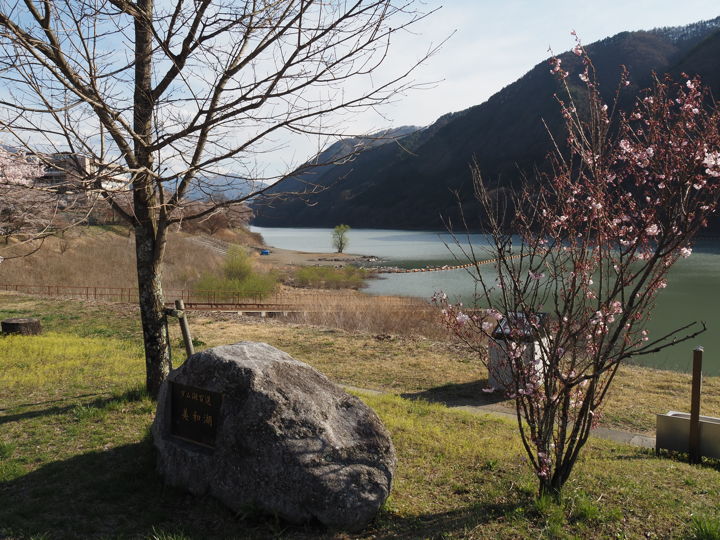
I drove to the edge of the dam lake.
Although it is hard to see in the photo because of the shadow, there is a plaque on the stone in the foreground that reads “Lake Miwa, one of the 100 best dam lakes.
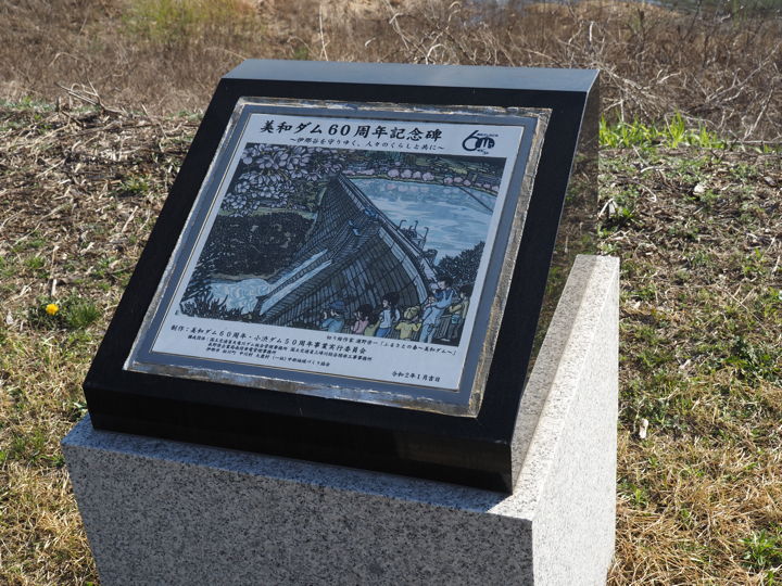
Behind it was the “Miwa Dam 60th Anniversary Monument,” which was installed in January 2020.
In 1952, the Mibu-gawa Comprehensive Development Project began. The Mibu-gawa River is the largest tributary of the Tenryu-gawa River, originating from Mt. Senjogadake (3,033 m), and passes through Takato Town to join the Tenryu River in Ina City. There was a lot of arable land along the river, but when the river flooded, the water containing sediment rushed in and caused damage to the arable land. The sediment also reached the lower reaches of the Tenryu-gawa River, which was a problem for flood control along the Tenryu-gawa River.
The Miwa Dam was built to prevent it.
The plan was to build a 70-meter-high, 400-meter-long concrete weir between Hiji, Miwa Village, and Katsuma, Kanami Village, on the opposite bank, to hold 37 million cubic meters of water.
When this lake is built, Miwa Village will be submerged in 67 ha of rice paddies, 7.4 ha of fields, 34 ha of forests, and 34 houses. The number of households that would lose their rice paddies and fields would reach 281. This led to a local opposition movement.
The prefectural government interceded and offered compensation, and construction began in 1953, but compensation negotiations were not finalized until 1956, three years later.
About 40 households moved to Ina City, Tokyo, Aichi Prefecture, and other locations.
Test flooding began in December 1957, and the Miwa Dam was completed in November 1959.
In 1957, during the construction of the dam, the Act on Specified Multi-purpose Dam was enacted, and the Miwa Dam was completed as a multi-purpose dam that mainly performs flood control functions and also generates electricity and irrigates the area.
Miwa Village merged with Inasato Village in 1959 to form Hase Village. It is now part of Ina City.
This is the dam management office. The entrance of the office is marked “Miwa Dam Management Branch Office, Tenryugawa Dam General Management Office, Ministry of Land, Infrastructure, Transport and Tourism”.
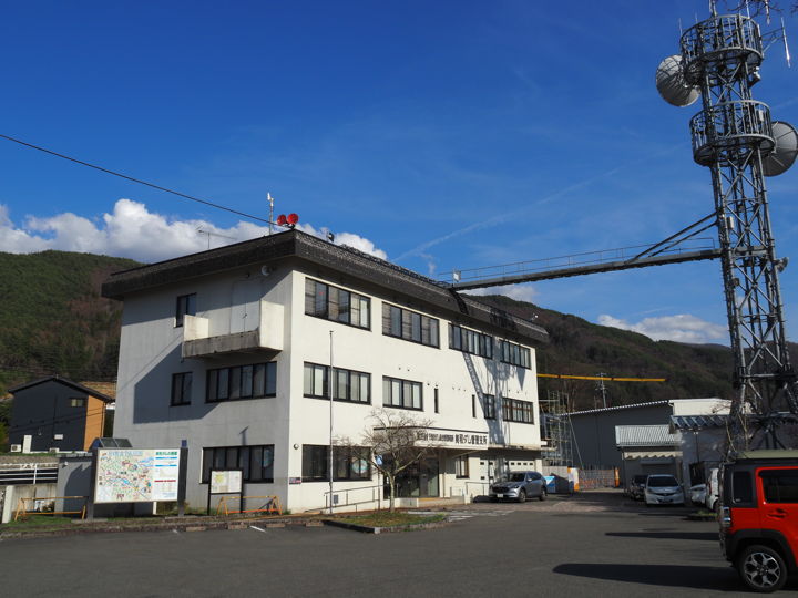
Next to the building stands a pictorial map of the surrounding area and an information board with an explanation of the Miwa Dam.
It says that the height of the embankment is 69.1 m, the length is 367.5 m, and the water area is 1.79 square kilometers.
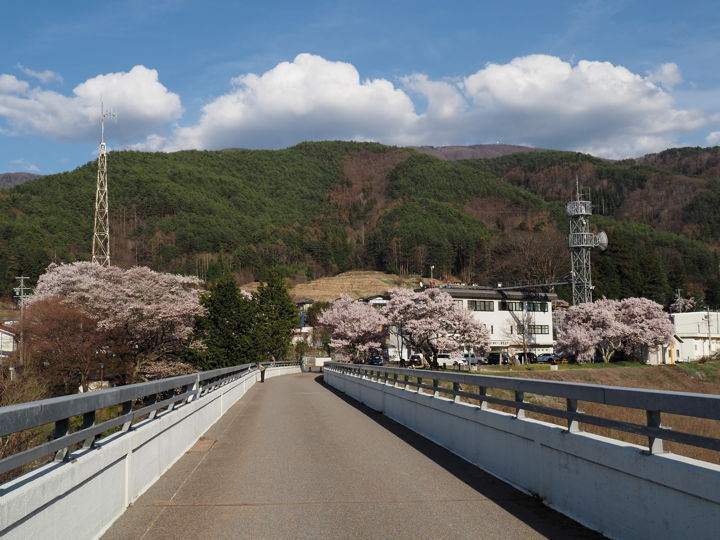
Now let’s go to the dam’s embankment. The cherry blossoms are in full bloom.
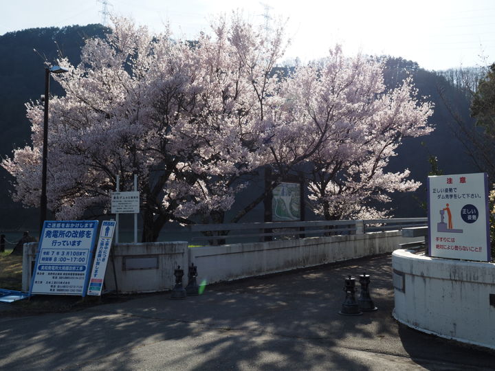
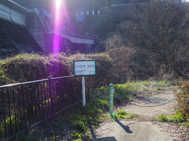
But then I saw a “No Trespassing” sign. It looks like they are doing some kind of work. Can’t I go there ?
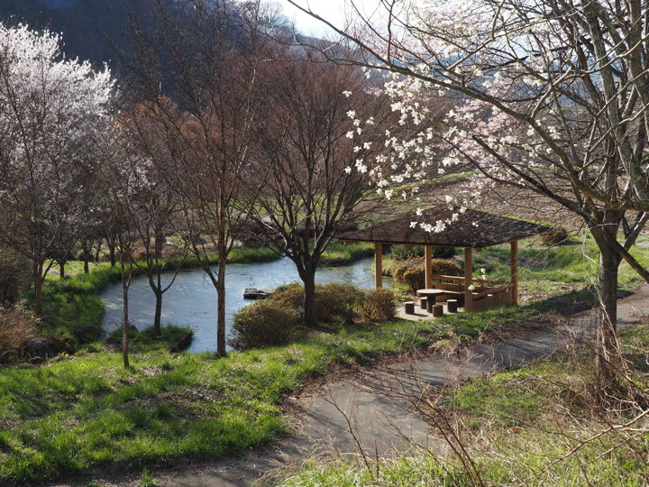
So I went to the lower side of the dam. Ponds and promenade had been built, and it had become a little park.
According to the sign, the two ponds are in the shape of a crane and a turtle, but from this position, it is hard to tell.
Looking up at the dam.
There was a chain stretched across it, and it was a dead end here. I decided to go back.
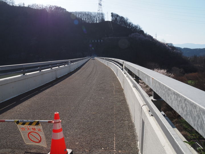
When I returned, the work seemed to have just finished and the “No Trespassing” sign was being put away. Thanks, I could now walk on the embankment.
This is a photo taken about halfway the embankment, looking back. The right side of the photo is the dam lake.
I will soon finish crossing the embankment. There is a tunnel at the end, but it is off-limits.
The west side of the dam lake is a rocky hill, so now, after 4:00 p.m., this area is in the shade.
A view of the dam lake. The mountain surface on the right is dark.
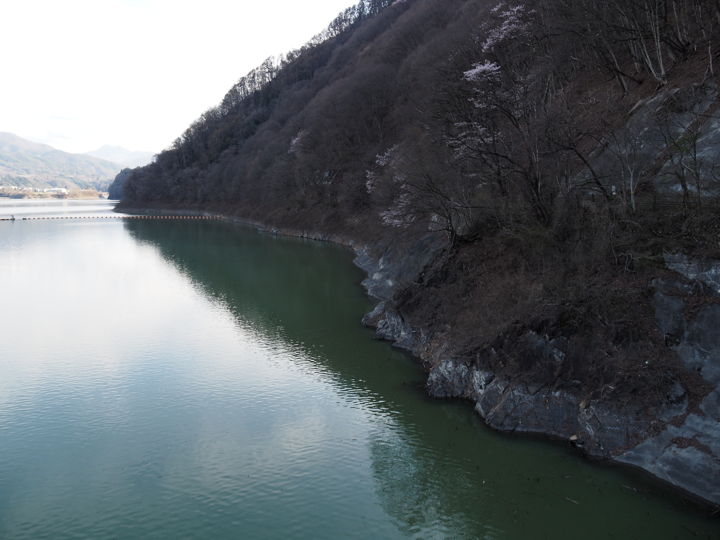
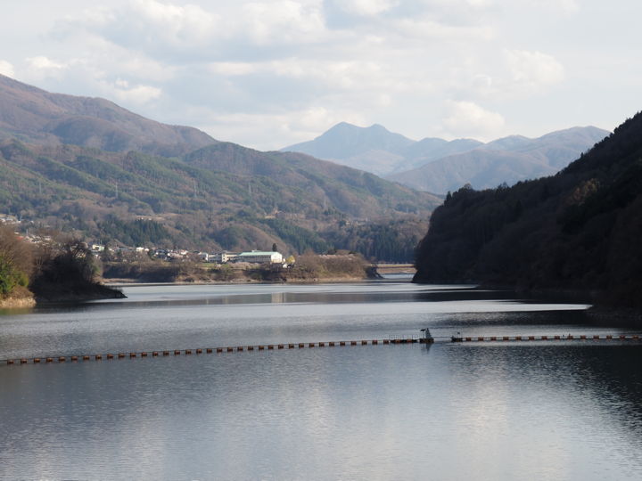
Zooming in on the end of the dam lake. The left side is in the afternoon sun.
Looking at the map later, the white building in the center of the photo seems to be about 2.2 km away from the dam embankment.
I heard that the dam lake is 5.2 km long.
On that day, I only saw the dam embankment and did not go to the upstream side of the dam lake.
When I checked later, I regretted that I should have visited the upstream side of the lake as well.
(To be continued)
[Reference]
“Our Country, Volume 2 (struggle against nature)” (edited by Shinzo Kiuchi, Kodansha, 1961)