The naming of the Onzoshi-bashi Bridge (1)
In an article I wrote on this blog in April 2023, entitled “No water in the dam?" , I also wrote about the Onzoshi-bashi Bridge.
The bridge spans the Saigawa River and crosses the former Ooka Village (now Nagano City) from National Highway 19. The present bridge was completed in 1994, but before that there was suspension bridge with the same name (the first and second generation).
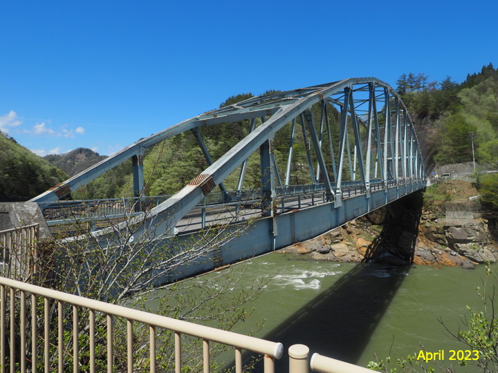
(This photo was taken in April).
In my previous article, I ended by saying that I did not know the origin of the name of the Onzoshi-bashi Bridge.
However, after that, I checked the documents and found the origin, so I am writing this article.
The reason of the naming of Onzoshi-bashi Bridge was written in “Ikusaka Village History, history and folklore" (1997).
In 1946, a suspension bridge was built connecting Hirotsu Village (now Ikusaka Village) and Ooka Village, and it is written that the bridge was 'named after the Onzoshi Shrine on the nearby Etchugawa district’.
(Note 1: The Chinese characters are written slightly differently on the local stone monument and in the Ikusaka Village History.)
(Note 2: I think the first bridge was built in 1948, but the Ikusaka Village History says it was built in 1946.)
Despite the discrepancy in notation, there is no reason to reject the theory that the bridge was named after the shrine, since the name of the bridge and the shrine are the same.
Therefore, I thought that all I had to do was to check the shrine and that would be it.
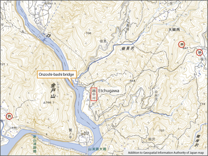
But… it is not on the map.
I drew the location of Onzoshi-bashi Bridge on a GSI map. There is a place name 'Etchugawa’ near the bridge. However, there is no map symbol for the shrine.
As indicated by the red circle, shrines in other areas are marked, but there is no shrine symbol for Etchugawa district.
I looked for a map of Ooka Village online, I found the 'Ooka Village Pictorial Map’ in the collection of the Nagano Prefectural Museum of History. It seems to be a map made in the early Meiji era.
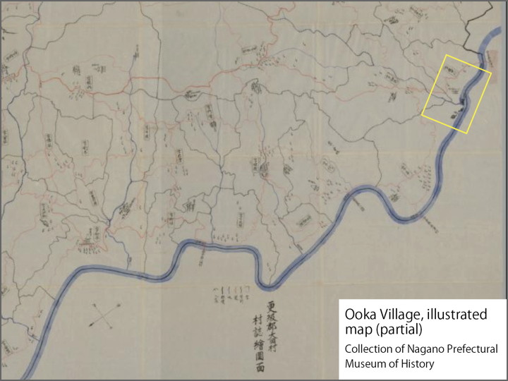
I’ll enlarge the yellow rectangle with the place name of the Etchugawa.
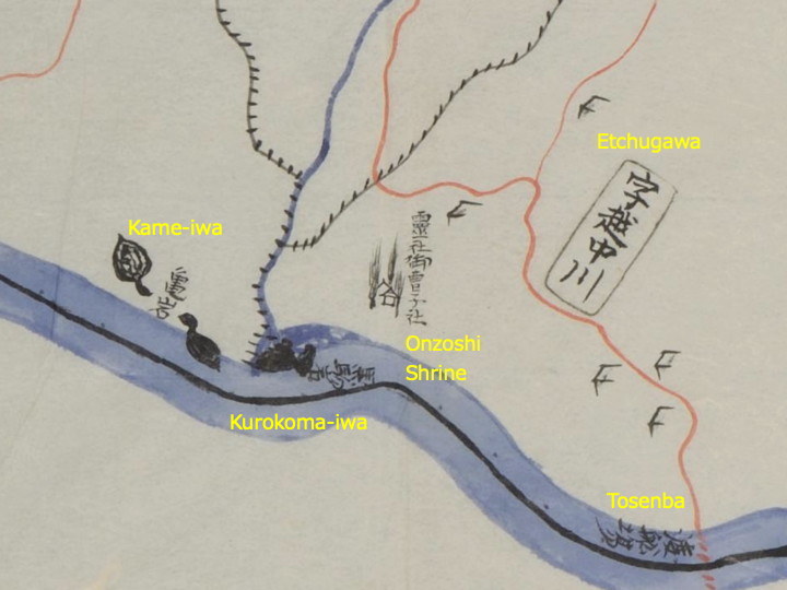
It reads 'Reisha Onzoshi-sha’. The Onzoshi-sha did exist.
Since this map was drawn in the early Meiji era, there wasn’t a bridge yet. In those days, ferryboats were used, and we can see a sign saying 'Tosenba (traject)’ on the right-hand side of the map.
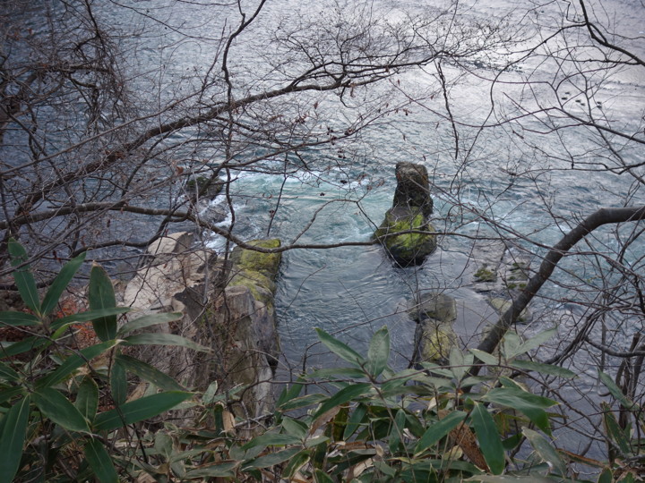
Also, where the bridge is now located, there are rock names 'Kame-iwa’ and 'Kurokoma-iwa’ .
Does this shrine still exist today? Or has it been lost?
I want to check at the site.
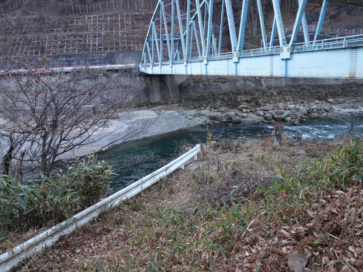
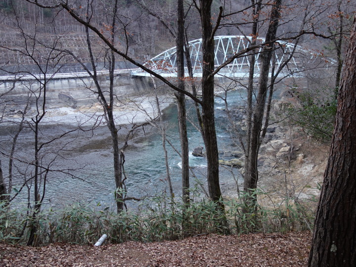
Mid-December. I came to the Onzoshi-bashi Bridge.
This location is one level lower than the bridge. Here is probably where the second generation Onzoshi-bashi Bridge, which was replaced in 1955, once stood.
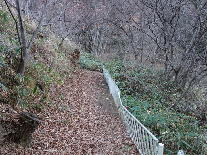
A path that looks like a promenade has been built along the river, so we proceeded along it.
Looking down at the river, I thought the Kurokoma-iwa (black horse rock) on the map might be here, and I saw a rock, but I cannot say for sure if this is the 'Kurokoma-iwa’ or not.
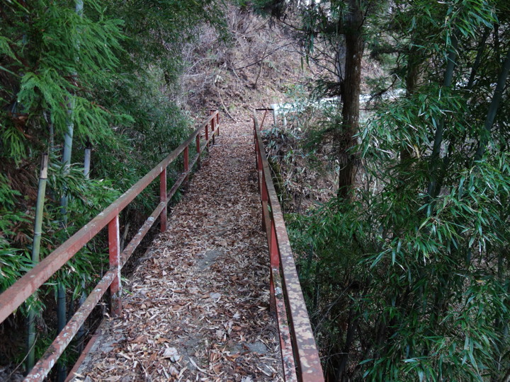
Cross the river on a pedestrian-only steel bridge.
Ah. There was a shrine!
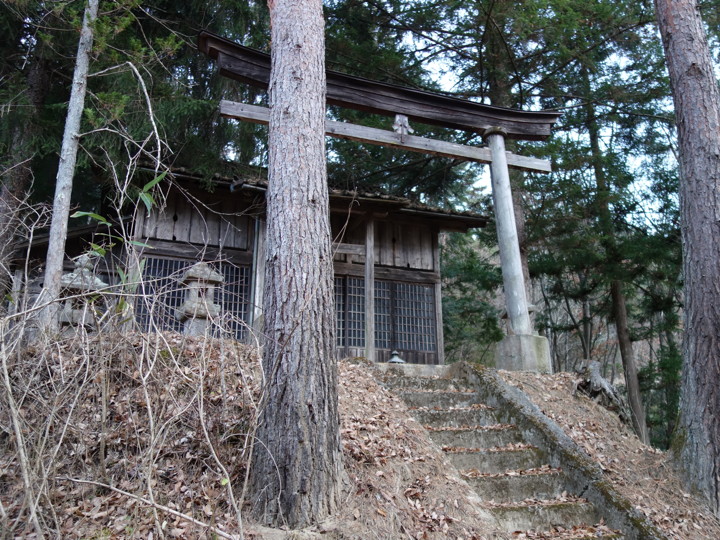
From the front of the shrine, the Onzoshi-bashi Bridge can be seen. Is it correct to say that this is the Onzoshi Shrine?
I checked the torii gate to see if the name was written on it, but I couldn’t find it.
(To be continued)
[Related articles]
'No water in the dam?' (2023/04/22)
[Reference] (written in Japanese)
'Ikusaka Village History, history and folklore’ (Published by Ikusaka village history publication society / edited by Ikusaka Village History compilation committee / 1997).
'Ooka Village pictorial map' (from the website of Nagano Prefectural Museum of History)