Former Okaya City Water Supply Collection Ditch
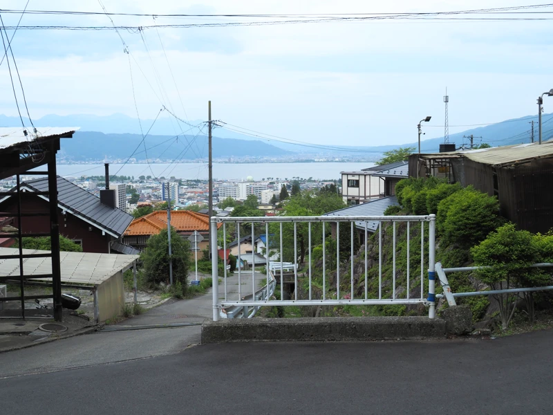
I am now on a hill overlooking Lake Suwa. It is difficult to see in the photo, but the road going down toward Lake Suwa in front of me is a very steep slope.
I was researching industrial heritage of modernization in Okaya City, and came here to check out the former Okaya City Water Supply Collection Ditch.
The location of the photo above is where I wrote “current location” on the map. The elevation is about 860 meters above sea level. The elevation of Okaya Station is 766m, which is about 100m higher than the flatland.
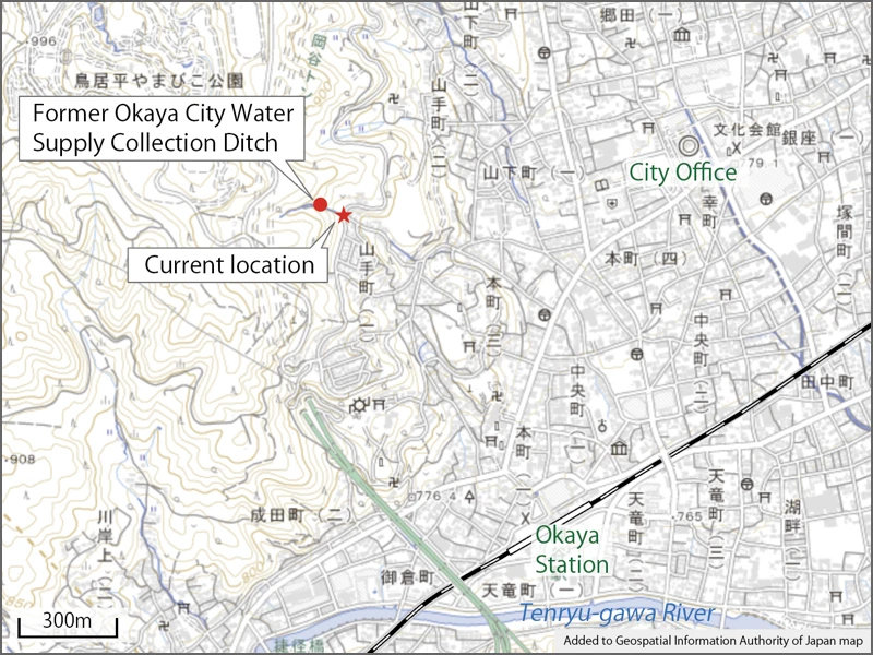
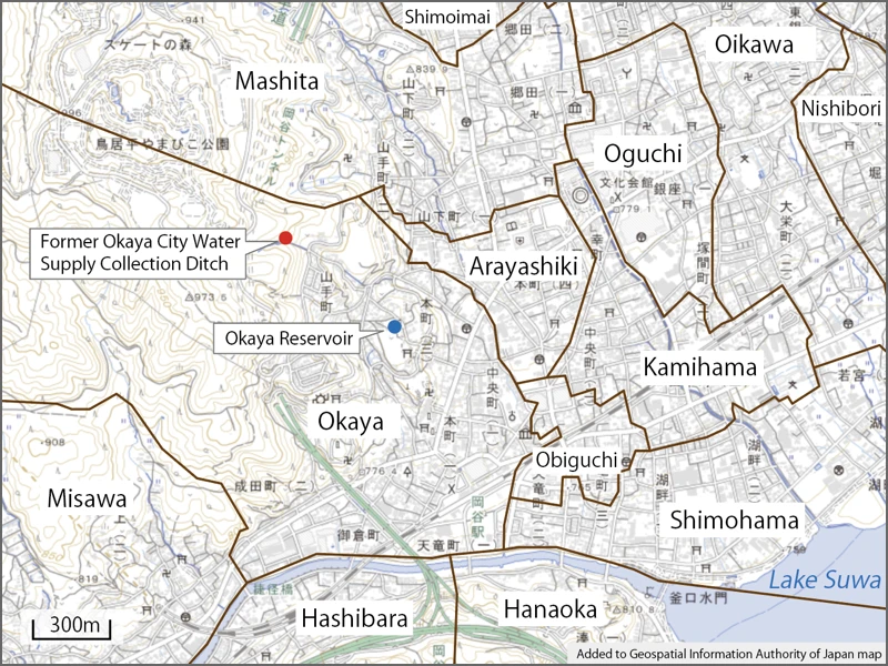
The “Former Okaya City Water Supply Collection Ditch” is located a little higher on the mountain side.
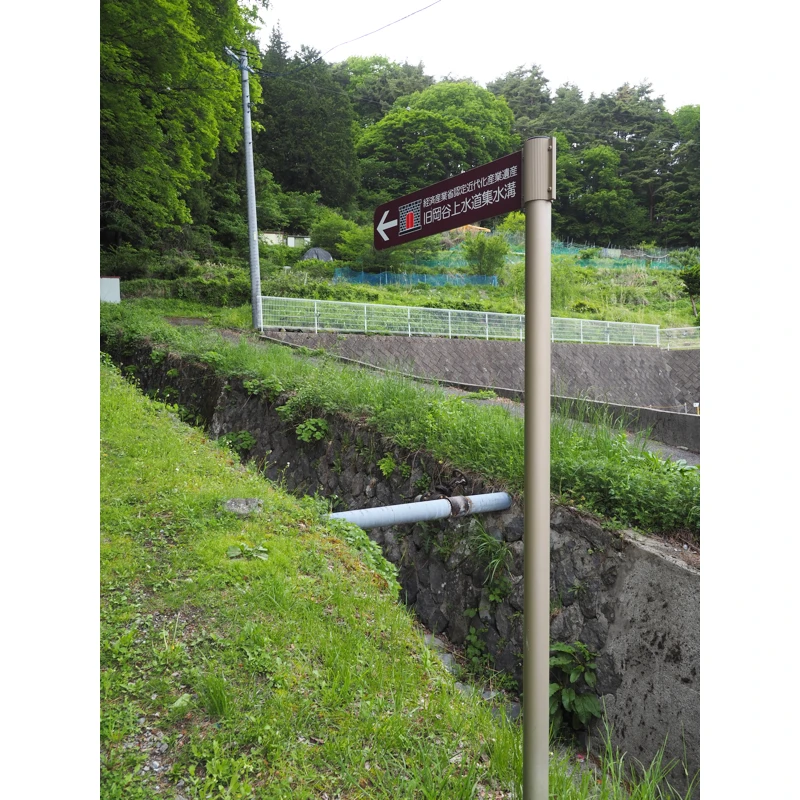
Looking up, there is a stone-walled canal and a sign that reads “Former Okaya Water Supply Collecting Ditch, a Heritage of Industrial Modernization recognized by the Ministry of Economy, Trade and Industry”.
Let us look at the history of water supply in Okaya City.
During the Taisho Era (1912-1926), the demand for water increased in Hirano Village (part of present Okaya City) due to the development of the silk manufacturing industry and rapid population growth.
Furthermore, an outbreak of typhoid fever in the village between 1920 and 1921, which was found to be caused by drinking water, led to increased demand for the construction of a water supply system.
However, Hirano Village had water rights issues, and it was difficult to construct a water supply system for the entire village. Water systems were planned for each area as follows.
In the Koigawa area, the construction of the Koigawa waterworks was approved in 1922 and completed in 1924. In the Obiguchi and Shimohama areas, the Hiranomura-Minatomura Waterworks Cooperative was established in 1924 jointly with the Hanaoka area of Minato Village, and construction was completed in 1926. (The Mashimo district was later merged into the cooperative.)
The Okaya area had also planned and investigated the construction of a water supply system, but the project was cancelled due to the Great Kanto Earthquake.
In 1926, the survey was restarted, and Shinyashiki and Kamihama joined in to begin laying the Okaya waterworks system.
In 1927, a water source collection ditch and conduit were constructed, water receiving wells and diversion wells were built, and Okaya Reservoir was constructed to supply water in 1928.
This is how the waterworks system was constructed.
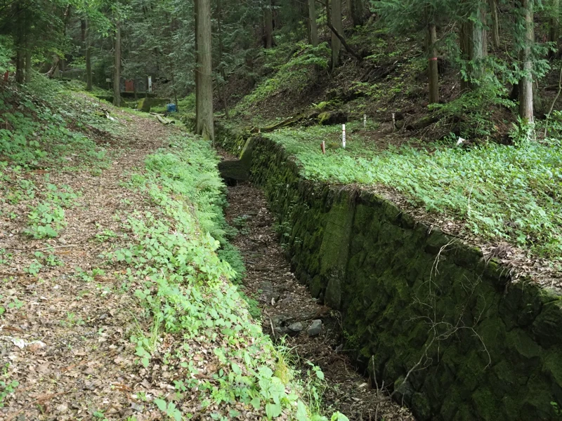
Now let’s go to the water collection ditch. I walked along the channel, but no water was flowing.
After walking only a short distance, I saw something brown in the distance.
I came close to it. The reddish-brown door on the right side is the water collection ditch.
There is a signboard explaining the ditch, so let’s go closer.
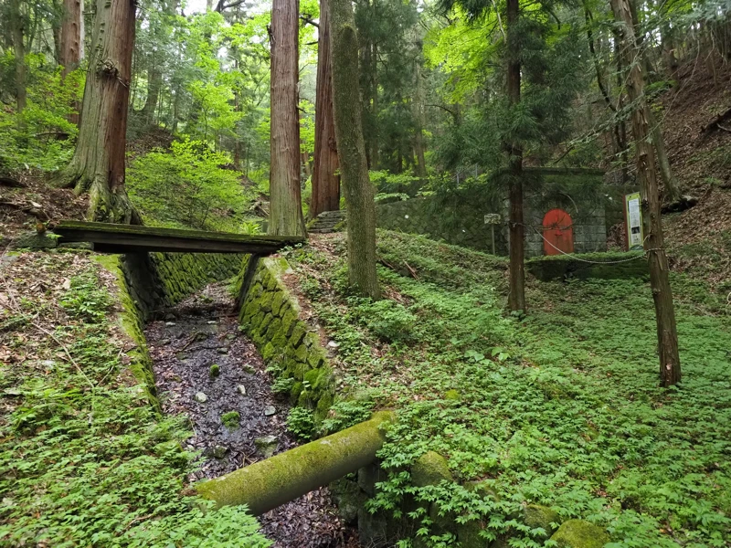
What? Is this bridge okay? It feels fluffy when I put my feet on it.
I crossed it carefully, looking for a place where the wood seemed to be solid.
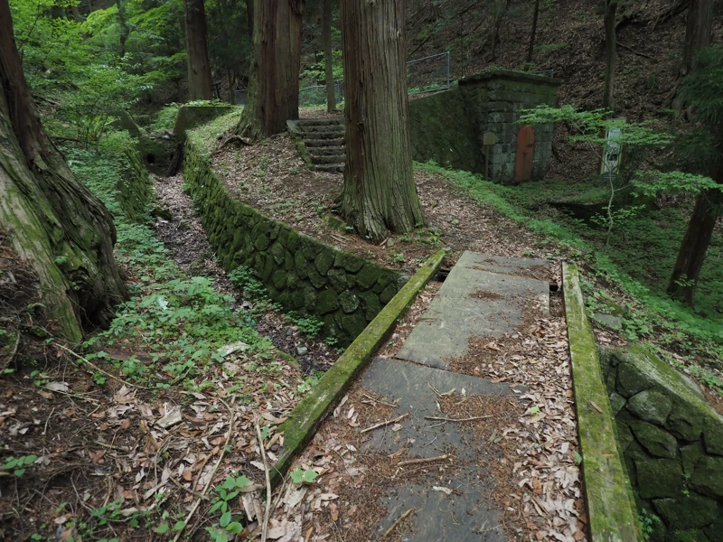
This is the water collection ditch.
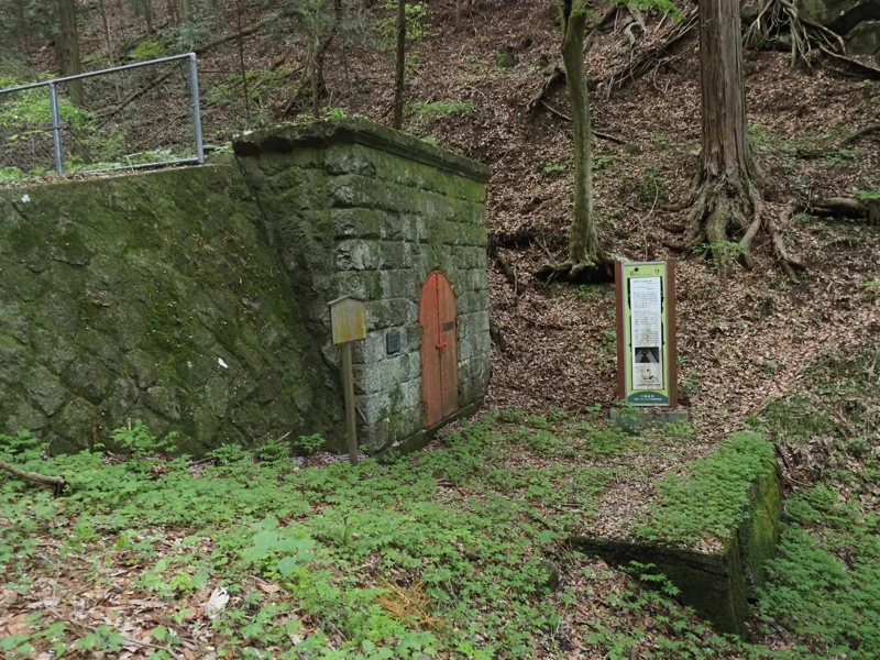
According to the explanatory board on the right side of the photo, the front is masonry and the side walls and interior are concrete. There are ventilations opening at the top. It is said that spring water was taken in through a gap in the masonry on the mountain side wall, and flowed down the slope.
It is said to have taken in 1,100 cubic meters of spring water per day.
However, the explanatory board goes on.
It says that the water dried up when the Okaya Tunnel of the Nagano Line of Chuo Expressway was excavated, and the use of the facility was discontinued in 1988.
So it is called with the word “former”.
The other explanatory board describes the name as “Okaya Waterworks Takinosawa Spring Water Catchment Ditch".
This one describes the history of its construction, its transfer to the Okaya Municipal Waterworks in 1955, and its abolition.
The masonry and metal door at the front. A plate of Heritage of Industrial Modernization (approved in 2007) is attached to the door, and a plate of Registered Tangible Cultural Property (registered in 2003) is attached to the left side.
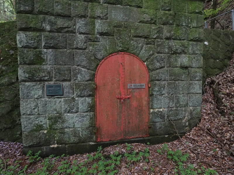
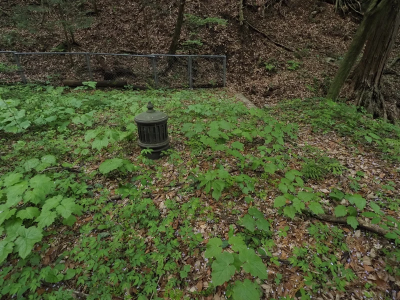
The upper level is surrounded by a fence and cannot be entered, but some ventilations opening could be seen.
After the water supply system was discontinued, this facility was returned to the mountain’s owner, the religious corporation Jugosha, which now manages it.
Next to the water collection ditch was a shrine. The area surrounded by a fence is the extent of the former water facility.
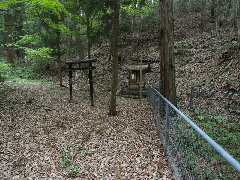
The stone wall of the waterway ended on the left side of the torii gate. Upstream was a dry river, and the terrain on either side appeared to be natural, but there were several small stone weirs in places, probably to prevent sediment runoff.
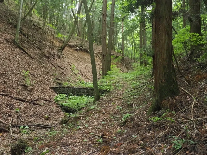
This photo was taken about 100 meters upstream from the shrine. I turned back here.
[Reference]
“History of Hirano Village, volume 1” (Hirano Village, Suwa County / 1932)
“History of Okaya City, volume 2” (Okaya City / 1976)
[Related Articles] (Okaya City Industrial Heritage of Modernization)
"Former Okaya City Office Building" (2025-05-23)
"Former Katakura-gumi Office" (2025-05-22)
"Former Yamaichi Hayashi-gumi Silk Manufacturing Office (2)" (2025-05-21)
"Maruyama Water Tank" (2025-04-28)
"Former Yamaichi Hayashi-gumi Silk Manufacturing Office" (2025-04-27)