No water in the dam?
The other day I was driving on National Route 19. The route 19 connects Matsumoto City and Nagano City. (To be precise, Route 19 connects Nagoya City and Nagano City, but this time I was driving from Matsumoto City to Nagano City, so I wrote the beginning of this article accordingly.)
Since Corona, I have been going out less and less, and when I do go out, I tend to take the expressway, so it had been a while since I had used Route 19.
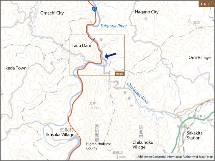
When I was driving around the arrows on the map, I felt something strange. The scenery was different from what I remembered.
…No water?
The following is a street view of the area near the arrow, taken in December 2020. The water on the right is the lake surface of the Taira Dam.
On this day, however, the water that should be there was not visible.
The water surface is quite low.
This photo was taken from the bridge, so if you move around a bit in the street view above and go to the bridge, you can see the view from the same location.
I did not know this because I did not pass by No. 19 very often, but when I looked it up later, I found that it had already been published in a newspaper in January of this year. (“Shimin Times", January 5, 2023)
According to the article, water storage at the Taira Power Station (Taira Dam) has been suspended since last May due to renovation work on the generator.
The work is scheduled to be completed in July of next year, so the water level will remain low until then.
The view was unfamiliar to me, so I revisited the site later for taking pictures.
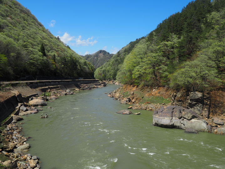
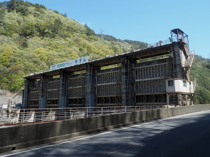
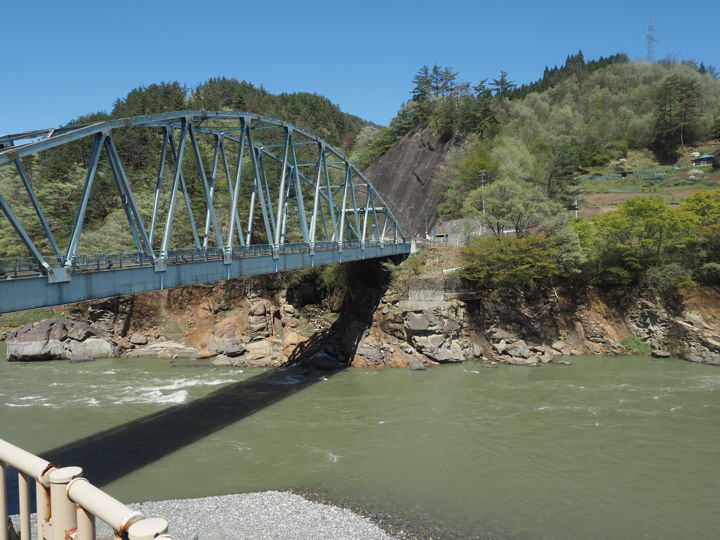
The Taira dam seen from downstream. The building on the left is the power station.
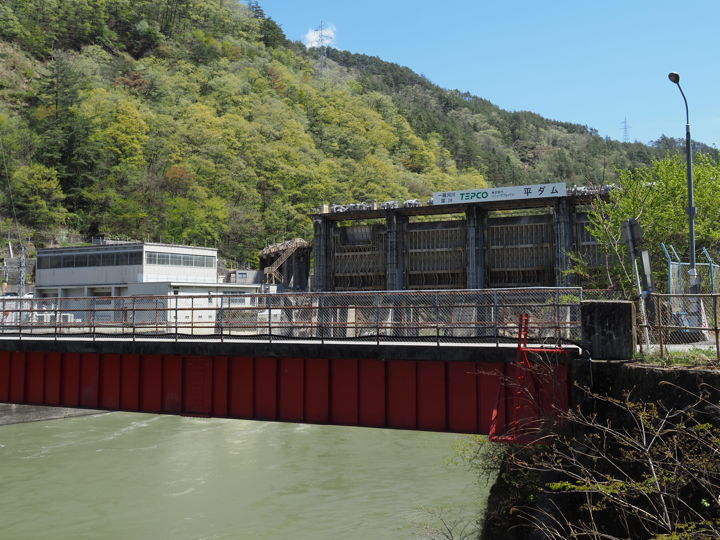
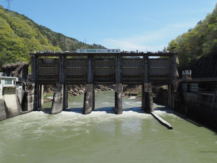
The dam was photographed from the bridge. All the gates are completely open.
The construction of Taira Dam started in 1955, and power generation began in 1957.
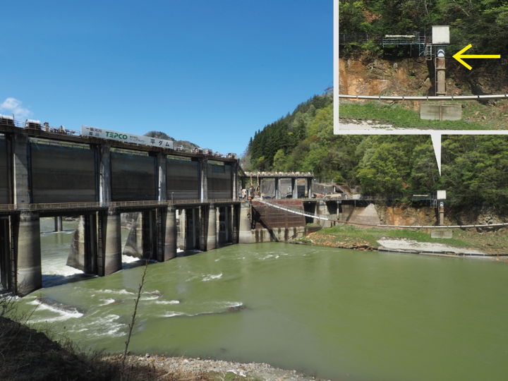
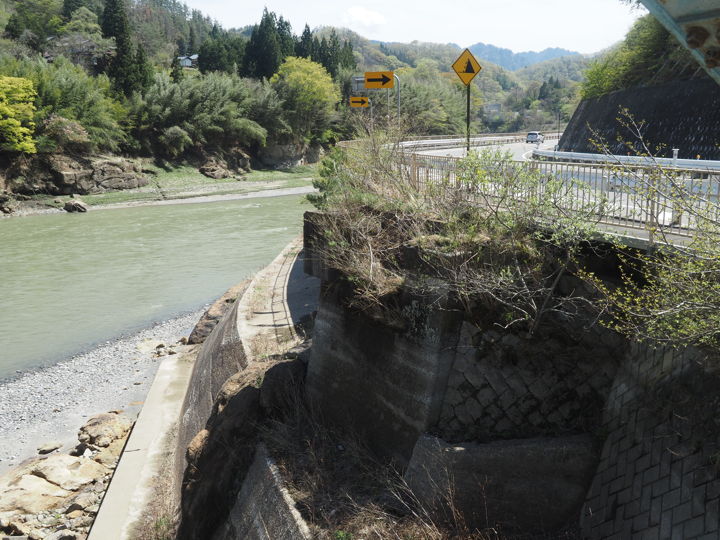
Taken from along the route 19.
The position of the water surface when storing water would be around the arrow.
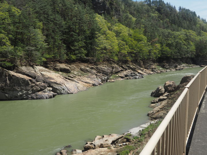
There is a sidewalk, so I walked a little upstream. I only remember seeing the water being stored.
I heard that water is sometimes released during heavy rains, but Nobody will visit the dam in the middle of a heavy downpour.
The bridge upstream of the dam is named “Onzoshibashi". When I crossed the bridge, I found a plate attached that read, “Completed in March 1994".
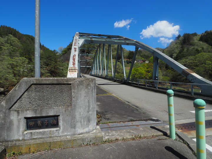
A stone monument stands near the bridge. On the front of the monument is engraved the inscription, “In commemoration of the completion of the Onzoshibashi Bridge, written by Goro Yoshimura, Governor of Nagano Prefecture".

On the back of the stone monument, the history of the Onzoshibashi Bridge is written.
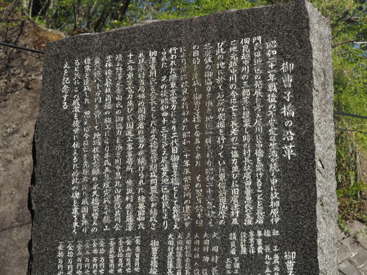
According to the inscription, the first suspension bridge was built here in 1948.
In 1955, the second Onzoshibashi (suspension bridge) was built by the Tokyo Electric Power Company (TEPCO) during construction of the power plant. The bridge was probably replaced in anticipation of the rising water level caused by the dam.
In 1968, an association was formed to demand that the bridge be replaced with a permanent one, and the movement had continued.
The construction of the current bridge began in 1987 and was completed in 1994.
In “Sentiment in Shinshu (Travels in Shinshu: Life and Climate Surrounding Rivers)," published in 1964 by Mitsunaga Kurenuma (Shakai Shiso Sha), there is a brief description of the second Onzoshubashi Bridge.
“There is a suspension bridge in the middle of the lake. The name of the bridge is “Onzoshibashi. I asked local people who crossed the bridge what the origin of the bridge’s name was, but they said they did not know. I asked two or three people, but they said they did not know.“
The origin of the name was not written on the stone monument either.
The old information sign next to the monument is also interesting.
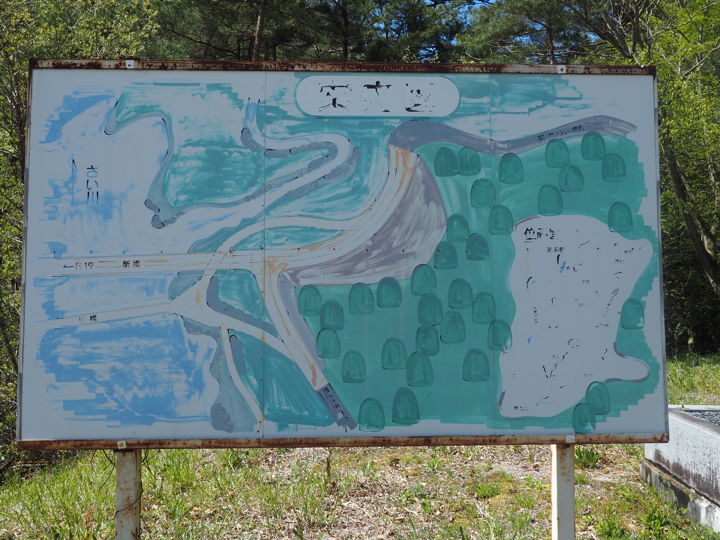
It is so faded that one can barely read the words, but it depicts both the current Onzoshibashi and the old bridge. The old bridge must have been removed after the new bridge was completed, so there must have been a period of time when both bridges existed.
Crossing the bridge again and checking the opposite bank from the left bank, I saw what appears to be the remains of the old bridge on the right side of the bridge.
The remains of the bridge were still there on this side as well.
I am looking for photos of the old bridge, but have not found any yet.
In the 1998 issue of “Ooka Village History", the bridge is mentioned and a photo of the first crossing ceremony of the current bridge (held in June 1994) is shown. However, in that photo, the old bridge was not visible.
However, the “Ooka Village History" shows a photo of the completion ceremony of another bridge. The “Daihachibashi Bridge" connecting Route 19 and the center of the village was built over the Saigawa River in 1978. In this photo of the completion ceremony, a suspension bridge is shown next to the completed bridge, about 10 meters away from it. Looking at that photo, I imagine a scene where the Onzoshibashi Bridge is standing side by side with the suspension bridge.
Now, there is a scenic spot called “Sanseiji" a little upstream from here, so I will go there next.
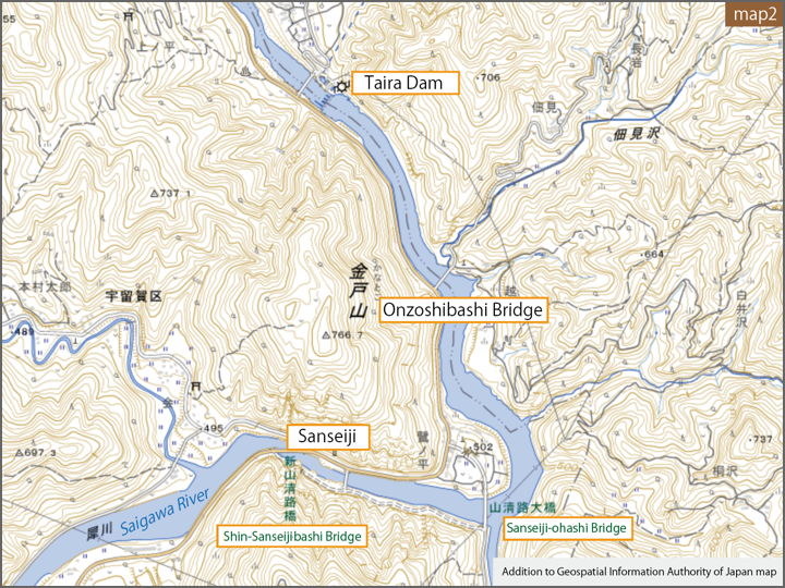
I plan to walk between the Sanseiji-ohashi Bridge and the Shin-Sanseiji-bashi Bridge on this map. There should be little water here, too.
(To be continued)