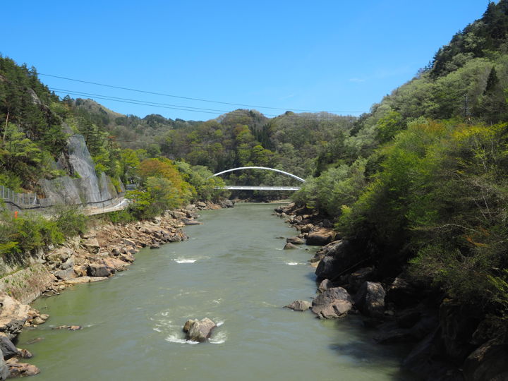
Sanseiji with less water(1)
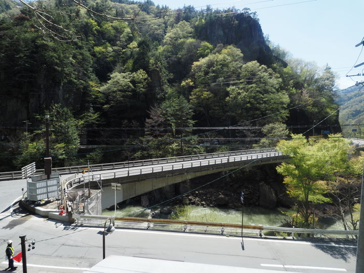
This is one of the bridges over the Saigawa River, the Sanseiji-ohashi Bridge, a new bridge completed in October 2020.
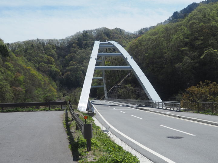
I moved south from Onzoshibashi Bridge, and arrived at Sanseiji-ohashi.
This is where the photo above was taken. (arrow)
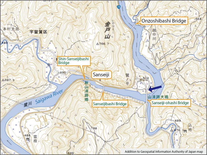
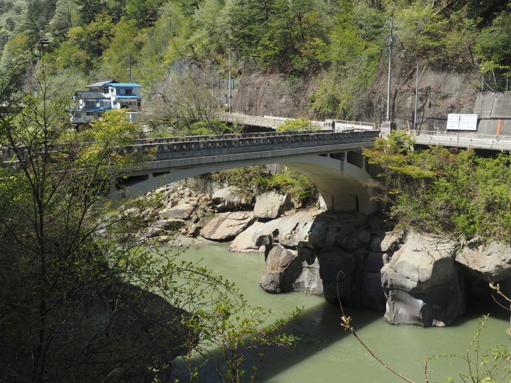
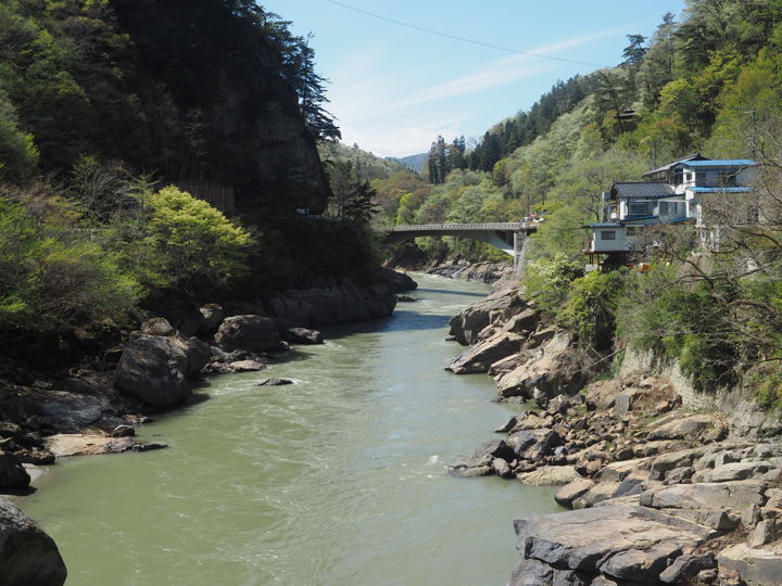
Looking west from the Sanseiji-ohashi Bridge, I can see the Sanseiji-bashi Bridge, which was built in 1934. The bridge is now closed to cars. Further west, the Shin-sanseijibashi Bridge (completed in 1967, meaning “new Sanseijibashi") is now in use as Route 19, but cannot be seen from here.
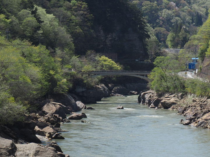
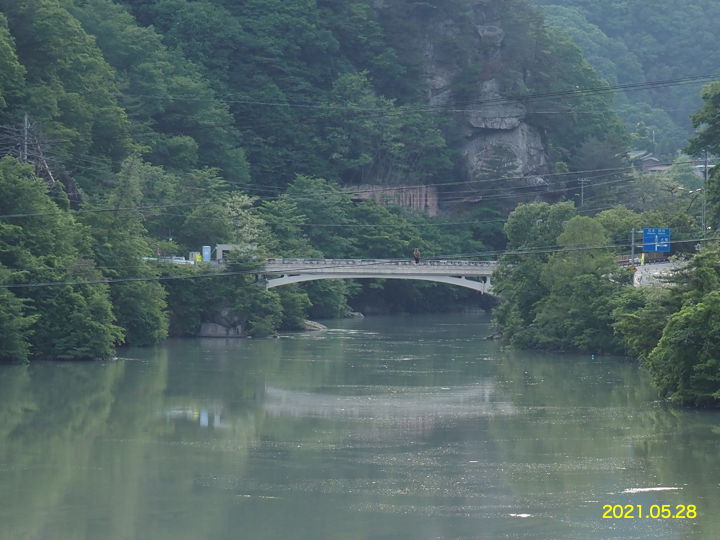
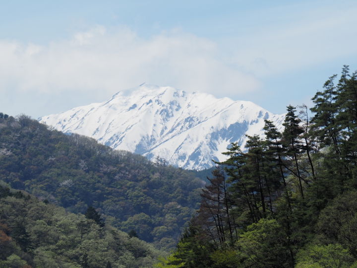
A photo taken in May 2021 is included for comparison.
When there is water in the dam, the rocks on both banks are not visible.
Another unexpected thing was that the Northern Alps can be seen from here. I thought they were hidden by the mountains, but I was surprised to see them.
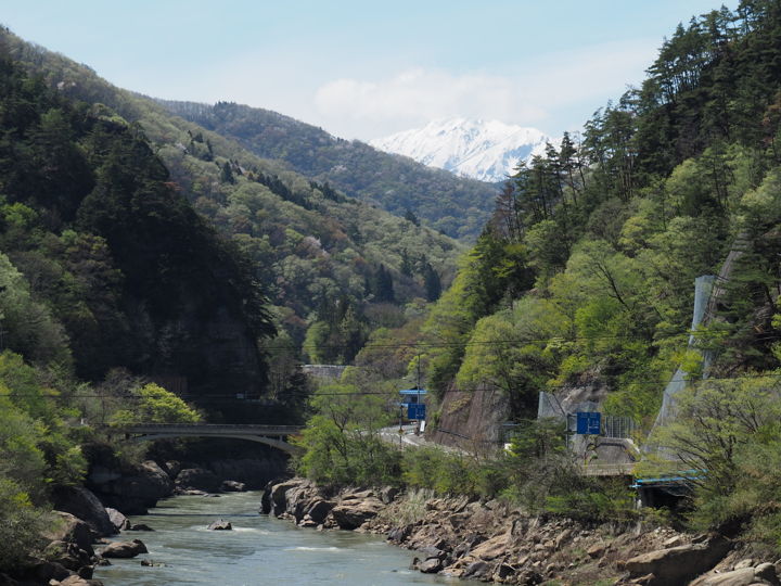
I am not at all familiar with the names of the mountains, so I had to make a judgment based on the map, but is it correct to say that it is Mt. Rengedake ?
South side after crossing the Sanseiji-ohashi Bridge. The area that used to be a road has been closed to traffic and turned into a walking trail. There is also a parking lot.
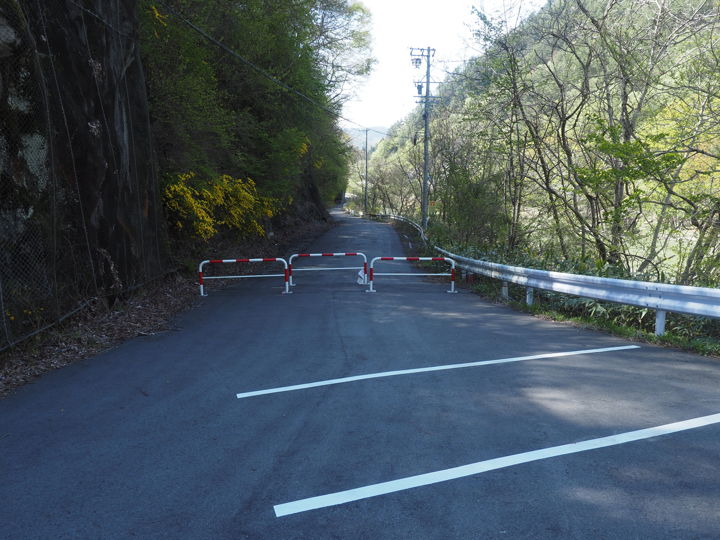
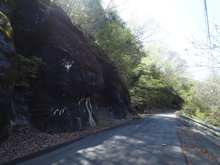
The road was originally a roadway, so it is wide enough to be used as a walking trail. Rocks are approaching the road.
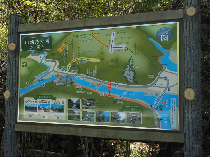
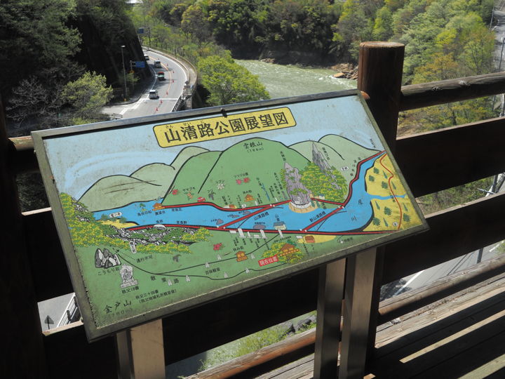
A new signboard has been installed. (The same signs have been erected at several locations along Sanseiji.)
There is a lookout on the other side of the river, so I decided to climb up.
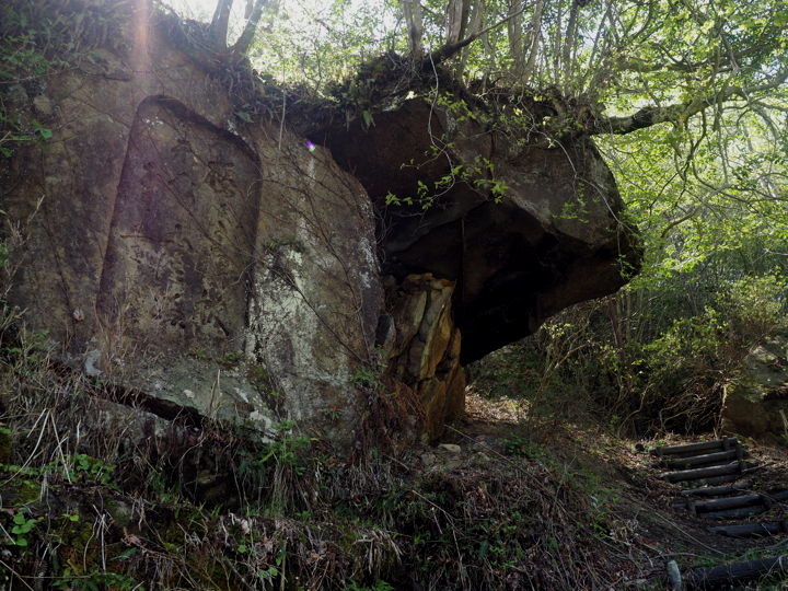
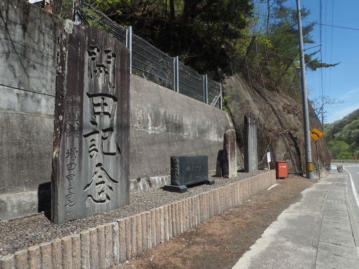
I saw some words carved on a rock, and a sign explaining that the phrase was carved in 1928 to commemorate Sanseiji’s inclusion in the list of the Ten Famous Places of Shinano.
I came close to the Sanseijibashi Bridge. The road on the other side is Route 19. Cars are not allowed on this bridge.
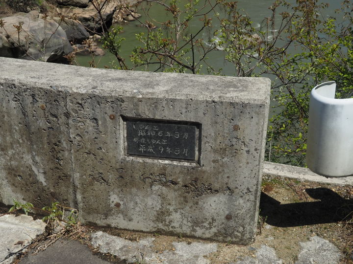
There is a plate on the bridge that was added after the restoration work was done. It reads, “Done in March 1931 / Done of restoration in March 1997".
In the prewar magazine “Road Improvement" (July 1934 issue), it says, “The Sanseijibashi Bridge, which had been under construction since last spring, was successfully completed and a grand opening ceremony was held on June 15".
So I believe that the completion of the bridge is in 1934.
I wonder why the plate says “1931". It is not likely that articles in magazines of the same period would be off by many years.
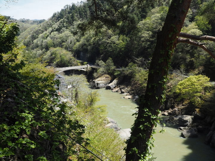
From the bridge, I can see the Sanseiji-ohashi Bridge to the east; the distance between the two bridges is about 570 meters.
From the same position, next looking west. The Shin-sanseijibashi Bridge, now used as Route 19, can be seen.
The distance from the old bridge is about 250 meters.
The Shin-sanseijibashi Bridge is a 100-m-long, one-span arch bridge that was constructed from April 23, 1965 to March 28, 1966.
The old bridge was built over a narrow section of the river, almost at right angles to the road, and was planned to be reconstructed because it had become a bottleneck for traffic due to the increasing size of trailers and other vehicles.
The bridge was designed to fit the scenery of Sanseiji and to resemble the design of the old Sanseijibashi Bridge, which itself is a famous landmark.
I reached the route 19. Four stone monuments line the north side of the road. The one on the left, “Commemorating Paddy Field Reclamation," was erected in 1948 to commemorate the cultivation of a total of 50 hectares of rice paddies in the five districts surrounding this area. Next to it was a stone monument erected in 1967 to commemorate the improved pavement of Route 19, which was apparently a gravel road until the mid-1960s.
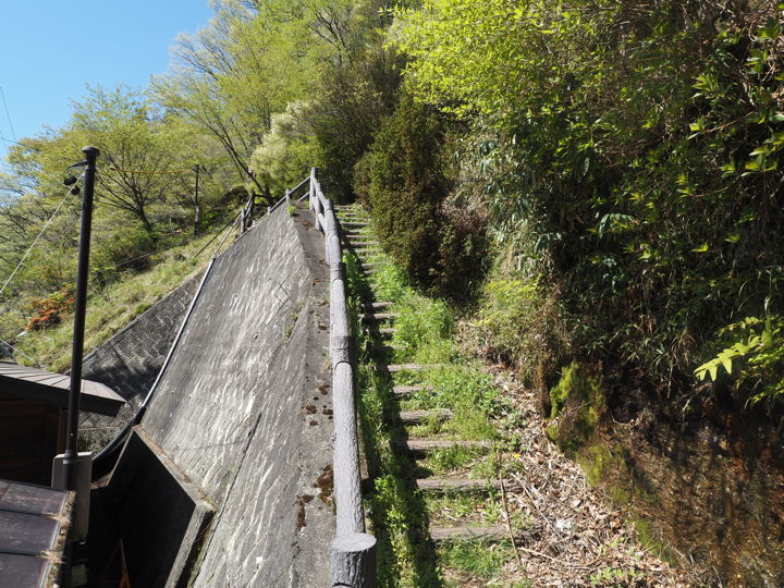
There is a restroom near the Shin-sanseijibashi Bridge and a stairway beside it. To get to the observatory, one climbs up here.
Incidentally, the observatory is located at the top of this rock, and it is clearly visible on the street view. So I quote it. As I am not fond of heights, I don’t want to climb it very much. (But I will climb)
As soon as I started climbing, I took a picture of the Shin-sanseijibashi Bridge, which can be seen in front of me.
In a couple of minutes, I reached the observatory. A panel is placed on the handrail of the observatory. Beyond the panel is route 19. The black rock to the left is part of the “Sarutobi-iwa (meaining monkey jumping rock)".
I am taking this photo in a calm manner, but I am standing one step back, keeping out of the handrail.
There is a walking trail leading up from the observatory and I continue on. Climing up once, but it leads down to the route 19 from the middle of the path.
From here, I could see the Sanseijibashi Bridge.
(To be continued)
[Reference] (written in Japanese)
“Road Improvement" July 1934 issue (Road Improvement Society)
“Road Construction" December 1966 issue (Japan Road Construction Industry Association)