Sanseiji with less water(2)
From the observation deck, the trail continues uphill.
According to the signboard I saw earlier, the trail dead-ends near “Kohmori-iwa Rock" but just before that, a path branches off to the right, leading to the Route 19.
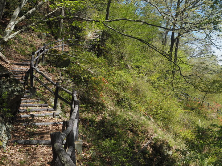
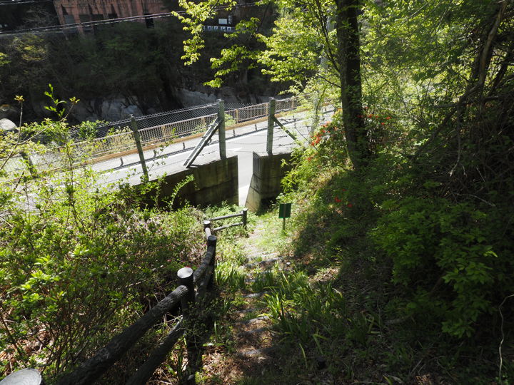
I saw a handrail on the right side. That must be the way down.
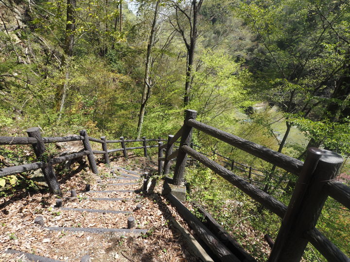
I started my descent from here. It is quite steep. So I descended slowly.
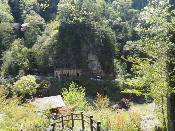
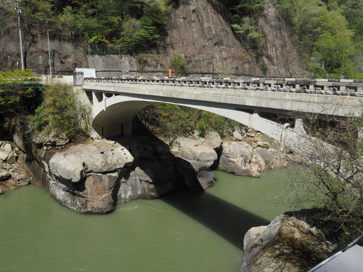
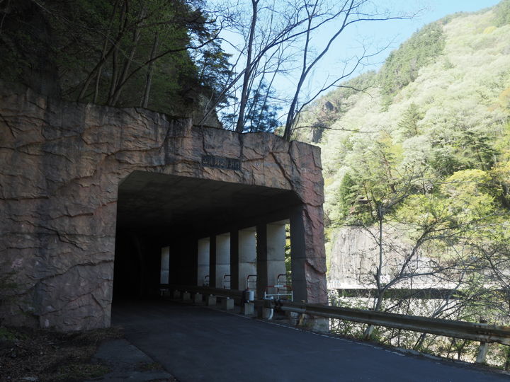
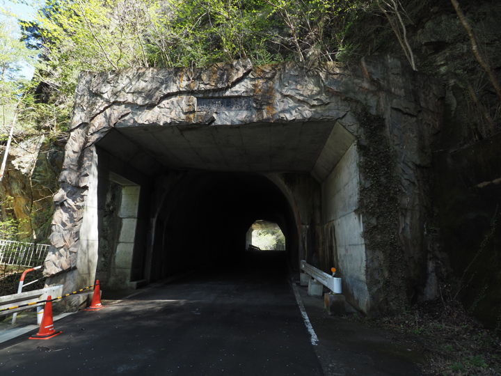
The rock in the center of the photo is called “Suijin-iwa Rock". The rock has been hollowed out to allow cars to pass through. The part that looks like a window is a rock shed that protects the entrance and exit of the tunnel from falling rocks. This used to be a national road before the Shin-Sanseijibashi Bridge was built.
The roof just in front of me is a rest area in the middle of the walking trail.
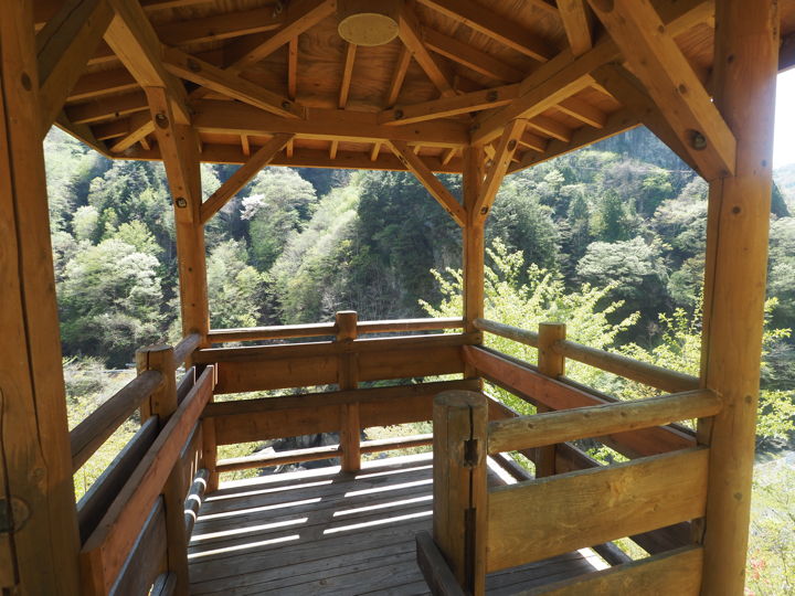
I arrived at the rest area. But did not take a rest and continued down the trail.
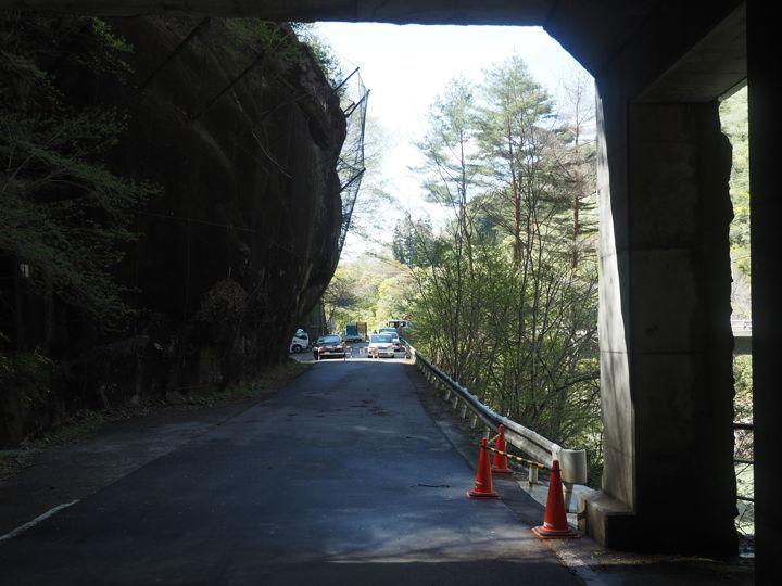
The national road was in sight. It looked like a back entrance. I guess that the administrator may not want to recommend climbing up from here because the slope is steep. I forgot to check what was written on the sign.
After getting out to the national road and walking east, I saw the Sanseijibashi Bridge. Crossing the bridge again, I will turn right this time.
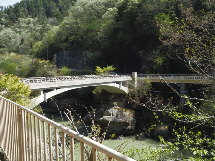
After crossing the bridge and turning right, I turned around and took another picture of the Sanseijibashi Bridge. Before this bridge was built, a wooden bridge was built here.
Walking west, I saw stone monuments and Jizoson standing. In the back is the rock shed in front of the tunnel.
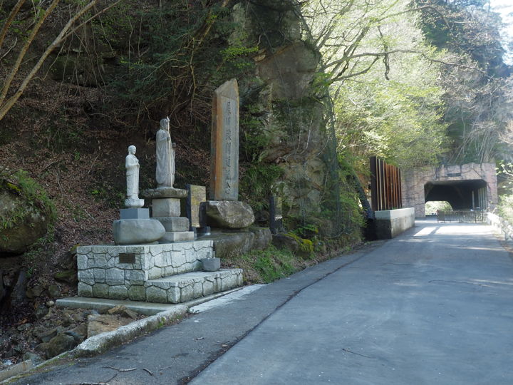
The Jizoson was erected to commemorate those who died during tunnel and national road construction, and later in traffic accidents. But it was washed away by a heavy rain flood in 1964. Then it was rebuilt in 1989.
Above was written on the stone monument to the right of the Jizoson.
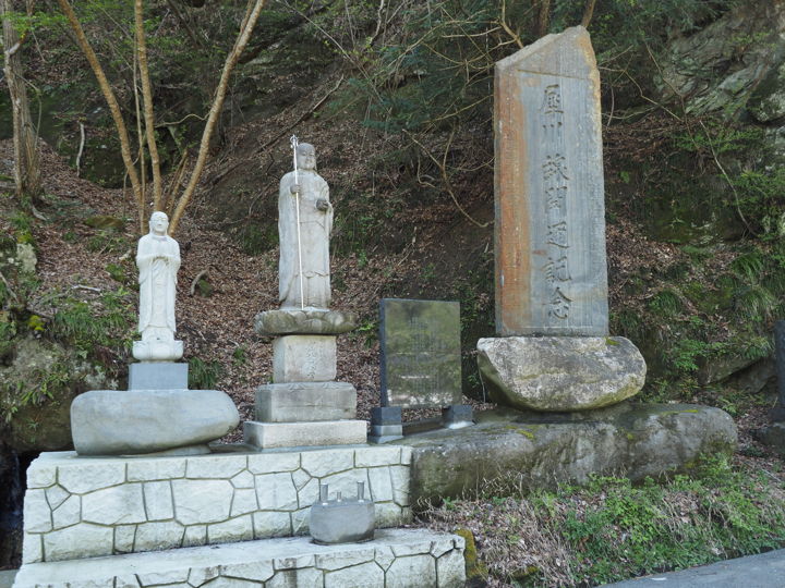
The monument seems to be erected in 1989, but in fact, a landslide occurred at this site in 2004, and the Jizoson was damaged. The place of enshrinement had not been decided for a while, but in 2022, the Jizoson was enshrined again, and the erection ceremony was held in June.
I learned this from the blog of the mayor of Ikusaka Village.
As for records of past accidents, I looked at the Shinano Mainichi Shimbun Annual and found two accidents.
First, four people died in a gunpowder explosion accident at a national road tunnel construction site in Sanseiji in October 1949. Moreover, in January 1950, a bus fell off the road in Sanseiji and four people died.
The information on the local stone monuments and explanatory boards is only information at the time they were erected, and the contents are written in brief, so there are many things that cannot be understood just by walking around the area.
The large stone monument on the right is engraved as “Commemorating the opening of the Saigawa Line (=road)". Nearby, an explanatory notice board reads as follows
Saigawa Line Opening Memorial Monument
In 1920, the Saigawa Line Establishment Alliance was formed by 13 villages along the Saigawa River from Nakategawa Village to Minochi Village. The construction was started in 1927 and a monument stands at Kido. The Kido Bridge was completed in 1930 and the Mutsumi Bridge in 1931. Since then, new roads in Ikusaka Village have been constructed,
In 1934, the Sanseijibashi Bridge was completed, and in May of 1938, the Saigawa Line was opened at Sanseiji. On the occasion of the opening, a monument unveiling ceremony was held with over 300 people including successive governors, prefectural assembly members, and village mayors. On the back of the monument, the names of the governors, prefectural assembly members, and mayors of the thirteen villages involved are inscribed. The monument was overturned due to the expansion of the national road, but was moved from the opposite bank in December 1988 and rebuilt, and the ceremony was held in March 1989.
January 1997, Ikusaka Village Board of Education
Saigawa Line Opening Memorial Monument
In 1920, the Saigawa Line Establishment Alliance was formed by 13 villages along the Saigawa River from Nakategawa Village to Minochi Village. The construction was started in 1927 and a monument stands at Kido. The Kido Bridge was completed in 1930 and the Mutsumi Bridge in 1931. Since then, new roads in Ikusaka Village have been constructed.
In 1934, the Sanseijibashi Bridge was completed, and in May of 1938, the Saigawa Line was opened at Sanseiji. On the occasion of the opening, a monument unveiling ceremony was held with over 300 people including successive governors, prefectural assembly members, and village mayors. On the back of the monument, the names of the governors, prefectural assembly members, and mayors of the thirteen villages involved are inscribed. The monument was overturned due to the expansion of the national road, but was moved from the opposite bank in December 1988 and rebuilt, and the ceremony was held in March 1989.
January 1997, Ikusaka Village Board of Education
Wait, it says here that the Sanseijibashi Bridge was completed in “1934". Why did they write “1931" on the bridge? (The plaque added after the restoration work was completed.)
There is another stone monument on the right side of the monument, which is not shown in the photo above, and it says that the monument was moved for construction and left for a while, and then rebuilt. (The monument was erected in 1989).
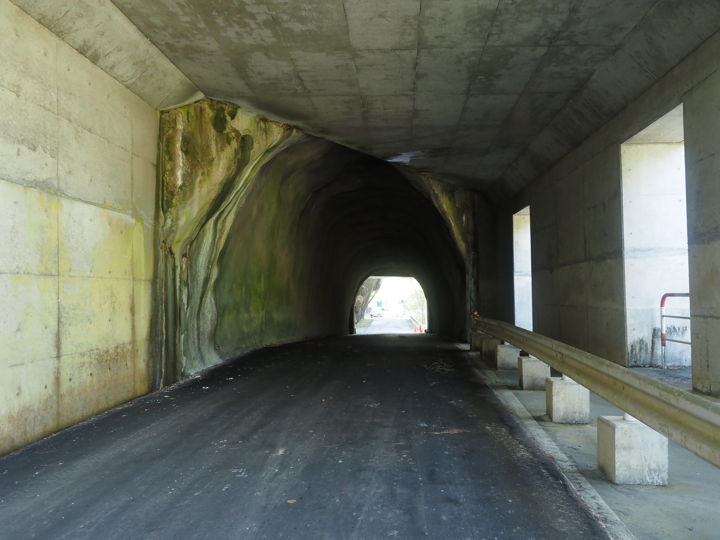
I came to the rock shed called “Domon". The sign on the monument reads “Sanseiji no.2 Domon".
The Domon is built in front of the tunnel through the rock.
And coming out from the window on the right side, there is a road that goes around the rock. This must have been the road before the tunnel was dug.
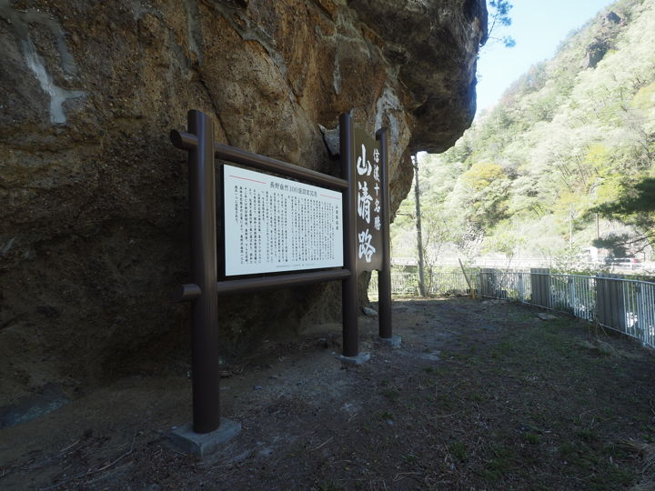
When I steps out there, an information board has been erected, apparently to commemorate the 1987 selection as one of the 100 best natural wonders of Nagano, with the legend of Sanseiji written on it. However, the information board itself is newer as it was renovated in 2020.
When I went out to the west side, I found a rock shed in front of the tunnel. The name is “Sanseiji no.1 Domon “.
A little further on, the road is separated by guard pipes, and the area along the national road is a parking lot. On this day, construction vehicles were using the parking lot, so I ended my visit here.
Last topic.
On the information board of the boardwalk, there are several photos of the sights.
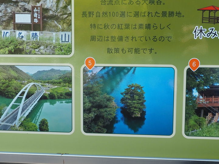
This photo #5 is called “Shimadai no matsu (Pine tree on island)" and is located beside the newly built Sanseiji-ohashi Bridge. The pine trees seem to float on the water.
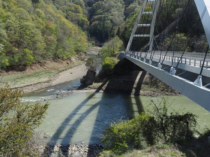
However, the water level is currently lowered. Let’s go back to the Sanseiji-ohashi Bridge to see how it is.
The photo on the information board was taken from the air, so it is not visible from the same angle, so I crossed the bridge looking for a direction that would make it easier to recognize the shape.
Zoom in.
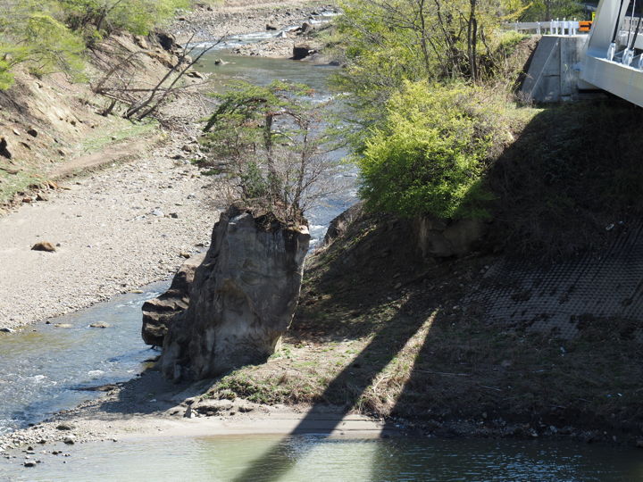
There was a long, narrow rock. It will become an island again when water is stored. The construction of the power plant will be finished around July next year, so the current state will continue until then.
Add a photo at the end, taken in 2021.
[Reference] (written in Japanese)
“Shinano Mainichi Shimbun Annual1951" (Shinano Mainichi Newspaper Company, Research and Publication Department, 1951)
“Sanseiji Jizoson Erection Ceremony & Scenery of Sanseiji" (2022.06.09) Ikusaka Village Mayor’s Blog