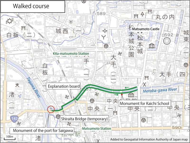
Walk along Metoba-gawa River
Here is the Meotoba-gawa River in Matsumoto City. I am walking along the river while admiring the cherry blossoms.
Last year, I wrote about the publication of a pictorial map of the Metoba River, so I decided to take a short walk along the river during the cherry blossom season.
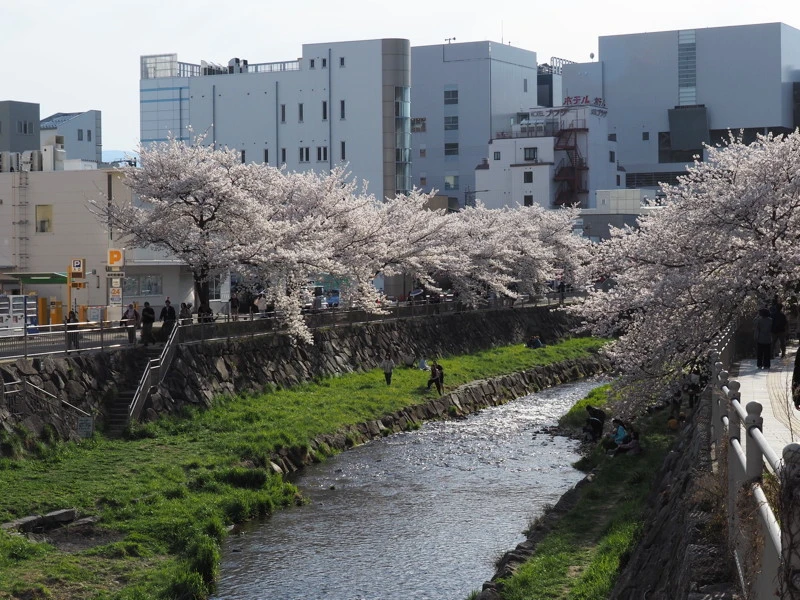
People were stopping along the sidewalk to take pictures of the cherry blossoms and relaxing on the riverbank. There seemed to be many tourists from overseas.
I remembered that there was the “Monument of the port for the Saigawa River ship service” at the confluence of the Metoba-gawa River and the Tagawa River on the picture map.
So I walked there today with that as my destination.
I also take pictures of cherry blossoms while walking.
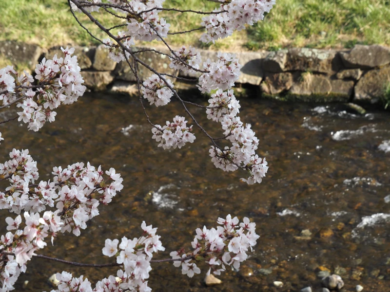
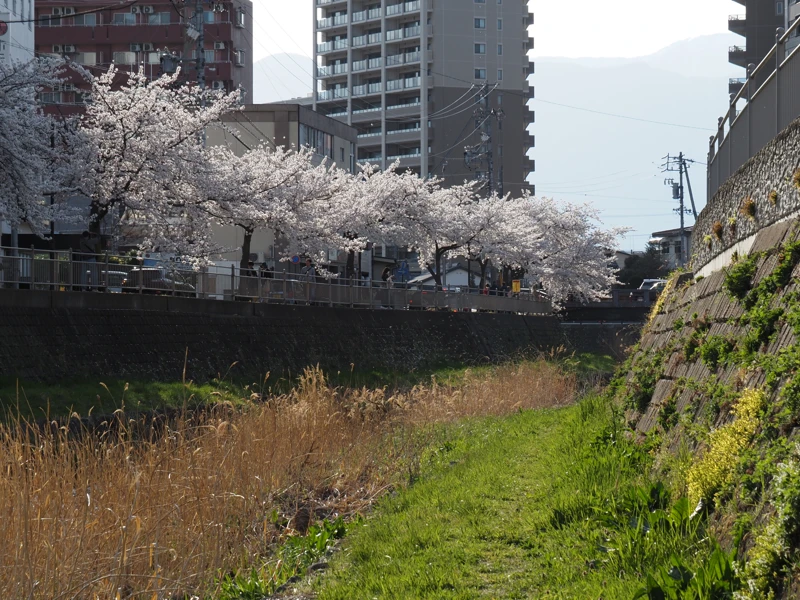
Walked along the riverbank for a while.
Walked back to the road from the riverbank and found an explanatory board just past the JR tracks.
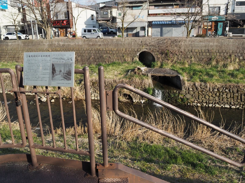
It was an explanatory board titled “(3) Use of Water from the Metoba-gawa River".
According to the sign, until around the early Showa period, there were silk mills and dye houses along the river, and the silk mills used water wheels for power, and the dye houses used the water from the canal to wash fabrics.
I was walking along the riverbank, so I did not look at the other explanation boards, but it seems that there are several other boards placed on the sidewalk along the river.
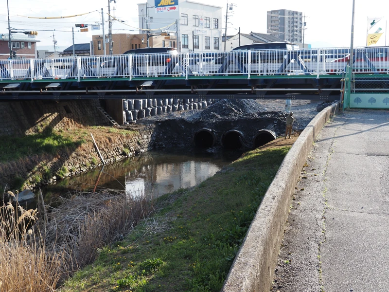
This area is under construction, so walking on the riverbank is not allowed.
Due to the replacement of the Shiraita Bridge, a temporary bridge (the bridge in the photo) is currently being used on the east side of the old bridge.
The work is said to be to build abutments for a new bridge.
After crossing the temporary bridge and walking for a while, I found a monument.
On the base of the monument, there is an inscription that reads “Monument of the port for the Saigawa River ship service".
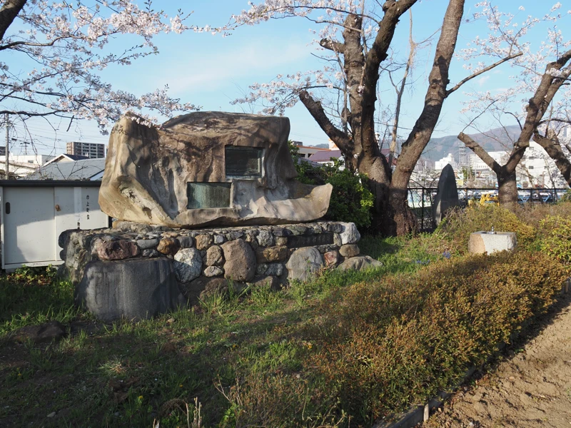
The inscription reads, “This monument was built by Matsumoto City in 1968″.
And the contents are summarized as follows,
1) The Saikawa boat transportation started in 1832 between Matsumoto and Shinshu-Shinmachi. Later, it was extended to the Nagano Basin.
2) In the Meiji era, the transportation became independence management of the company and flourished. Two companies that had started business in the early Meiji period merged in 1892 to form a new transportation company.
3) The business declined when the Shinonoi Line of the railroad opened in 1902.
(4) The overland Saigawa Line (present-day National Route 19) was opened and the boat service was discontinued in 1938.
This is a relief attached to the monument.
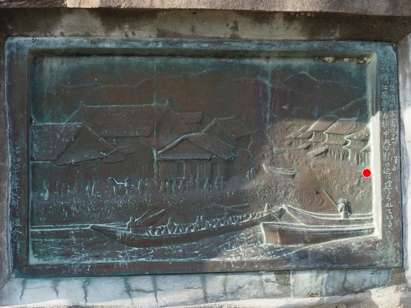
It was created based on a photograph taken around 1887, and it says that this monument was built at the red circle (which I wrote on the photograph).
Since the monument is located here, the view is from downstream, but the water surface seems to be higher than it is now. Was there much water in the past?
According to my research, the river was widened after the flooding caused by a typhoon in 1959, so this may have something to do with it.
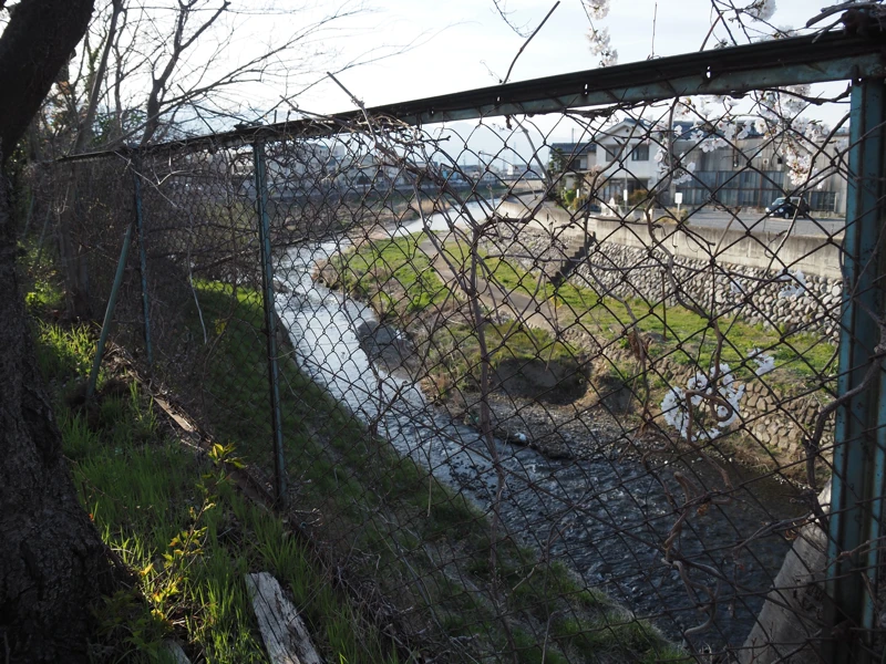
The confluence of the Metoba-gawa River and the Tagawa River as seen from the monument. The water surface in the lower right is the Metoba-gawa, but beyond the bend is the Tagawa.
I turned around here and headed back upstream.
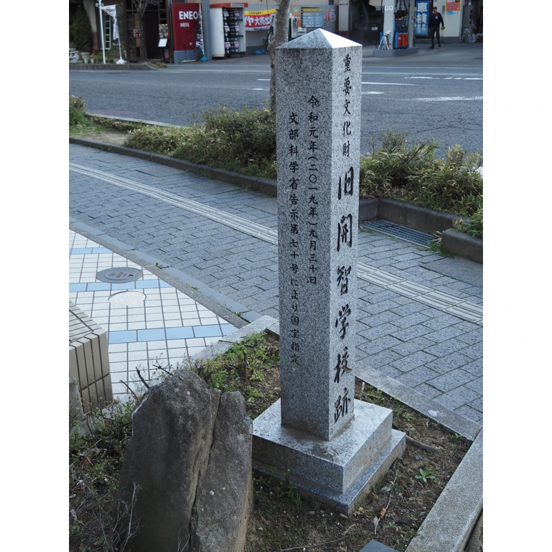
At the corner of Chuo-oote-bashi Bridge, there stands a stone monument that marks the site of the former Kaichi School.
There was the school building of Kaichi School here.
The school building, which was used until March 1963, was moved to its current location and is now open to the public as a museum.
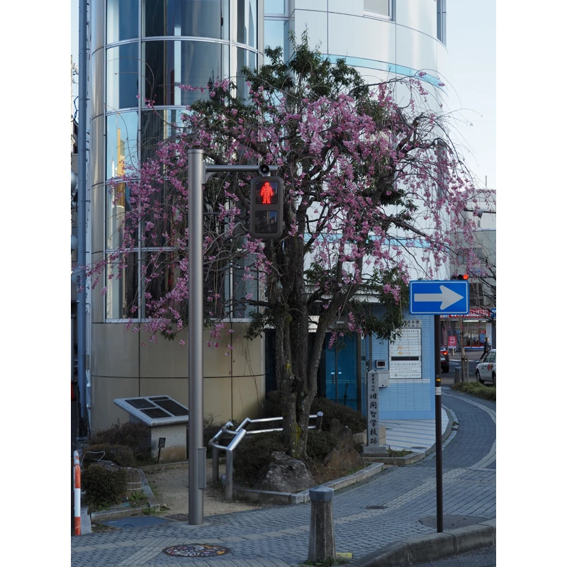
This monument was erected in 2002, but it also noted that the former Kaichi School was designated a national treasure in 2019. The letters were probably carved and added later.
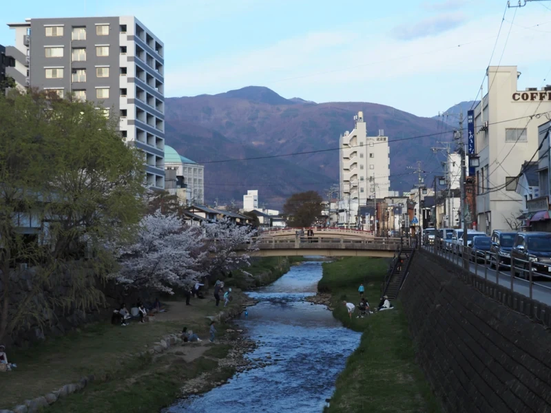
The last photo is the upstream view from the Chitose-bashi Bridge.
It is evening and the riverbank is getting a little dim.
[Related article]
“Pictorial map of Metoba-gawa River" (2024-01-29)