Pictorial map of Metoba-gawa River
The other day, I attended the “Metoba-gawa River Symposium – Designing the Waterfront of the Future" held at the Matsumoto Performing Arts Center.
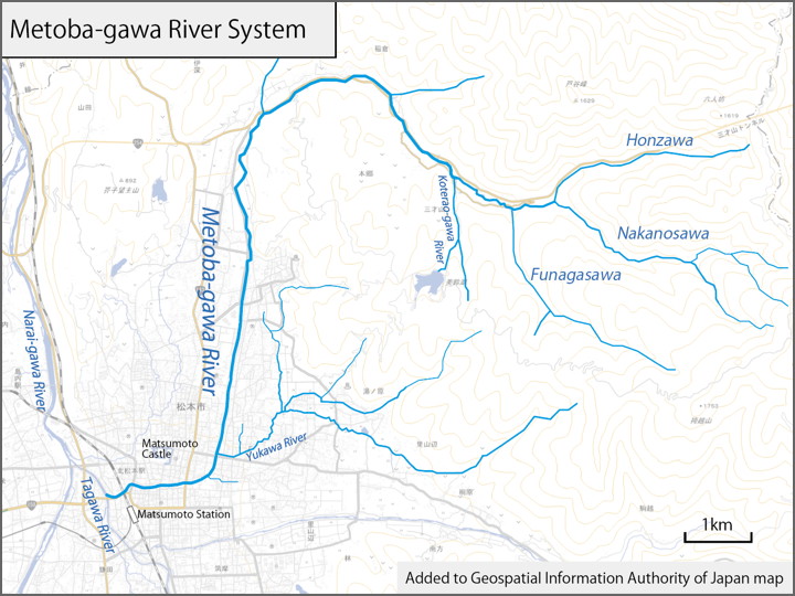
The Metoba-gawa River flows through the downtown area of Matsumoto. I drew its flow on the Geographical Survey Institute map.
The Honzawa Stream flowing from Misayama Pass, the Nakasawa Stream originating from Takeishi Pass, and the Funagasawa Stream flowing from Mountain Hakamagoshi, these merge and head west, turning south halfway and descending through Matsumoto City.
Then the river turns west around southeast of Matsumoto Castle and joins the Tagawa River.
This symposium was organized by the Matsumoto Urban Design Study Group.
The first half of the symposium featured a lecture by Atsuko Yamamoto, who worked on “Tokyo Waterfront Walk," followed by a panel discussion in the second half.
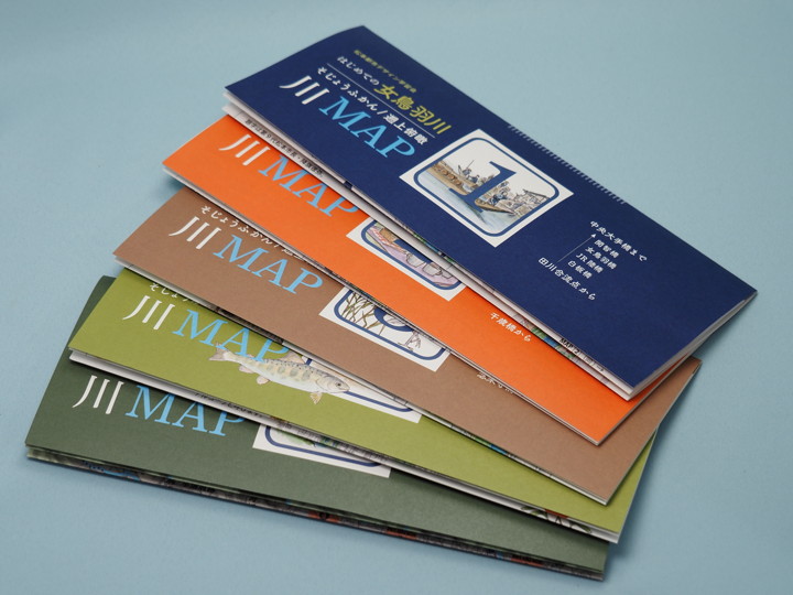
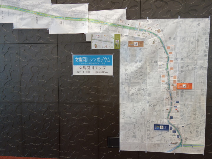
The Design Study Group has created “The first time of Meotoba-gawa River: Upstream bird’s eye view river MAP" in 2023.
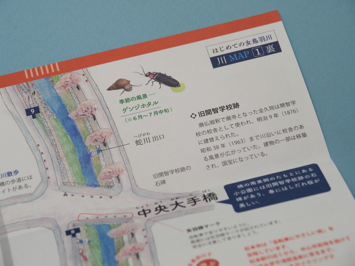
The following photograph shows a portion of the map, which depicts both banks of the river, roads and bridges along the river flow. It also depicts the locations of temples and shrines, as well as the flora and fauna of the riverside area, so that visitors can enjoy nature and history as they stroll along the riverside area.
Moreover, at this symposium, participants were given this map. That was the main reason why I decided to attend the symposium.
The river MAP was made in five parts, divided into Maps 1 to 4 from downstream, and Map 5 is the overall map; Maps 1 to 3 are on a 1/1000 scale, and Map 4 is on a 1/6400 scale.
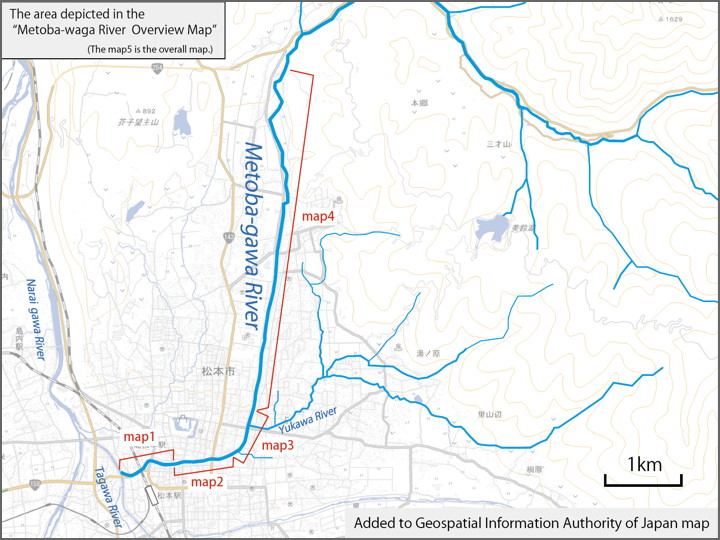
Maps 1 to 3 are the same scale, so they are able to be connected. However, since the maps are printed on both sides of the paper, two copies are needed to connect the maps.
Since I got the good maps, I’m thinking of cycling along the river with this map in hand when spring comes.