Maruyama Water Tank
About 300 meters south of the former Yamaichi Hayashi-gumi Silk Manufacturing Office is a hill called Maruyama.
There is a facility there commonly called “Maruyama Water Tank,” so I headed there after seeing the office.
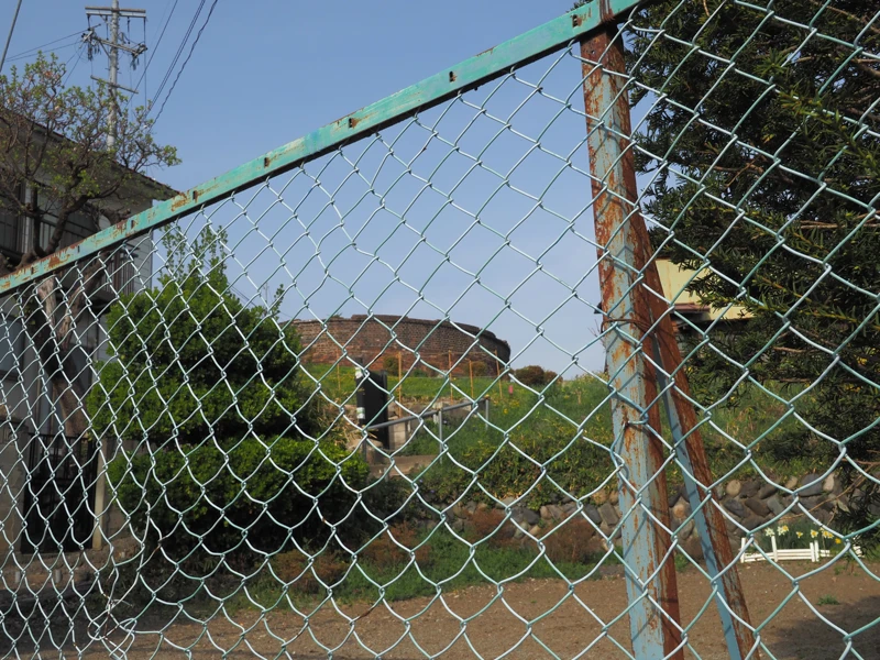
There are two entrances to the hill, one on the north side and the other on the west side, but I found the one on the west side first.
I could see Maruyama Water Tank through the fence from the road. The hill is higher than I had expected.
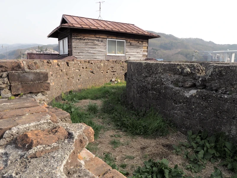
I climbed up the narrow path between house and fields. I took this photo halfway up the hill.
As I found out later, the north entrance seems to be the official entrance. An explanatory board was also standing on the north side.
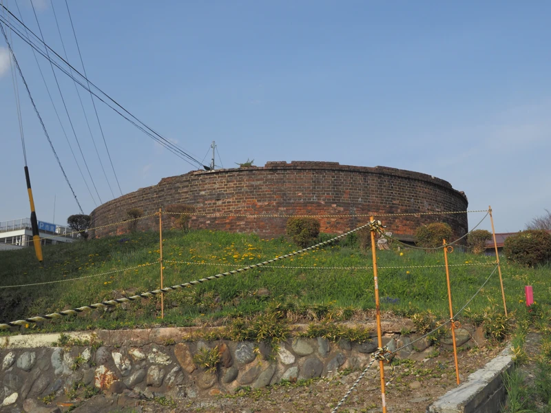
That is a brick structure with a diameter of about 12 meters and a height of about 2 meters.
Good quality water is necessary for the production of raw silk.
In Okaya, water from the Yokokawa-gawa River (one of the rivers flowing into Lake Suwa) was often used in the early Meiji period, but from the end of the Meiji and Taisho periods, the number of silk mills that used water from Lake Suwa and the Tenryu-gawa River increased.
Water was lifted by foot-pedal with human power or waterwheels, but around 1908, it became possible to lift water by electric power, and the use of water from Lake Suwa and the Tenryu-gawa River increased significantly.
The increase in the number of silk mills led to a shortage of water, so in 1914, five silk manufacturers jointly formed the “Maruyama Silk Manufacturing Waterworks Association” and built a water tank. The tank was built to pump water from the Tenryu-gawa River to supply water to the silk mills.
The Maruyama Water Tank is about 20 m above the surface of Lake Suwa, which made it possible to supply water to the surrounding factory area.
An explanatory board was found on the north side of the tank.
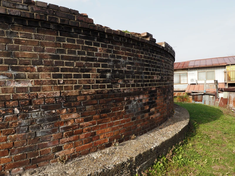
It said that the tank was 38 m in circumference, 2 m in height, and the wall was 60 cm thick.
There is a double concrete ring wall inside the brick outer wall, making a three-layered structure.
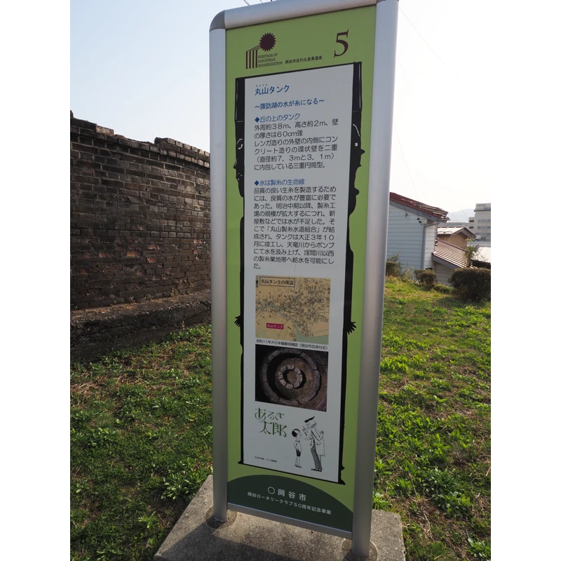
On the back of the board, there was a pump shed along the Tenryu-gawa River, where two electric pumps were installed. The pump shed existed until around 1972, but no longer exists.
The pipeline had 10 lines (main and branch lines) with a total length of 2,044 meters.
The water supply capacity was said to be able to supply 1,400 cubic meters per day.
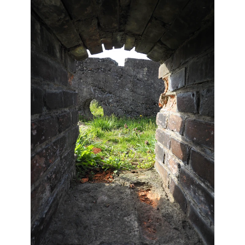
There was a window on the exterior wall, so I looked inside.
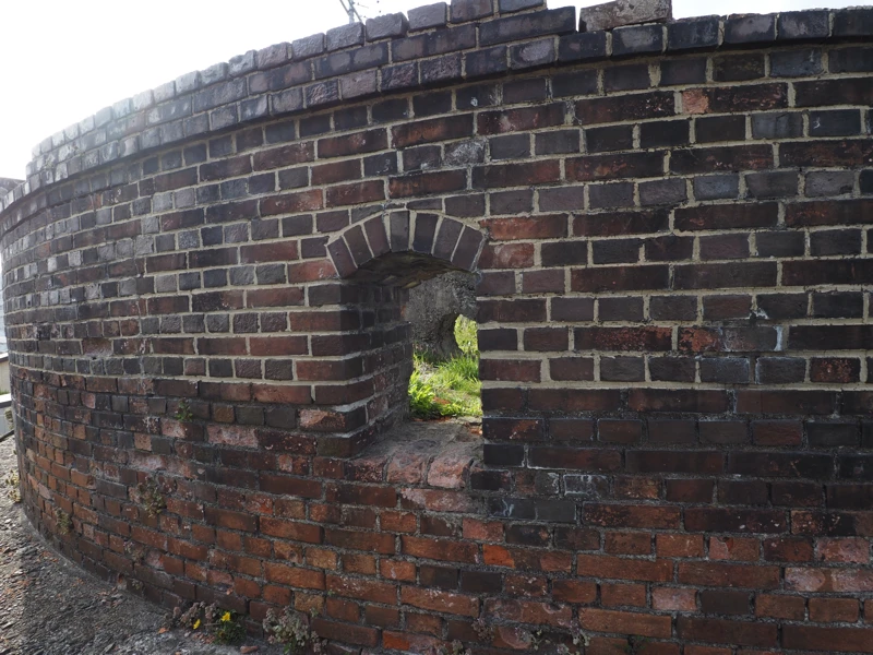
I saw a concrete wall in the back and grass growing inside.
Wanted to see it from above, so I reached out with my camera hand to take pictures.
The inner double wall looks like this.
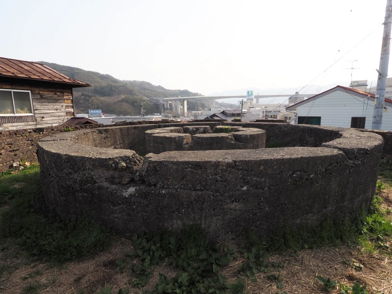
The innermost one is 3.1 meters in diameter and the outer one is 7.3 meters in diameter.
The elevated road in the distance is the Nagano line of the Chuo Expressway.
By the way, where was the water actually stored?
The pamphlet of the Industrial Heritage of Modernization states that this structure was a pedestal for a metal tank.
What remains is not a tank but a “pedestal". However, there is no further explanation.
There is a tea‐leaf store just north of the Maruyama Water Tank, which is introduced in the store’s blog.
There, you can see a photo of the tank as it was when it existed. (Link at the end of the article.)
I am not sure about the structure of the tank.
Is that inner double wall meant to settle the fine sediment in the water?
Or is the double wall just to support the metal tank? The fact that there are windows opening in the brick wall suggests to me that the brick portion was not used to hold water.
I think that the fact that there was a metal tank on top should be included on the explanation board at the site prepared by Okaya City.
Since the site is recognized as an industrial heritage site, it would be better to inform about the structure of the tank and how the water flowed through it.
Also, how long it was used.
When the tanks were removed, but we can narrow it down to some extent from aerial photos.
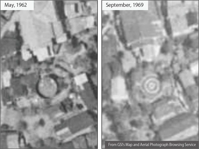
The 1962 aerial photo shows what appears to be a flat plate. Probably the top surface of a metal tank.
In the 1969 photo, a distinctive triple circle can be seen. This is the same as in the current aerial photograph.
This means that the tank was removed in the 1960s.
[Reference] (all written in Japanese)
“Okaya’s Industrial Heritage of Modernization recognized by the Ministry of Economy, Trade and Industry" (Okaya City Official Website / updated 2020-03-27)
(Link to brochure is available.)
“Maruyama Water Tank, water from Lake Suwa makes raw silk” (Tea-leaf Store Cha-Koizumi Blog / September 22, 2019)
“Okaya City History, Middle Volume” (Okaya City Edition / Okaya City / 1976)