Cycling along the Jikkasegi Canal (1)
There is an irrigation canal named “Jikkasegi" in Azumino City, Nagano Prefecture.
The canal was excavated in 1816, in the late Edo period (1603-1868). It is said to have been named so because it supplied water to ten villages in the area at that time.
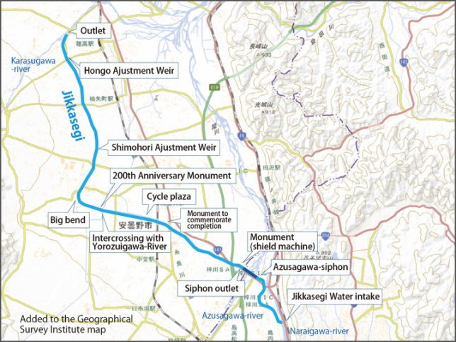
The water intake is where is written on the map as “Jikkasegi Water Intake", and it flows slowly along the contour line for about 15 km to the outlet of the Karasugawa River, passing under the Azusa-gawa River through an underground channel (reverse siphon) on the way.
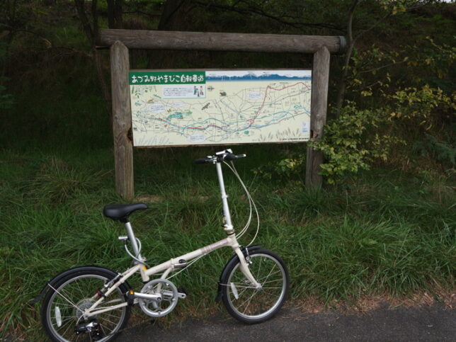
I heard that there is the Azumino Yamabiko Bicycle Path along the canal. (Although the southern part of the path is still under construction in Matsumoto City.) Since the waterway is mostly flat, I thought the bike path would be easy to follow… so I decided to take out my folding bike and go for a ride. I was tired of being cooped up in the house all the time.
One day in early October.
Considering the time and my strength, I decided to run about half of the course this day. I’m planning to ride to the “Cycle Plaza" or the “Intercrossing with Yorozui-gawa River".
I parked my car at the Toyoshina Nanbu General Park, which is near the Jikkasegi canal. From there, I will go to the water intake first by bicycle. And then ride along the canal (although I would have to go back) and finish when I felt like it near the Cycle Plaza.
The photo starts when I arrived at the water intake.
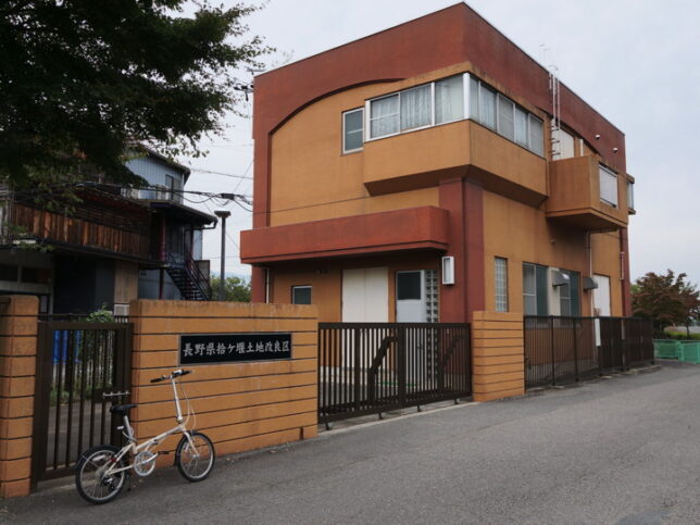
I found a building near the water intake that said “Nagano Prefecture Jikkasegi-Canal Management Association", so I thought here as my starting point. I parked my bicycle and took some pictures.
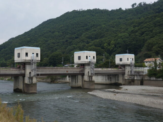
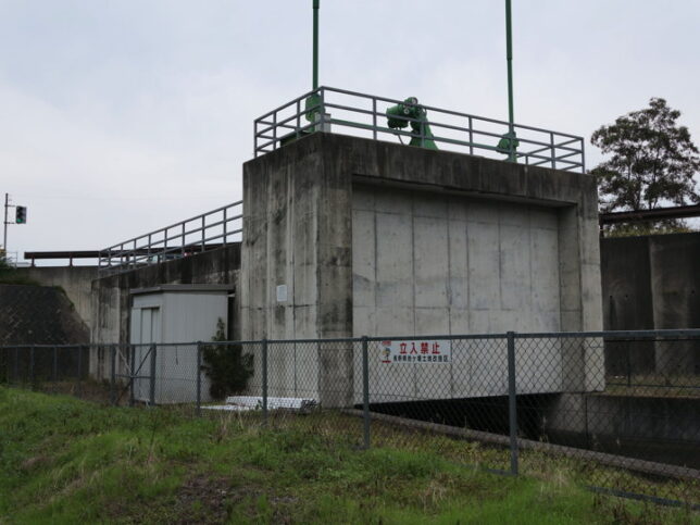
This intake weir was completed in March 1994. It’s a movable weir, and it seems to store the water here and lead it to Jikkasegi-Canal. The nameplate attached to the pillar read “March 1994", “Weir length 90m, height 3.67m", and “Three movable weir".
There is a water use signboard beside the intake weir.
The name of the user is Nagano Prefecture Jikkasegi-Canal Management Association.
The amount of water withdrawn varies depending on the season: 7.543 cubic-meter/second from May 1 to 10, 6.996 cubic-meter/second from May 11 to September 30, and 2.543 cubic-meter/second from October 1 to April 30. This is water for agriculture. The irrigated area is said to be 795 hectares.
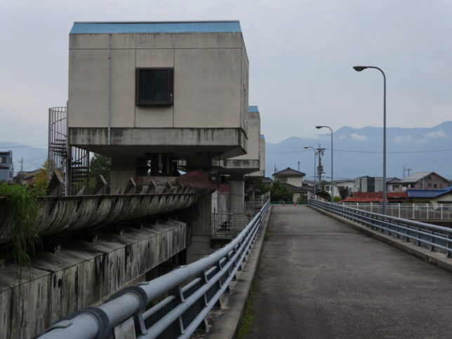
There is a bridge at the movable weir, so we can cross it on foot or by bicycle.
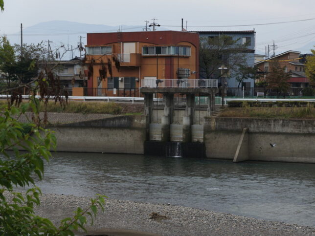
This photo was taken from the other side of the river. The brown building is the office of the Jikkasegi-Canal Management Association. The sluice gate in the center is the water intake of the Jikkasegi Canal.
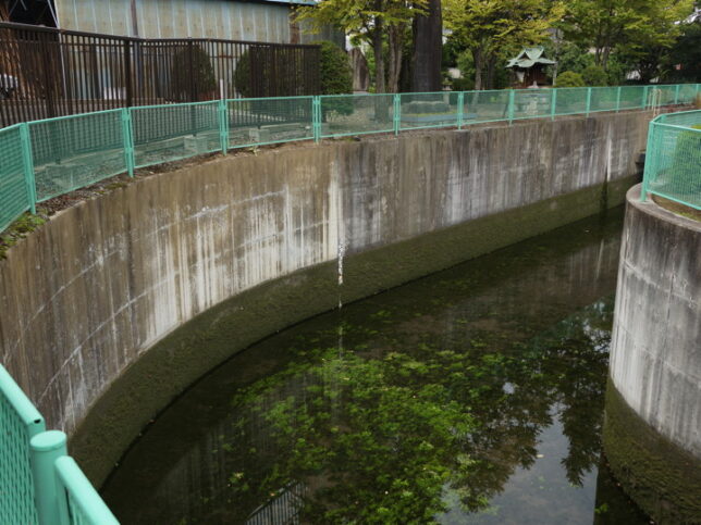
I crossed the bridge again and came back. I looked at the inside of the gate. The water does not seem to be moving.
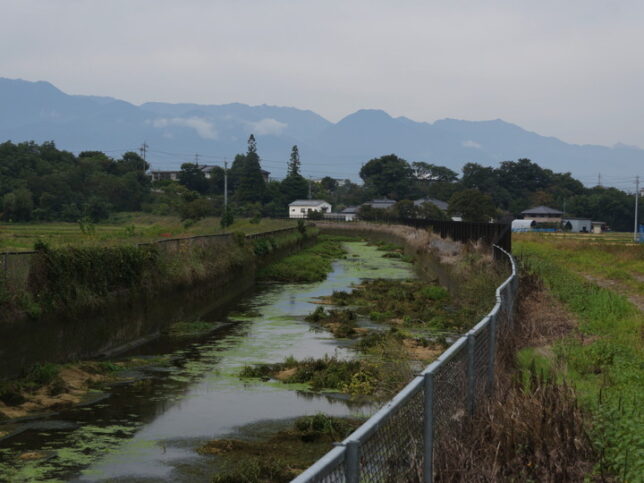
A few hundred meters later. It seems that this area has not been developed as a bicycle path yet.
Route 147 crosses the Narai-gawa River at Hirase Bridge, a sign for the bicycle path appeared. But the grass is growing a bit long here. I guess it can’t be helped this year.
This is a photo taken looking backwards.
Tree roots are growing under the pavement here, and the ground is very bumpy. I thought the tree roots are very strong, but it is difficult to ride a bike.
According to the information board, the bicycle path will be extended south to Shiojiri City in the future.
Near the signboard, there is an entrance to a reverse siphon. This reverse siphon was renovated in 1998. The water goes underground from here.
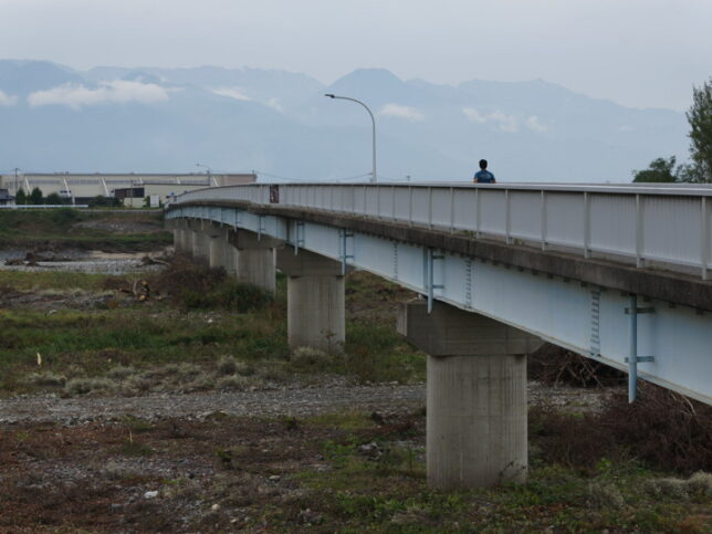
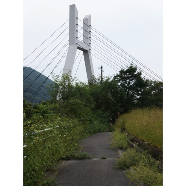
The bicycle path cross the Azusa-gawa River on a bridge. Only people and bicycles are allowed to cross this bridge. On the parapet of the bridge, there is a sign saying “Azumino Yamabiko Bicycle Path. According to the nameplate on the bridge, it was completed in July 1988. The name of the bridge is “Azumino Bridge".
The water of the Jikkasegi Canal passes 12m underground of the Azusa-gawa River.
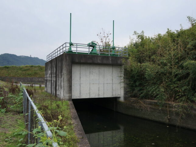
A little further on after crossing the Azumino Bridge, I found the exit of the reverse siphon. The water was hardly moving.
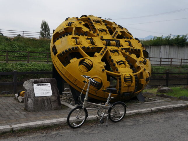
Near the exit, there is a monument. It says, “Shield Machine Face," and is said to be a part of the top of a machine used to excavate underground waterways. And the length of the underground part is 353 meters.
A monument with the words “Forever Green" engraved on it stood right next to Shield Machine face, so I transcribed the nameplate on the back.
The Azusa-gawa River siphon is an important facility to Jikkasegi Canal that transports water from the Narai-gawa River, which originates from Torii Pass, across the Azusa River, which originates from Kamikochi, to Azumino.
The old siphon had been pumping water for 78 years. The new siphon with a diameter of 2.8 meters and a length of 400 meters was completed 10 meters below the old siphon as part of the prefectural government’s reservoir improvement project, using the most advanced technology and the wisdom and passion of the people involved. A monument is erected here in the hope that it will bring abundant blessings and water in the future.
Start of construction: October, 1995
Completion: March, 1998
Total construction cost: 1.7 billion yen
April, 1998: Jikkasegi Canal Management Association, Minami-Azumi County.
The previous generation of reverse siphon was built in the Taisho era. So what did they do with the water before that? In the beginning, they used to cross it in a transverse channel.
Soon, the Jikkasegi Canal and the bicycle path went under the Rout 147 and passed through the south of it.
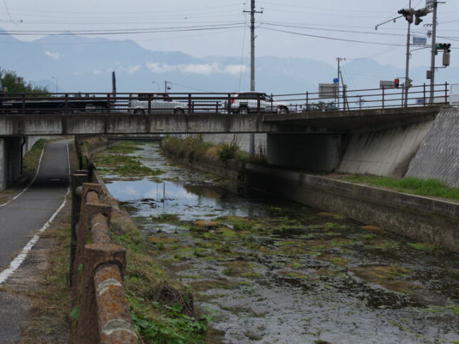
The signal on the right in the photo is a signal of the Rout 147.
The canal is supposed to be “downstream" in the back, but since the water is not moving, it’s hard to tell which way is downstream.
There was a convenience store on the right side of the signal, so I bought lunch there. I decided to eat at a nearby park.
After lunch, I took a short detour. (To be continued)
[Reference]
Jikkasegi Canal Walking and Cycling Guide", Azumino City Tourist Information Center