Chikuma-gawa River Levee Breach – One Year Later Photo Exhibition
The East Japan Typhoon of 2019 caused damage in many areas.
In Nagano Prefecture, the Chikuma-gawa River, which flows through the eastern part of the prefecture, was flooded by the heavy precipitation, especially in the eastern area, causing flood damage to many areas in the basin. In Nagano City, the northern part of the city and the Shinonoi and Matsushiro districts were flooded.
This photo, taken from the Ministry of Land, Infrastructure, Transport and Tourism, shows the northern part of Nagano City.
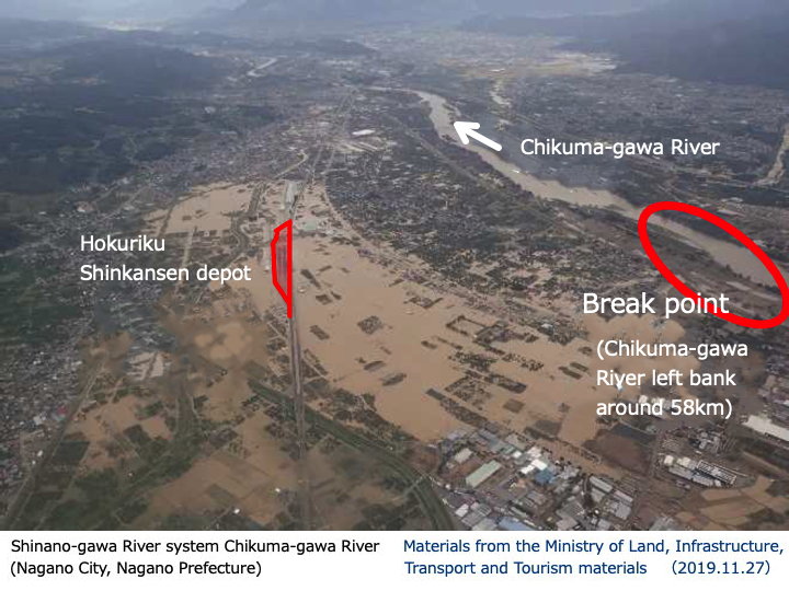
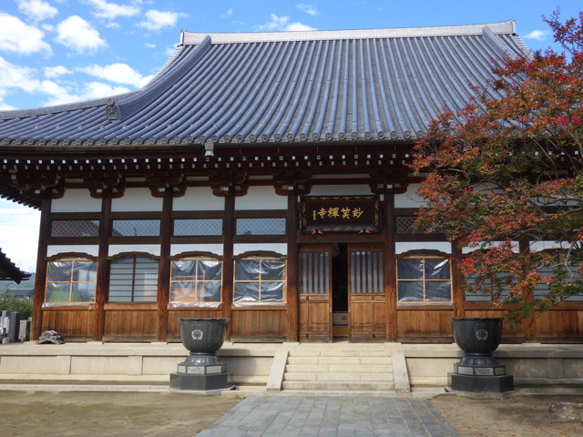
There is a temple called Myosho-ji Temple (玅笑寺) near the breakwater point in this photo. And Myosho-ji Temple is holding a “Photo Exhibition of the Levee Breach" from October 12 to October 18.
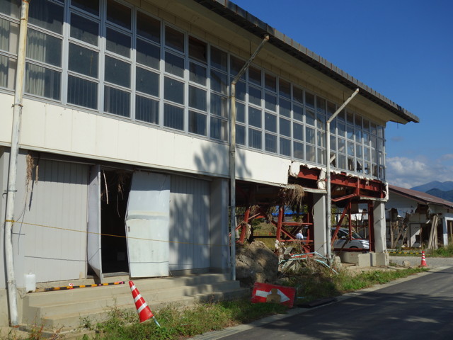
When I arrived at the temple, I saw that the wall was still peeling off.
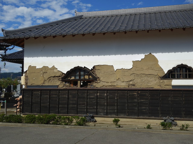
This part had lost its wall completely.
Myosho-ji Temple was originally a Rinzai sect temple founded in 1156 in Samizu Village (now Iizuna Town), but was later converted to the Soto sect. The temple was moved to its current location in 1580 by Shimazu Awajinokami Tadanao, lord of Naganuma Castle.
The character “玅" used to be difficult to write in computer, so it is sometimes replaced by the character “妙" on the Internet.
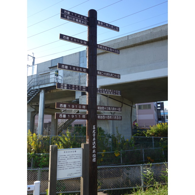
The area has suffered from flood damage in the past, and there is a pole on the temple grounds that reads “Chikuma-gawa River Flood Marker".
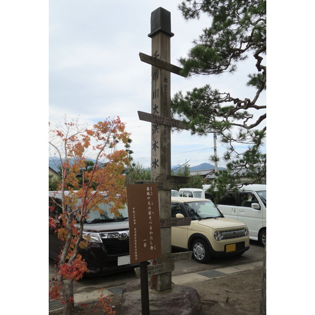
The note says, “this was copied the record on the pillar in the main hall," so it seems that the level of the flood water was originally written on the pillar in the main hall of the temple.
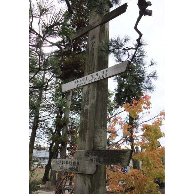
The newest, whitish board is dated October 13, 2019.
The top one is hard to read, but it reads “1724 August ?" The bottom two are dated 1891 (Meiji 24) and 1847 (Koka 4).
The temple area was flooded 114 times during the Edo period and 15 times during the Meiji period.
Here is the reception desk of the exhibition.

I transcribed a part of the information given to me at the entrance.
“(…omitted in the foregoing…) The purpose of holding this photo exhibition is to have the people of today remember and arouse their interest in disaster prevention awareness, and for future generations to sound the alarm and convey the message to them. One year has passed since the day of the disaster, and the exhibition documented a year of local activities for recovery and reconstruction. The photos were provided by people who supported this project: 1:Outside the levee, 2:Levee, 3:Damage in the Hoyasu area, 4:Damage in the Tsuno area, 5:Damage in the Akanuma area, 6:Volunteers, 7:Disaster Garbage Dump, 8:Event Activities, 9:Walking in the Community (October 19). We divided the group into 9 groups. (…omitted…)"
I did not ask whether I was allowed to take pictures of the exhibition hall, so I will not post pictures of the interior, but there were over 500 pictures on display.
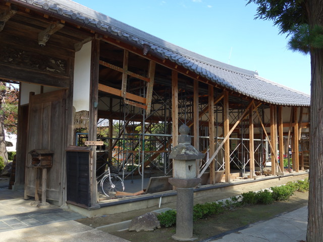
The main hall also had some windows covered with vinyl, and in other parts of the building, the floorboards were still removed. There are still traces of flood damage here and there.
At the lecture on October 18, lecturers talked about what the temple looked like when it was flooded on October 13 last year, the condition of the area after the flood, and the history of past floods.
Apparently, the area where the levee broke was once the site of a castle called Naganuma Castle. Due to frequent flooding, almost no trace of the castle remains, but old maps seem to show the location of the castle moat to some extent. Some parts of the area are still wet, probably due to the location of the moat.
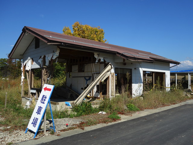
The temple is not the only place that still bears the scars of flood damage.
Walking around the area, I could see houses that are in the process of being restored and houses that appear to be uninhabited. I did not feel like photographing private residences, so I only took pictures of public facilities.
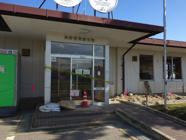
The Naganuma Branch Office of the city is located near the temple. The building remains closed and unused. A temporary government building was built next door and operations have been conducted there since May.
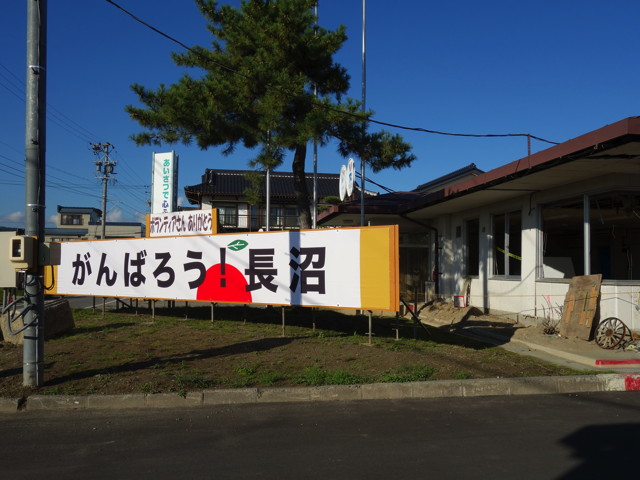
In front of the building is a sign that reads “Let’s all do our best! Naganuma" and “Thank you for the volunteers".

This is the side entrance to the old branch office. It is a typical glass-cased bulletin board, but the posted paper was tattered and sand had accumulated inside.
This is the Naganuma Gymnasium next to the branch office. It too remains closed.
The Naganuma Branch of the Nagano City Firefighting Team was located next to the gymnasium.
Immediately east of the branch of firefighting team is an embankment.
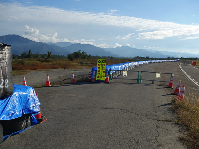
I went up to the embankment. Behind the “No Entry" sign is the repaired embankment.
The population of the Naganuma area has decreased by 10.7% in the year since the disaster. In the Tsuno district around the temple, the decline was 17.7%. (From the Shinano Mainichi Shimbun)
A whole year has passed, but the area is not yet in a state of recovery.
The last photo is a little far away from branch office and temple. There is a Shinkansen train base in Akanuma, Nagano City. And a little north from there along the Shinkansen tracks, there is a sign pole along Prefectural Route 386.
The pole is labeled “Zenkojidaira Flood Level Marker," and shows the past six floods.
This water level marker was originally constructed by Busuke Fukase in 1941 at his own expense. It was rebuilt by Akanuma Ward in 1992 because it had become decrepit.
Last year’s October 13 flood marker was shown second from the top.
I heard that such water level markers exist in Suzaka City and Obuse Town on the other side of the river, as well as in Nakano and Iiyama Cities downstream.
【reference】(written in Japanese)
* National Long-Term Perspective Special Committee (2019.11.27) “Damage Situation and Future Responses to Typhoon No. 19” Ministry of Land, Infrastructure, Transport and Tourism