The second visit to “Jikkasegi ” (1)
In Azumino City, Nagano Prefecture, there is an irrigation canal called “Jikkasegi," which was opened in 1816. There is a bicycle path along the irrigation canal, and last year, I rode along about half of it.
In the middle of May this year, I heard about the discovery of a pictorial map of the Jikkasegi and that it would be exhibited at the Toyoshina Folk Museum at the end of May. I wanted to see the map. And if I go there, I would also see the other half of the Jikkasegi that I didn’t see last year.
Scope of this visit.
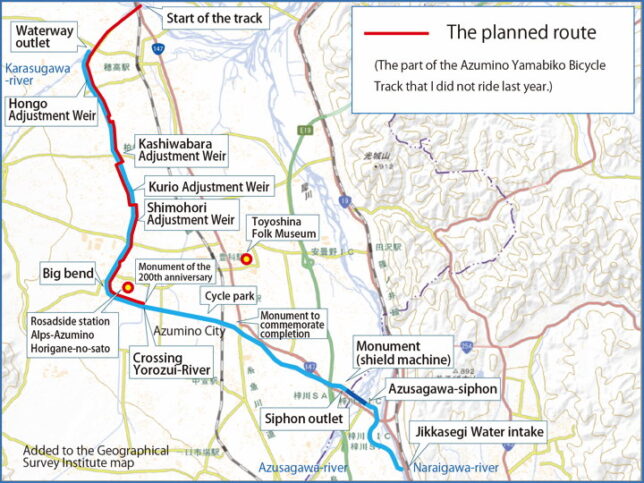
Last time, I ran from the Jikkasegi Water Intake to the crossing (multi-level intersection) with the Yorozui-gawa River, so this time I plan to run along the red line on the map.
Again, I loaded my bicycles in the car and drove to “Roadside Station Horigane no Sato". From there, I planned to cycle back and forth along the Jikkasegi, and then drive to the Toyoshina Folk Museum.
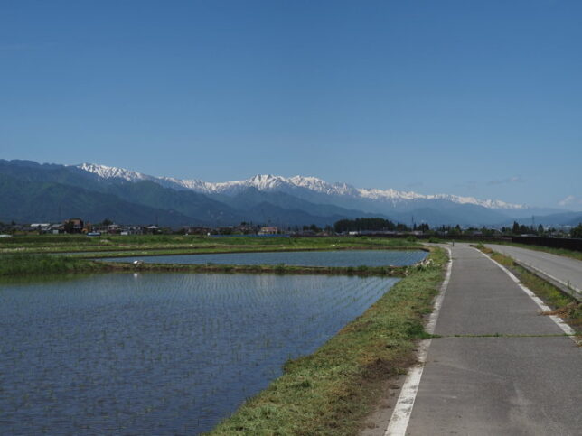
It was a fine day. I could see the Northern Alps beyond the rice paddies that had been planted.
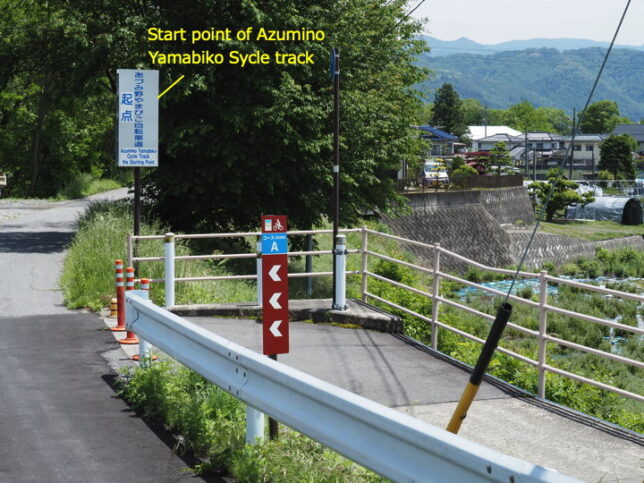
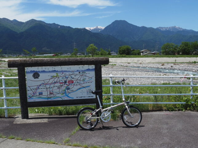
First, I headed to the starting point of the cycle track. The starting point of the cycle track is beside the Hotaka Bridge on Route 147.
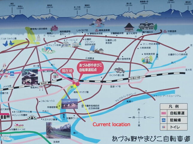
There was an information map of the cycle track nearby.
The cycle track passes under the railroad tracks.
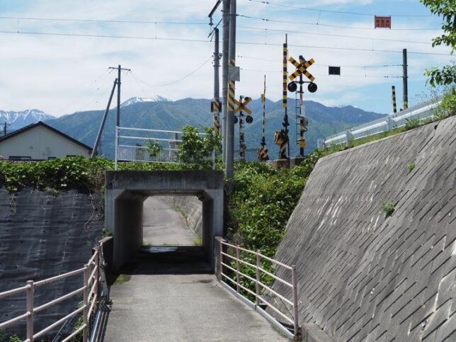
It was almost flat and easy to ride.

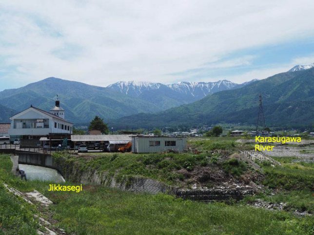
There was an information map again. This is very close to the waterway outlet of Jikkasegi.
It’s hard to tell from the photo, but the waterway outlet of the Jikkasegi is on the left. The river beach on the far right is the Karasu-gawa River. Jikkasegi joins the Karasu-gawa River here. The building on the left is a driving school.
The waterway outlet of Jikkasegi.
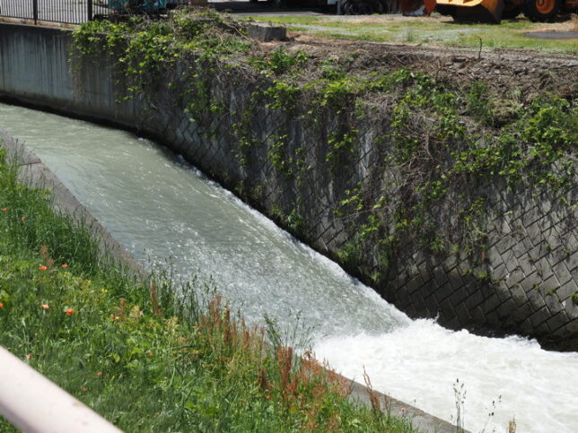
I looked downstream toward the outlet. The road on the right is not a cycle track, but a roadway.
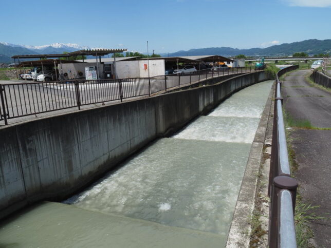
Upstream from here, a cycle track and a roadway run along Jikkasegi.
This is the Hongo Adjustment Weir, about 200 meters from the outlet.
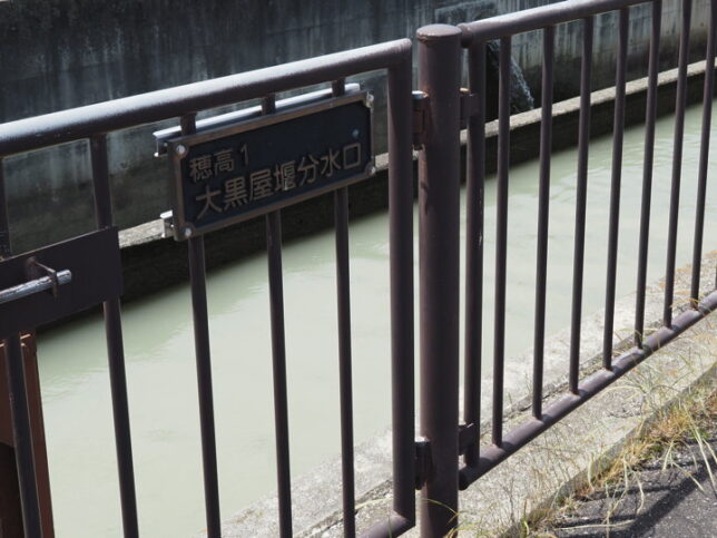
There is a sign saying “Hotaka 1, Daikokuya waterway intake" near it. I guess it is taking water from Jikkasegi. After this, I saw many more plate written “intake". There are not only waterways that take water from the jikkasegi, but also waterways that join the Jikkasegi.
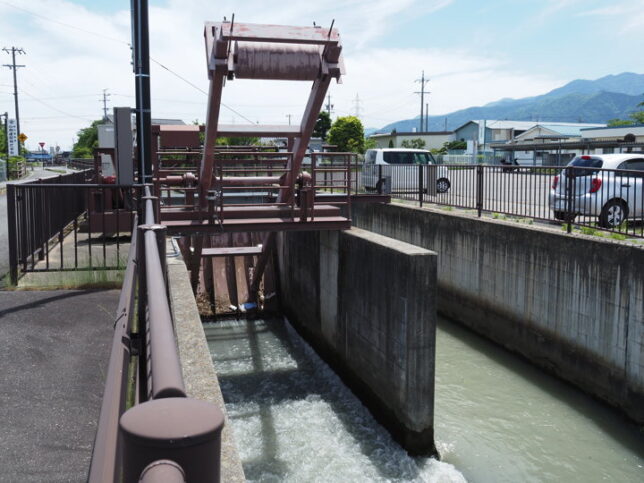
Here was 600 meters from the waterway outlet. I saw the second adjustment weir. This is the Kashiwara Adjustment Weir.
In this area, the irrigation canals built in the Edo period lacked drainage functions, resulting in flooding and damage during heavy rains. In particular, typhoon No. 10 in 1983 caused serious damage to crops and agricultural facilities. This led to the implementation of “the national irrigation and drainage project of Azumino District" from 1995 to 2006. The Jikkasegi was also included in the project, and its channels, control weirs, bridges, and protective fences were constructed. The project was also aimed at improving the agricultural production environment.
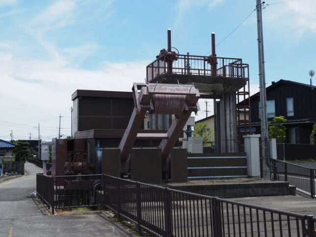
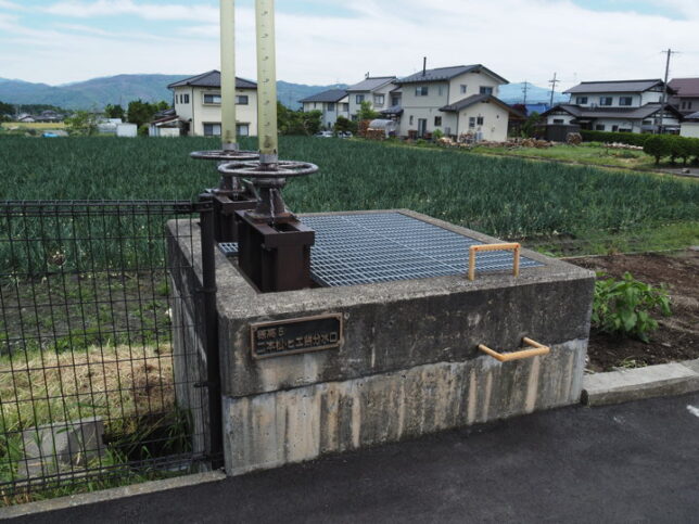
A nearby water intake. Hotaka 5, Nihonmatsu and Hiemochi intake.
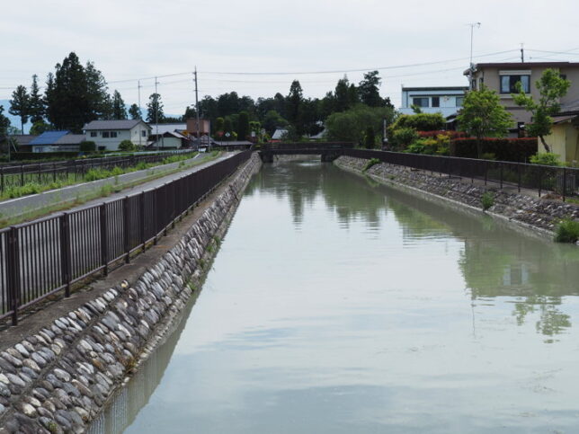
This photo was taken from the bridge for pedestrian .
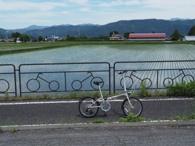
The fence of the cycle track has a pattern of bicycles on it. The building in the back is an elementary school.
The 23 Night Pagoda and the Dosojin (road ancestor kami) were side by side, and the words on the 23 Night Pagoda were painted in blue. And Dosojin was also colored. The words on the back, “February of the seventh year of the Bunsei era" were also painted in black.
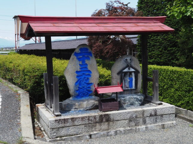
It is customary for children to color this Dosojin at the Dosojin Festival in February every year.
We don’t know why the coloring started, but one theory is that the puppeteers who make the Hotaka dolls for the Ofune Festival at Hotaka Shrine colorerd the dosojin. I heard that there are more than a dozen other colored Dosojin in Hotaka area.
This picture was taken looking downstream. This is about 1.6 km from the water outlet.
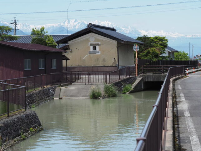
There are several paths leading down to the water’s edge, like this.
(To be continued)
[Reference] (All materials in Japanese)
“FY2015 National Land Improvement Projects, Post Evaluation. National Irrigation and Drainage Project 'Azumino District’ Basic Materials" (Kanto Regional Bureau of Agriculture, 2015)
“Furusato Azumino, Yestreday today tomorrow No.10" (edited by Azumino City Toyoshina Folk Museum, 2013)