Cycling along the Yabarasegi (2)
I am cycling along the Yabarasegi Canal in Azumino.
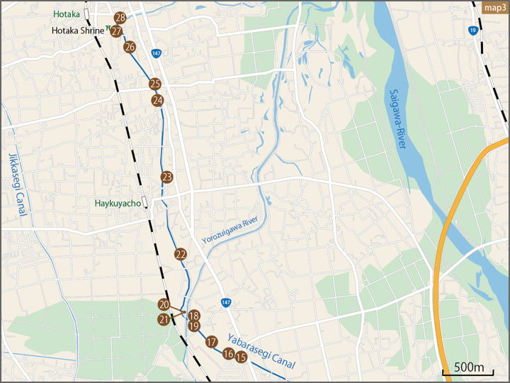
In this map, I am starting from the water intake along the Saigawa River at the lower right of the Azumino Interchange and proceeding northwest along the canal.

Since this is the second half of this article, I will enlarge the rectangular frame and fill in the shooting points again.
The shooting point this time.
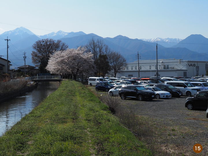
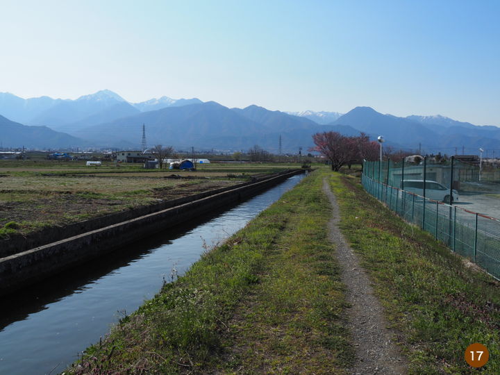
This is about 4.2 km from the intake of the Yabarasegi. Here is about half of the total distance.
The headquarters of VAIO can be seen over there.
The road along the waterway is more like a bank than a road.
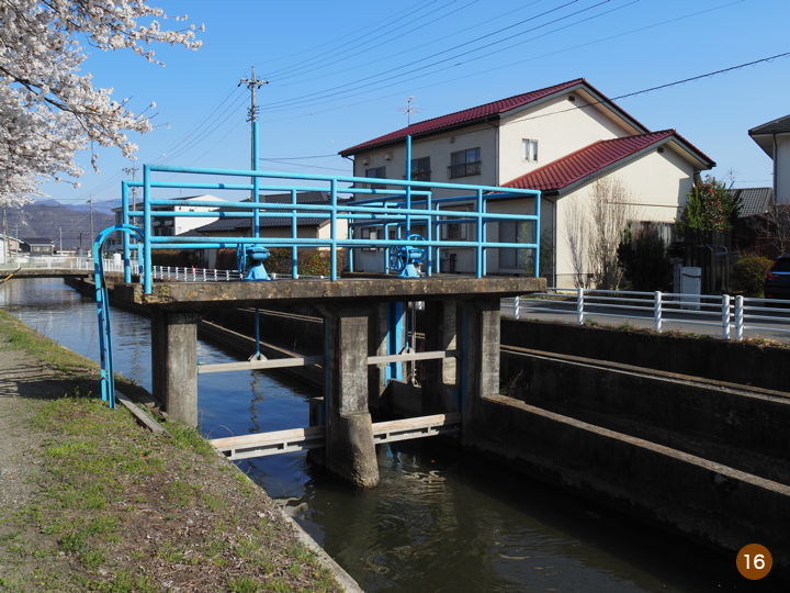
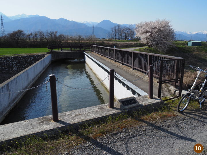
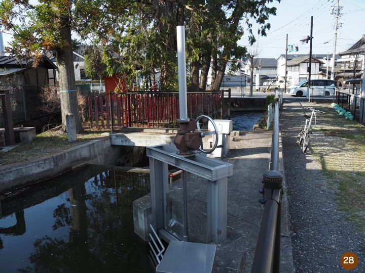
There was a sluice gate near here. The water is divided here into two channels, and the separated channels are flowing in the same direction.
The number of houses has decreased and the surrounding area has become farmland. The two waterways flow side by side.
I came to a point where the waterway intersects with the Yorozuigawa River. Since the River runs low, the Yabarasegi crosses over to the other side of the river in a multi-level crossing. A plate was attached to the bridge, which read, “Construction completed in April 2000". The name of the bridge is Yabarasegi Aqueduct Bridge.
However, the bridge was sealed off, so bicycles could not cross. I had no choice but to go around to the next bridge.
This photo was taken looking back before moving on.
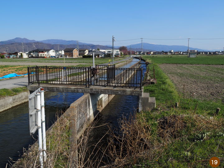
The two channels flowed together up to this point, and the water in the narrow channel flowed down to the Yorozuigawa River here. The wider channel on the left crosses over the river to the other side.
Now, I crossed the next bridge and came to the other side of the Yabarasegi aqueduct bridge.
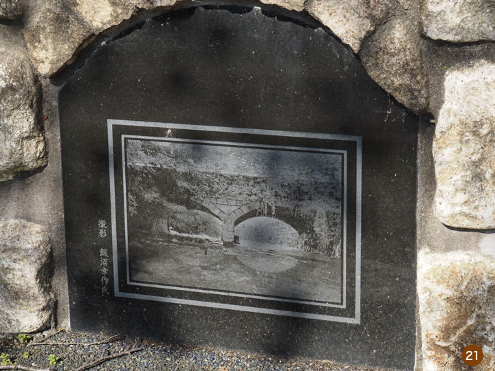
On the side of the road near the bridge, there was a stone monument.
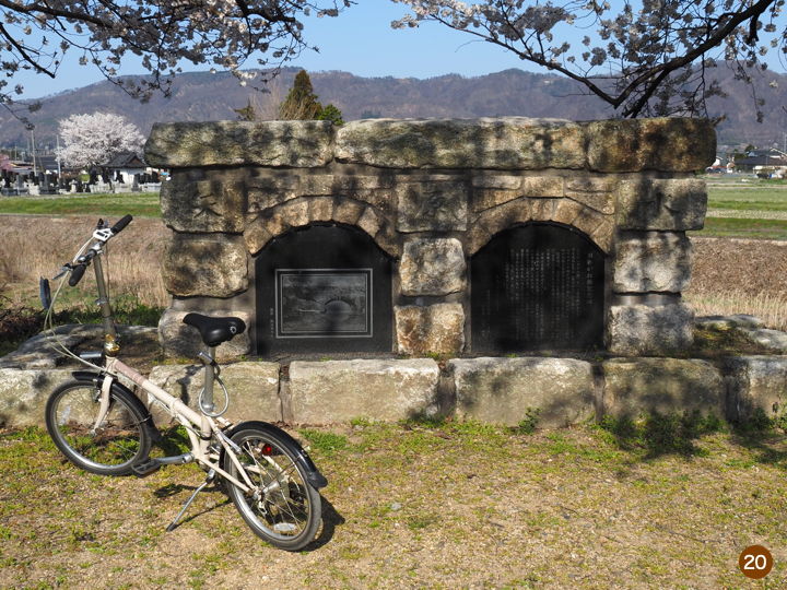
I will transcribe the words on the stone monument here.
Old Megane-bashi Monument
There was a water passage bridge called “Megane-bashi" here. When looking upstream from the downstream of Yokezawa (now Yorozuigawa River), which flows below, the two arched bridges are reflected roundly in the river and look like glasses, hence the name “Megane-bashi" and it was loved by many people.
The Yabarasegi was the first waterway constructed in Azumidaira, and was opened to work on March 21, 1653, 355 years ago in the early Edo period.
At that time, the bridge was a wooden bridge, but in May 1926, it was replaced by a magnificent Western-style waterway bridge [photo] made of granite. The bridge, which had been a familiar sight for more than 80 years, was washed away by the unusually high waters of the Yorozuigawa River during a torrential rain disaster on June 30, 1999. We regret the loss of this valuable cultural asset.
We picked up the stones that were washed away and build a monument here using as evidence the stones inscribed with the Chinese characters for “Ya," “Bara," and “water," as well as other stones that had been used.
March 31, 2009
Yabarasegi Land Improvement District, Azumino City, Koji Koana, Chairman of the Board of Directors
So a stone bridge existed here until 24 years ago.
A photo of the stone bridge was also installed at the monument.
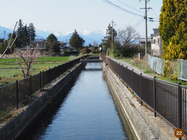
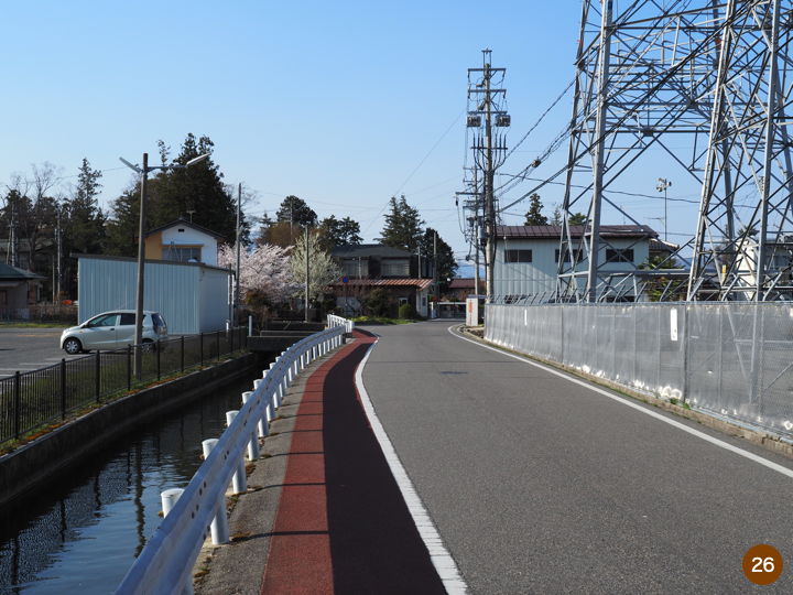
After crossing the Yorozuigawa River, the Yaharasegi turns and flows almost to the north. I entered a residential area again.
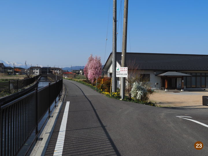
This is the Hakuya-cho Community Center. The road here is paved, but a little further on it becomes gravel again.
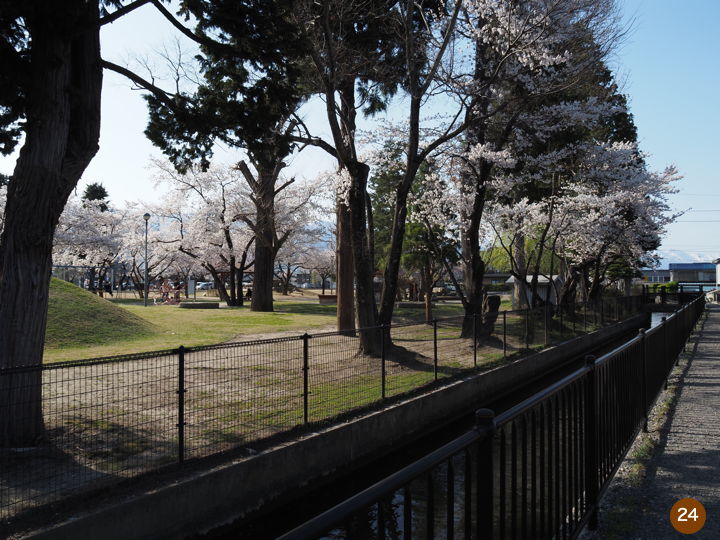
I pass by a park. I was getting tired by now, so I didn’t have the energy to stop by and check it out.
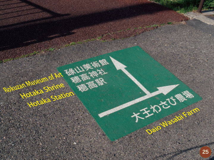
I saw a mark on the sidewalk for directions. If we continue along the Yabarasegi, we can get to Hotaka Station, Hotaka Shrine, and Rokuzan Museum of Art.
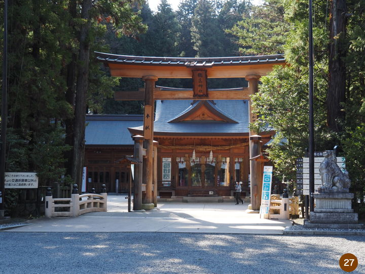
Passing by the substation, I soon reached Hotaka Shrine.
I arrived at Hotaka Shrine. I took a picture but did not go to worship the shrine.
The Yabarasegi still flows north past Hotaka Shrine, so I followed it a little further.
The waterway turns off to the right before the road on the north side of the shrine and descends. The channel narrows and the flow becomes steeper. The description on the Azumino City website says that the Yabarasegi flows into the Kakenokawa River on the north side of Hotaka Shrine, so this must be the final point of the Yabarasegi.
Although I have looked a little downstream, the article ends here.
Now let’s go back. I had parked my car at Toyoshina Nanbu General Park, so I had to ride my bicycle there.
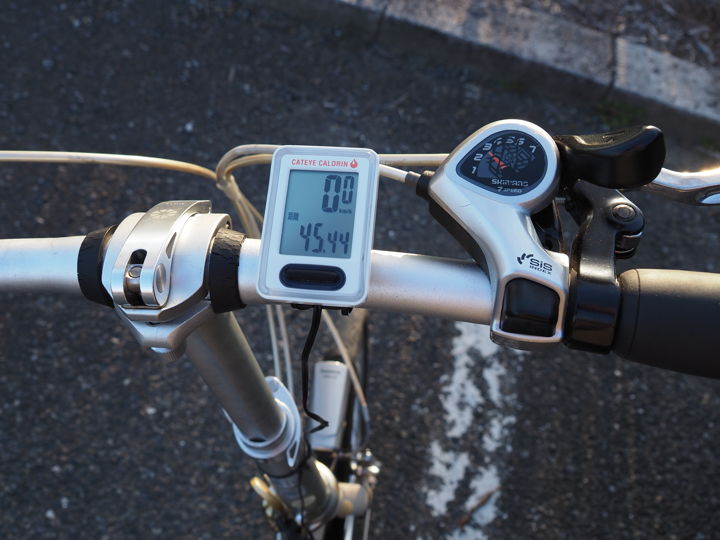
When I arrived at the park, I checked the odometer and found that I had run 45 kilometers this day.