The second visit to “Jikkasegi ” (3)
I came to the Toyoshina Folk Museum in Azumino City.
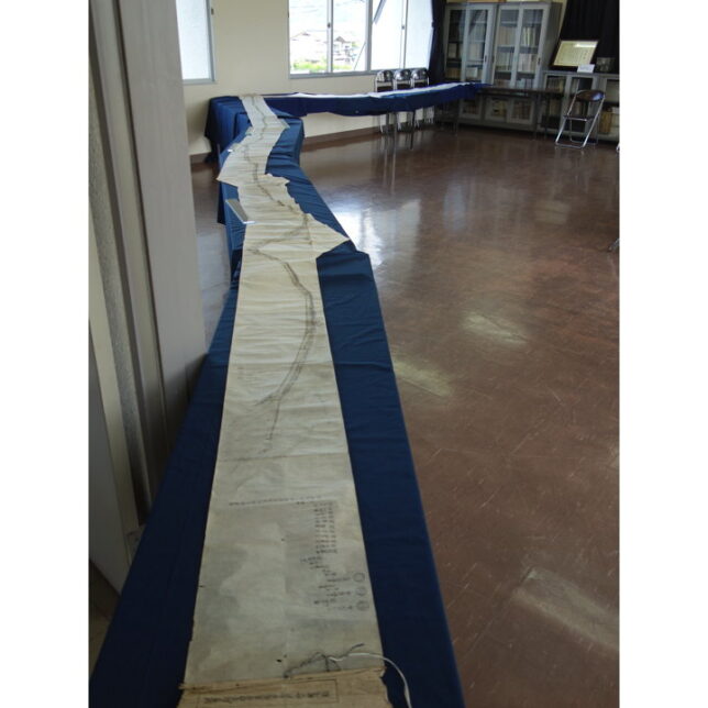
The recently discovered “The illustration map of Jikkasegi-waterway, Chikuma jurisdiction, Azumi County, Shinano Province" was on special display here for three days.
It was open to the public twice a day, once in the morning and once in the afternoon, and the parking lot was almost full when I arrived. There seemed to be a lot of interest from the locals. We waited for a while in the museum before we were allowed to up the second floor.
We were given a briefing first, and then looked at the illustration map.
We were told that photography was allowed, so I gladly took pictures. We heard that the museum would be releasing digital images in the future, so I thought that it would okey to post a few photos on my blog.
This picture scroll is not a straight line scroll, but a piece of paper bent and pasted together along the actual topography.
I took this picture so that the entire scroll would be included. The water intake is in this side, the right turn at the “Omagari (big bend)", and the water outlet at the far right.
When I looked at the newspaper article on the net, as far as I could see, it was labeled as “The illustration map of Jikkasegi-waterway…", but when I saw the actual picture, it was slightly different.
The title of the map was “The illustration map of Jikkasegi NEW waterway…". This is because some of the waterway were built before the Jikkasegi, so it seems that when the Jikkasegi was built, it was also called “new waterway".
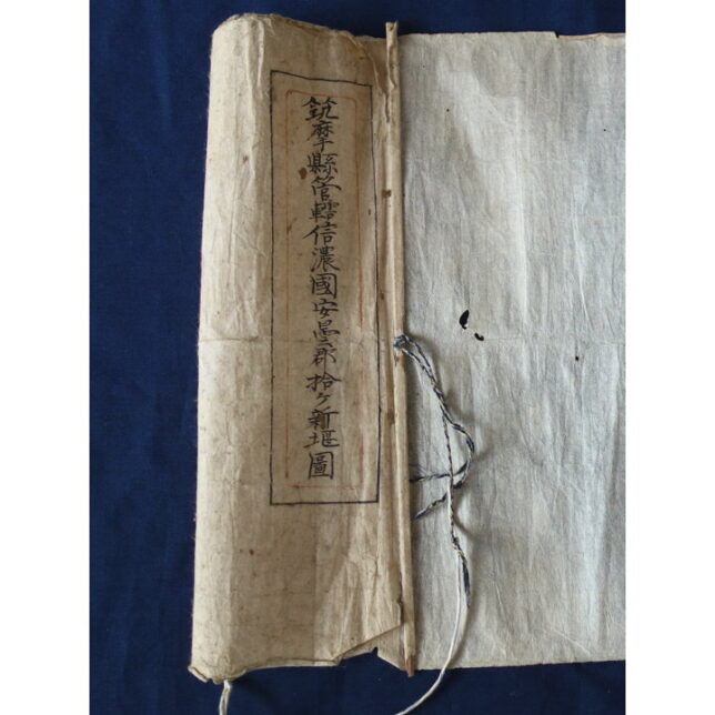
Chikuma Prefecture was established in 1871, and was abolished in 1876. Therefore, this drawing with the word “Chikuma Prefecture" on it was probably drawn during these years.
This is the “Omagari" section, where the waterway turns to the right, and it seems that the paper was folded diagonally and rolled up like a picture scroll.
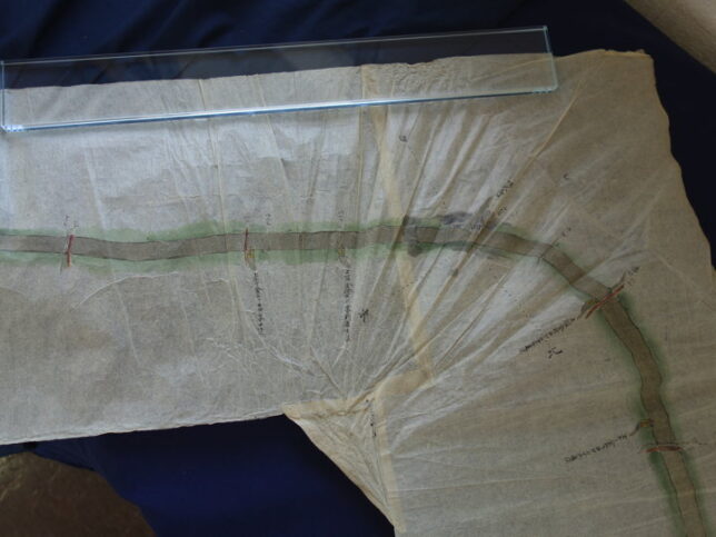
Here, roads and bridges are drawn. In the upper left corner, there is a sign that says “Kamihorigane Village Shrine", which probably refers to current the Suwa shrine in Kitaura.
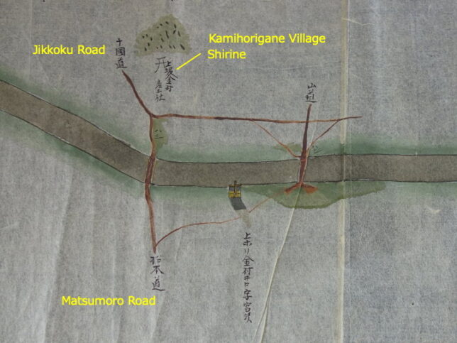
There was also “Shimohorigane Village Shirine". I think this is the current the Suwa Shrine in Shimohori Ogimachi.
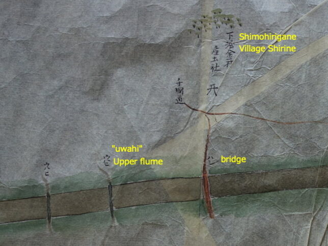
On the left side, there is the word “uwahi", this means “upper flume".
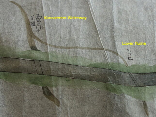
It was also written “sokohi". I guess this refers to the waterway that passes underneath. The Kanzaemon waterway passes under the Jikkasegi. The Kanzaemon waterway is older than Jikkasegi, and it was completed in 1685. There were many other waterways in the area, so I thought it was natural that the Jikkasegi opened in 1816 was called “New waterway".
This was the end of my visit to the Toyoshina Folk Museum.
I still have some time left, so I decide to ride my bike for a while longer. Last year, I hadn’t seen the Kanzaemon waterway pass through under the Jikkasegi, so I decided to check it out.
I thought leave my car at the Southern Toyoshina General Park and ride my bike along the waterway.
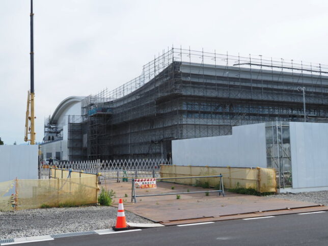
South of the park, there was construction going on. It seemed to be the construction of a new gymnasium for Azumino City.
As I was riding along the bike path, I saw a new stone monument on the other side of the river. There was a bridge, so I crossed it to check it out.
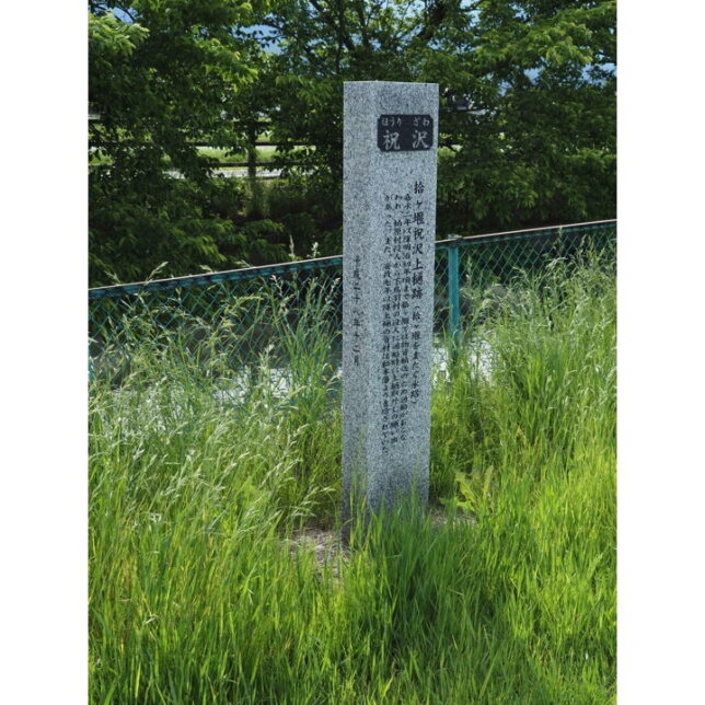
On the stone monument were written the following words.
“The remains site of the Jikkasegi’s upper flume
From 1859 to the beginning of the Meiji era, the Jikkasegi was used to transport goods by boat, and the officials of Kashiwabara Village asked the officials of Shimotoba Village to remove the upper flume temporarily when the boats were passing through. And the materials for the upper flume were supplied by the Matsumoto clan."
The monument was erected in December 2008.
I wonder how long the upper flume existed.
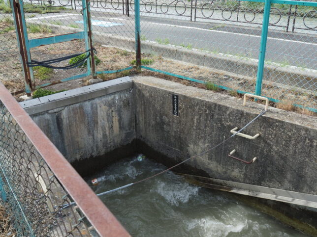
I arrived at the Kanzaemon waterway. The waterway in the photo is the Kanzaemon waterway, and the Jikkasegi is behind the fence on the far right. The waterway does not join the Jikkasegi, but passes underneath it, so I approached to check.
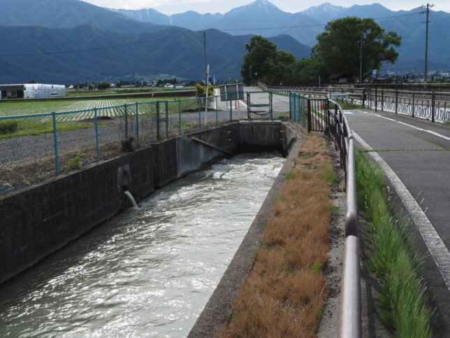
There was a plaque saying that it was completed in March 1989. Water was flowing, but I couldn’t tell how deep the hole was. Plastic bottles were dancing on the surface of the water.
I should have checked the place where the water came out after passing through the Jikkasegi, but I was already tired. I decided to turn back.
On the way back, I found another stone monument along the railroad track, so I checked it out for the last time.
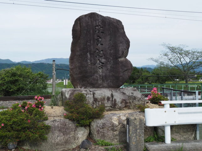
It read, “Commemorating the improvement of the prefectural large-scale drainage facilities.
When I looked at the back side, it said that the construction started in 1976 and was completed in 1990. They paved three sides of the waterway in the 3.6km area from the siphon exit of the Azusa River to the Meisei area (where this stone monument is located) and built a bicycle path.
After this, I returned to the car and finished our cycling for the day.
This is the end of the article about Jikkasegi.