Cycling along the Jikkasegi Canal (3)
Continuation of the previous post.
I got my bicycle off the car and ran, so no matter how far I ride, eventually I’ll have to get back to my car. I’ll return when I get to a good point.
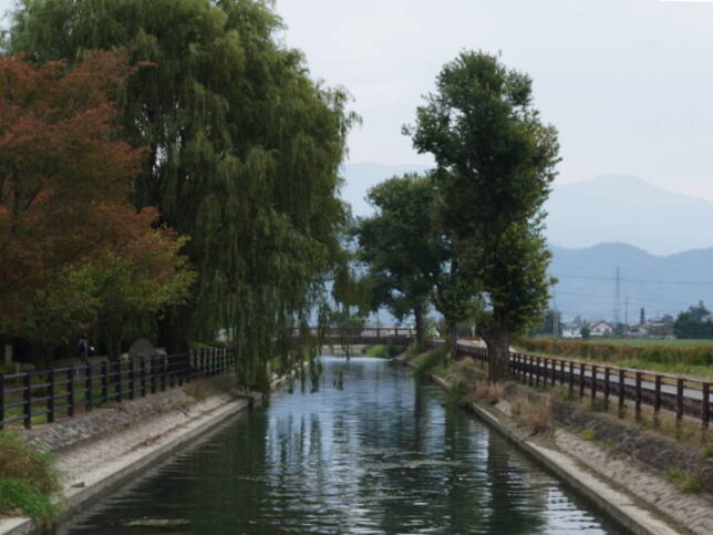
I am now on the bridge near the restrooms at the “Cycle plaza". The photo was taken looking back to the east.
Now let’s go a little further west.
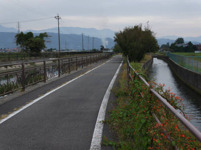
The straight line continues for a while.
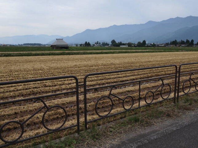
Looking to the left, I saw that the design of the fence was a bicycle pattern.
At the end of the corner of the community center, I crossed the bridge and moved to the right bank. However, the bicycle path disappears there. After about 150 meters, the bicycle path was reappeared again.
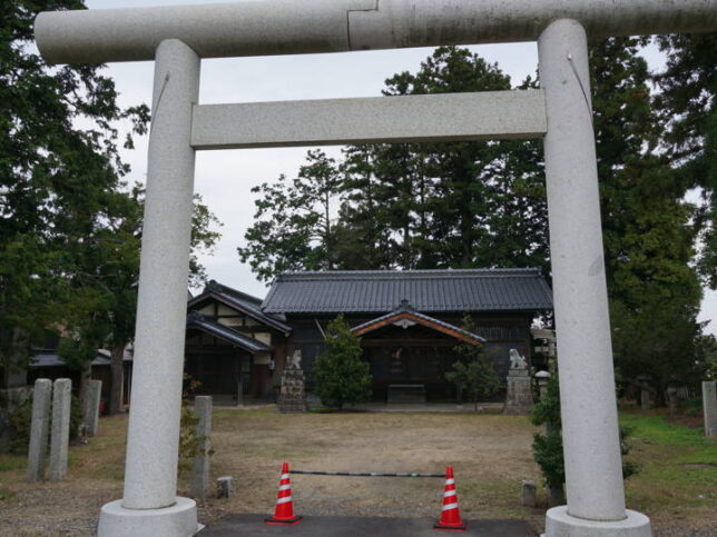
There was a shrine along the shared section between the bicycle path and the road. I didn’t look up the origin of the shrine, but I noticed a white marker next to the lantern of the shrine that said “The ruin of Nakabori Warehouse and Nakabori School".
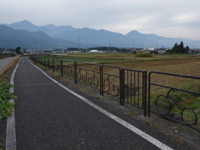
The bicycle path is back. It ran parallel to the roadway.
A little further on, I saw a sign on the left side of the canal fence that said “Nakakita Diversion.
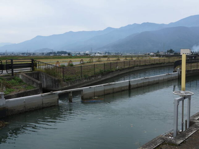
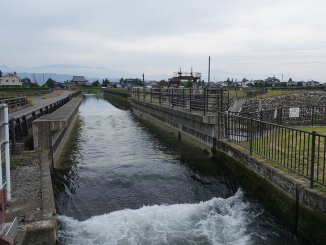
I guessed this was the water diversion port. The waterway splits into two.
At the end of the waterway on the left side, there is what looks like a sluice gate.
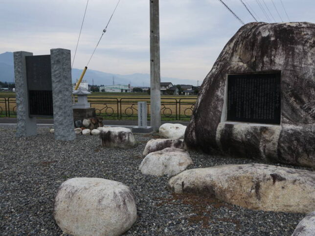
When I proceeded to look at the end of the gate, I saw a stone monument on my right, so I checked this one first.
On the left was a stone monument commemorating the registration of the site as a World Irrigation Heritage Site.
Registered as a World Irrigation Facility Heritage Site
Jikkasegi Canal, in the Chikuma-gawa River system in Azumino City, Nagano Prefecture, Japan, is to be registered as a World Heritage Site of Irrigation Facilities. The reason is that it is an outstanding example of the contribution to local economic development for more than 200 years and the maintenance and the management by the local people’s human-powered water management organization that conducted the project using advanced design and siphon construction technology.
November, 2008
International Commission on Irrigation and Drainage
And the stone monument on the right side of the road read.
A monument commemorating the 200th anniversary of the excavation
This canal was planned by Nakajima Rinbei, Todoriki Magoichiro and others in 1799 (Kansei 11), and in 1814 (Bunka 11), an application was submitted to the Matsumoto domain for a drawing and estimate, and the canal was staked. It was completed in a short period of time, which could be said to be astonishing at that time, with a total length of 15 kilometers and an average gradient of 1/3,000. As a result, Azumino, which had been suffering from a constant shortage of water, was transformed into a rich rural area.
Today, the canal enriches 800 hectares of rice paddies in the Toyoshina-Horigane Hotaka area, and also plays an important role in regional disaster prevention by providing drainage functions for the national Azumino Wide-area Drainage Project, which was completed in 2005.
On the occasion of the 200th anniversary of the canal’s excavation, this monument is erected to commemorate the great achievements of our predecessors and to pass on their wishes to future generations.
April 1, 2008
Nagano Prefecture Jikkasegi Canal Management Association.
I didn’t know this until I came here, but it seems that the canal now serves not only as an irrigation channel, but also as a drainage channel in case of disaster.
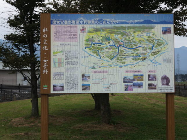
I found this out from a signboard erected nearby. But hey, this sign is already cracked. When was it built?
According to the explanation on the signboard, after the World War II, as a result of changes in land use, such as the conversion of paddy fields to farmland and urbanization, the water retention capacity of the area decreased, and when it rained, a large amount of rainwater began to flow out. This is why they built drainage channels.
The name of the project is the National Azumino Agricultural Water Conservancy Project, which started in 1995 and was completed in 2005. The name “National Azumino Wide-Area Drainage Project" on the stone monument was referring to this project.
This photo was taken from the bridge, looking back east. The waterway in front of us is the main stream of the Jikkasegi Canal, which was flowing straight along the road at the previous diversion point. It continues to flow further west, and then turns to the north.
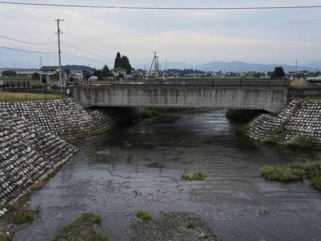
I moved a little and took a picture of the same channel from the side. What looks like a bridge in this photo is the waterway in the previous photo.
The waterway crosses over the river. The river flowing below is the Yorozui-gawa River.
The Yorozui-gawa River flows toward the famous Wasabi farm.
I thought it was about time, so I decided to return.
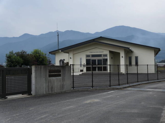
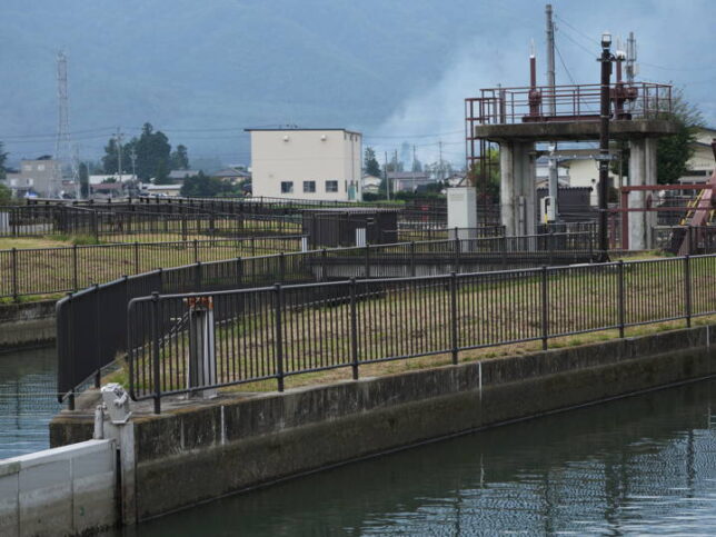
This building nearby was the Azumino District Drainage Monitoring Station. There were also nameplates for the Azumino-Matsumoto Administrative Business Association and the Azumino District Regional Drainage Office.
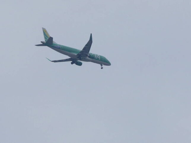
Oh, it’s an airplane. (A part of the photo is cropped. It doesn’t look this big in real life.)
I headed back along the left bank of the weir. (After about 100 meters, we merged with the road we had come on.)
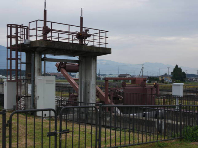
Checked the sluice gate that I saw earlier.
After checking the nameplate
No. 4 adjustment work
Type Zero gravity water level control gate
Diameter x Height of gate 3.500m x 3.200m
Number of gates 1 gate
Type 2-stage electric roller gate
Distance between gates x height of gates 3.300m x 3.000m
Number of gates 1 gate
Year of installation March 2005
Construction Toyokuni Kogyo Co.
It was written on the gate.
Since it was installed in 2005, this sluice gate must have been constructed as part of the national Azumino Agricultural Water Conservancy Project. In case of heavy rains or floods, the gate is opened to let water flow from the Jikkasegi Canal to the Yorozui-gawa River.
This is a view a little east of the Cycle plaza. The waterway on the right is the Kanzaemon Canal, which I later found on the map. I didn’t check it out, but this canal doesn’t join the Jikkasegi Canal, but crosses it by passing underneath it with a reverse siphon. Here’s another reverse siphon.
I returned to the parking lot, loaded up my bicycle, and headed for my next destination.
That was the end of my tour of Jikkasegi Canal. I only rode about half of it.
I’d like to check out the rest of the route when I get a chance, but hopefully next time I’ll do it during the cherry blossom season.
[Related article]
“The second visit to 'Jikkasegi’ (1)" (2021.06.26) I visited again the following year.