Ryusai-ikkan Irrigation Channel (1)
There is an irrigation channel just south of the former Zakoji Omi School and the Zakoji Community Center.
I knew nothing about it until now, but when I looked at Google Map, I found the words “Ryusai-ikkan Irrigation Channel, Diversion Point No.16” about 750m southwest of the former Omi School, near the Iida Line.
The Ryusai-ikkan Channel is an irrigation channel completed in 1969 with a total length of 24 km. The water is taken from the discharge channel of the Minakata Power Station in Nakagawa Village to irrigate farmland in Iida City, Matsukawa Town, and Takamori Town on the west bank of the Tenryu-gawa River.
Construction of the channel began in 1941, but was halted due to a lack of materials and labor. The construction was resumed in 1948 as a state-run project.
The state-run portion (trunk channel) was completed in 1963, and the rest of the project was carried out as a prefectural and group-run project, which was completed in 1969.
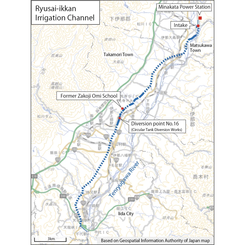
Of the total length of 24 km, only about 4 km appears on the surface of the earth, and the rest is underground in the form of tunnels and siphons.
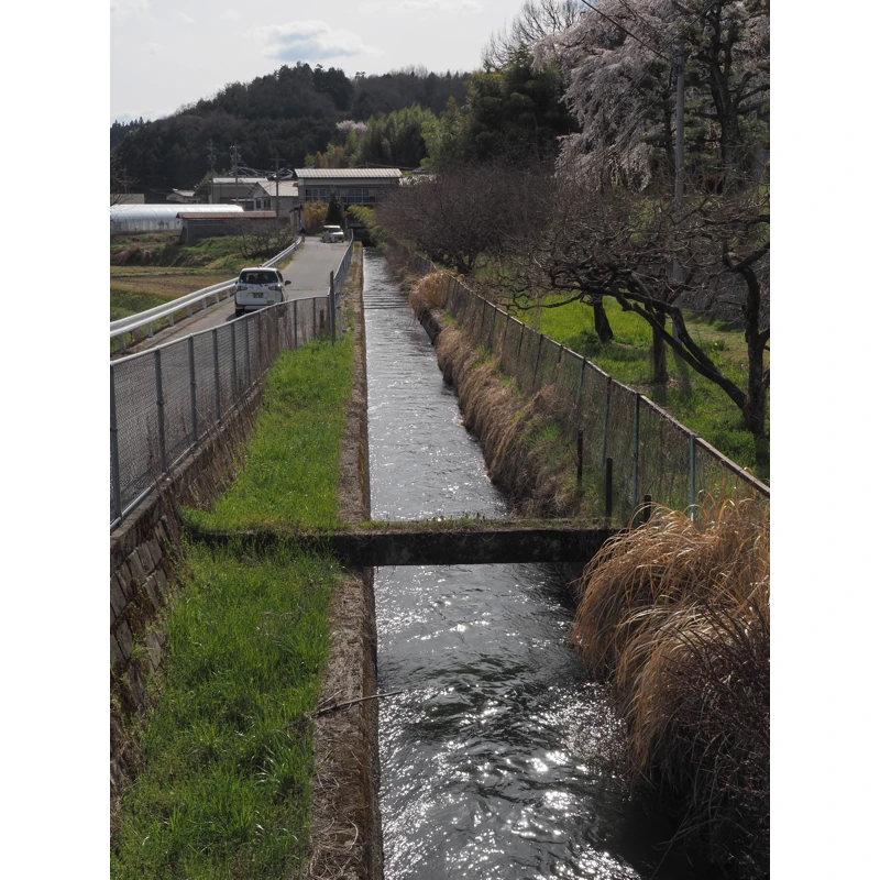
Since the channel appears on the surface in front of the former Zakoji Omi School, I walked from here to the No.16 diversion point.
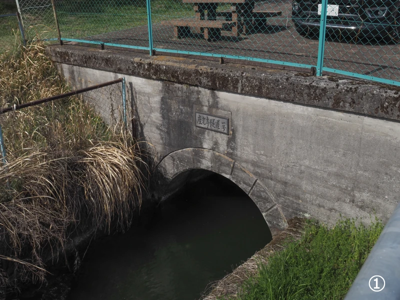
The channel that passed through the tunnels appears on the surface of the ground in front of the former Zakoji Omi School. The exit of the tunnel is marked with a nameplate that reads “Zakoji Tunnel No. 1".
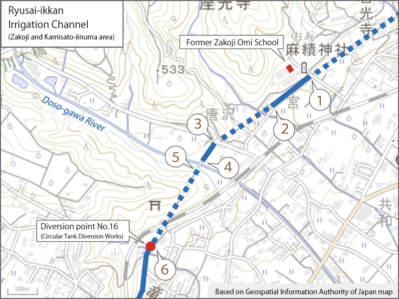
The numbers on the photos in this article indicate the locations where the photos were taken. (If two or more photos were taken at one location, the same number is given. Photos taken at locations not along the channel are not numbered.)
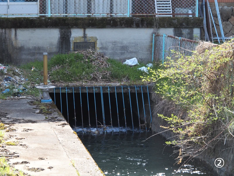
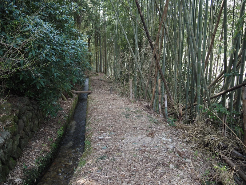
It flows 150 meters on the surface in front of the former Omi School.
It then flows under the house again.
The name of the tunnel was written as “Zakoji Tunnel No. 2".
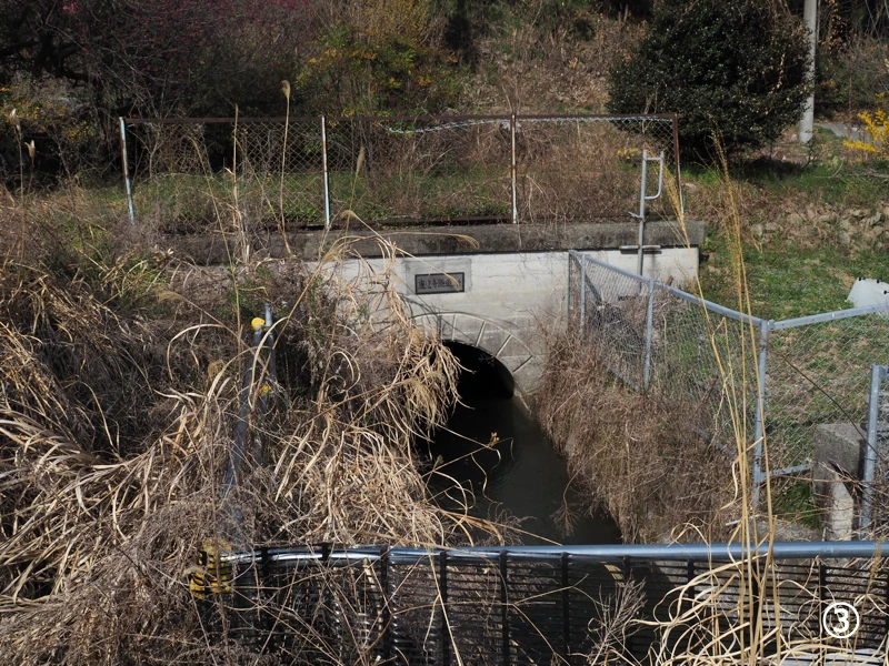
I found the exit of Tunnel No. 2, although I had to take a long detour as I had walked along the road.
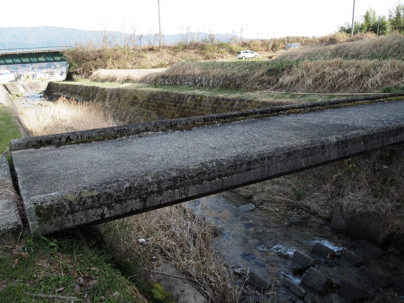
From there, I walked along the side of an orchard and came to the left bank of the Dosogawa River. The irrigation channel crosses the Dosogawa River by a bridge.
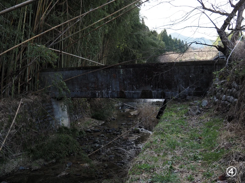
I climbed up the bank and checked the top of the aqueduct bridge. On the other side is another tunnel.
The name of the tunnel is “Kamisato Tunnel No. 2".
A little further downstream from the bridge, there was a bridge that could be crossed by people. Crossing to the right bank of the Dosogawa River, I went up to the location of the tunnel I saw earlier.
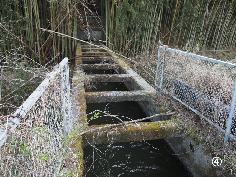
There was another small waterway flowing on the right bank. I walked a little further to find the aqueduct.
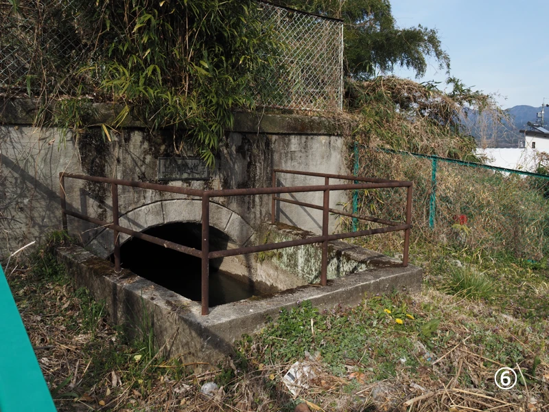
I have reached the aqueduct. After this point, I cannot follow the channel on foot because of the tunnel.
Let’s walk along the road to the diversion point.
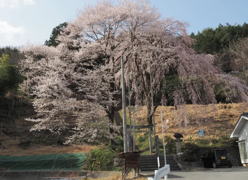
There was a shrine gate along the road and cherry blossoms were in bloom. According to the map, there is a railroad of the Iida Line at the top of the stairs, and the shrine seems to be across the line.
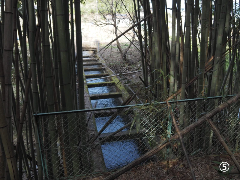
I arrived at the diversion point. It is surrounded by a fence, and there seems to be a tunnel in the back.
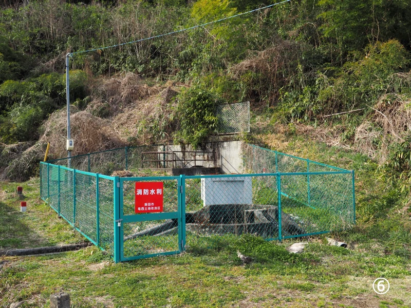
This is the diversion point. Water from the tunnel passes through a siphon and flows out from the center of the cylindrical shape. The water is then diverted to the left and right.
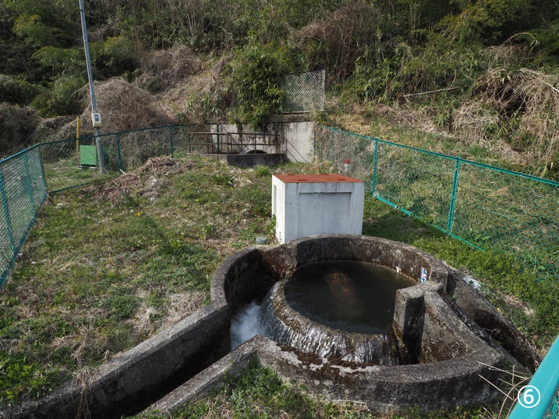
This form of water diversion is called “circular tank diversion works,” and is a mechanism for dividing the water into fixed proportions. The proportion of water is controlled by the length of the slits in the circumference. The size of the right slit is completely different from the left one, so it is likely that five to six times as much water flows in the left one.
I also checked the exit of the tunnel. The exit of the tunnel is marked “Kamisato Tunnel No. 2,” so it is the exit of the tunnel I saw at the aqueduct bridge earlier.
I also checked the exit of the tunnel. The exit of the tunnel is marked “Kamisato Tunnel No. 2,” so it is the exit of the tunnel I saw at the aqueduct bridge earlier.
This is a little south down from the diversion point. The yellow arrow points to the diversion point seen earlier.
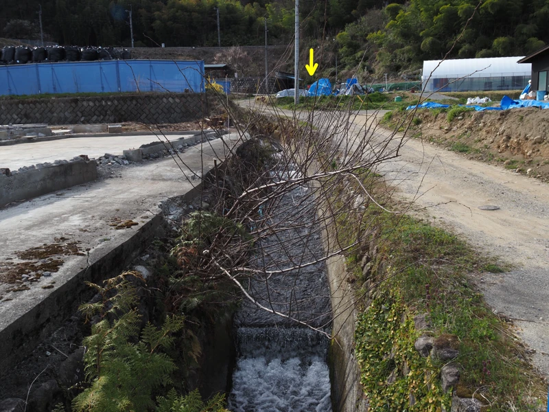
On the day the photo was taken, water from the circular tank diversion works was flowing into this river, but the topographic map says that the Ryusai-ikkan Irrigation Channel as flowing behind the blue fence in the upper left corner of the photo.
Google street view around 2023 shows that there was a house in the left foreground of the photo, but it has been demolished. The land on the left is said to be undergoing advance construction of a shield tunnel for the Chuo Shinkansen (linear) bullet train. The channel may have been changed the line due to the construction, but I did not confirm that because it is a construction site.
I should have at least checked the surrounding area a little more at the site.
Well, I did not do much preliminary research this time, and my goal was to check the diversion points, so I decided to end my visit here.
It seems that there are several other diversion works and aqueducts in the Ryusai-ikkan Irrigation Channel. My interest was piqued, and I wanted to check other places as well. I put the number (1) in the title of this article on the assumption that I would write another article.
But when I will be able to write the next article is yet to be determined.