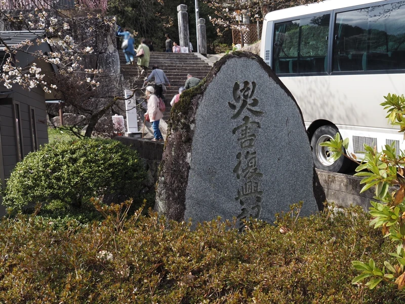
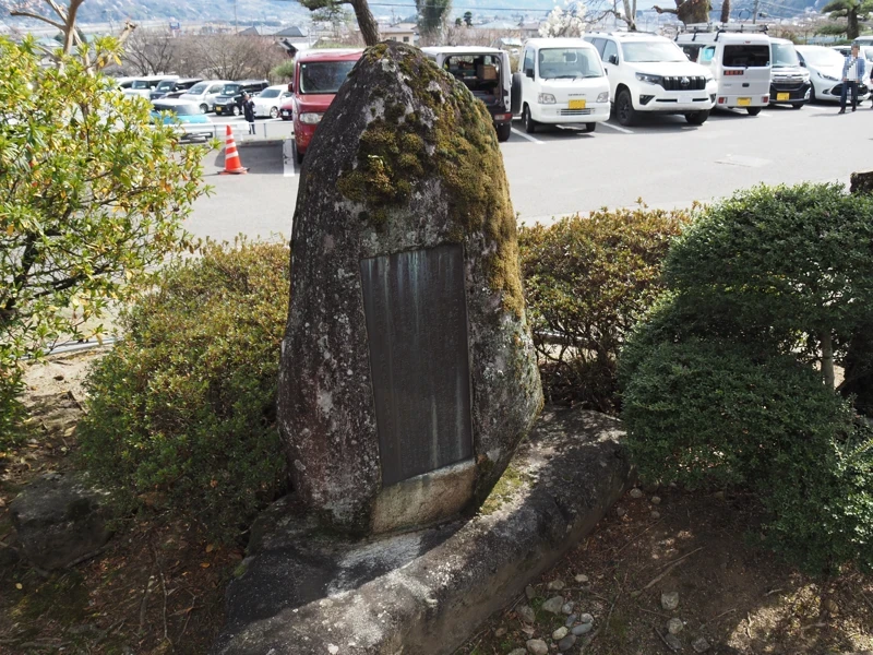
The reconstruction monument in Zakoji
The land on the lower side of the large stone wall of the former Zakoji Omi School was the site of Zakoji Elementary School until 1984, but is now the site of the Zakoji Community Centre and the Local Government Promotion Centre.
Here, I found a monument commemorating the disaster recovery.
Looking at the reverse side, it was a monument commemorating the recovery from the 1961 disaster.
In 1961, heavy rains caused by an approaching typhoon and a stagnant rainy season front caused rivers to overflow, mudslides and landslides throughout the Ina Valley, causing extensive damage. It is known as the ‘Saburoku Saigai’ (means 36 disaster) because it occurred in Showa 36.
There were more than 10,000 landslides in the Ina Valley, 136 people were killed or missing and 18,488 houses were flooded. (Figures are from the 1 June 2011 issue of Iida City Newsletter.)
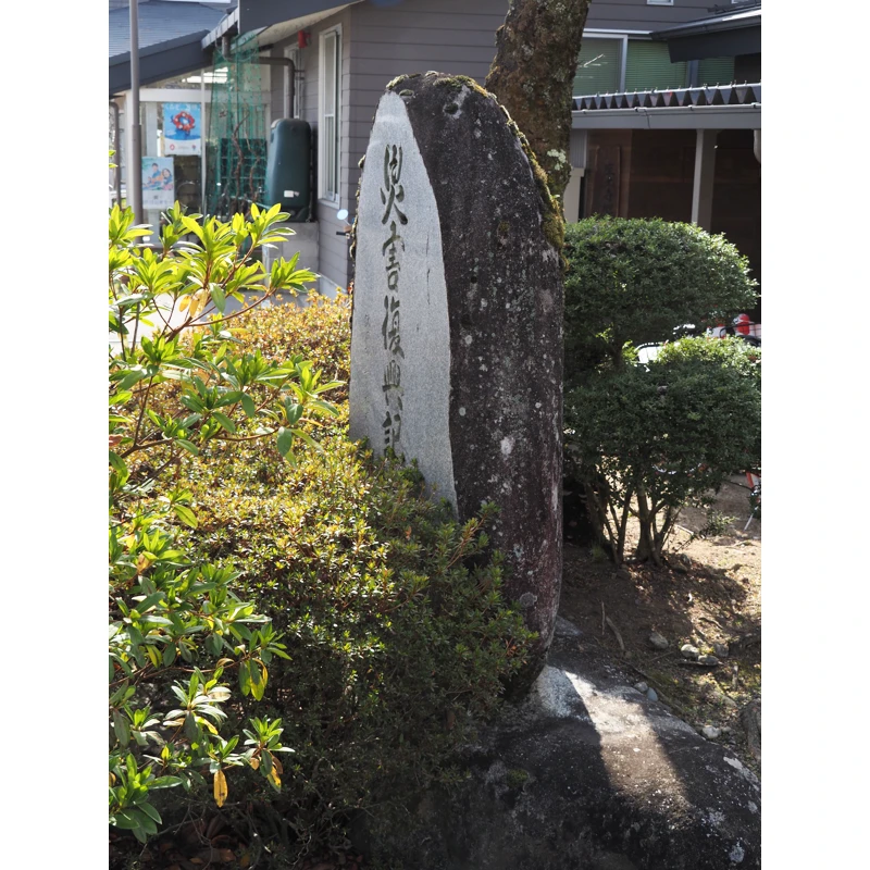
The following is an English translation of the text on the reverse side.
The rain from the rainy season front, which began on 25 June 1961, turned into a torrential downpour from midday on 27 June, causing rivers to overflow, landslides to continue, roads to be cut off, levees to break and the area suddenly became a scene of carnage. Twelve houses were completely destroyed and 42 houses half destroyed or flooded. 100 hectares of fields lost or buried, and 100 hectares land flooded with earth and sand. Electricity was cut off, communications and traffic were disrupted and the area was completely isolated for several days, and elementary, junior high and high schools were temporarily closed for seven days.
Rainfall during this period was recorded at 565 mm and the total damage was estimated at over 1 billion yen. The residents of the district rose up to overcome the disaster out of fear and despair, and the national Government immediately invoked the Disaster Relief Act and the Self-Defense Forces were mobilized, and the whole community worked together to restore the area. Agricultural lands, including Kamigawara and Shimohaba, were restored with 90,000 cubic meters of red soil from the land next to Otsutsumi, Hara. Large and small rivers, roads, bridges and erosion control weirs were completed, and the destroyed forest roads were also restored in good condition.
As a result of the unyielding efforts made over a period of four years at a cost of one billion yen, the locality was restored to its former glory and reconstruction was successfully completed.
It was a blessing in disguise that not a single person was killed in this catastrophe. We erect this monument to commemorate the recovery from the catastrophe and to request that such a catastrophe will not happen again in the future.
November 1965, Zakoji Area Disaster Reconstruction Committee
Let me add some additional information since the place names have been mentioned.
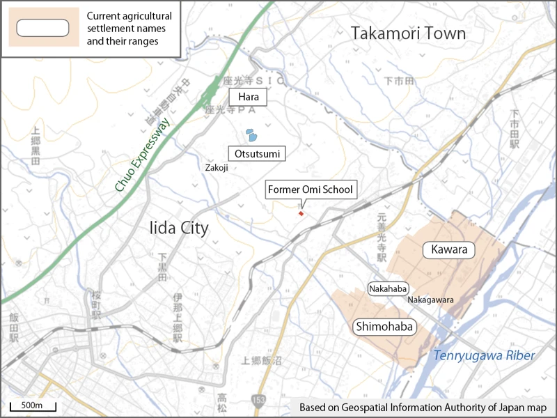
Kamigawara and Shimohaba are areas along the Tenryugawa River. Since “Kamigawara” is not found in the current agricultural settlement names, the map shows the area of “Kawara". (In fact, they also carried sediment to Nakagawara, so the entire area along the Tenryugawa River was probably targeted for restoration.)
The phrase “next to Otsutsumi, Hara” refers to reservoirs in the Hara area, and the two reservoirs that have existed since the Edo period are called Otsutsumi. Soil was taken from the field south of the reservoirs and used to restore farmland. Iida City purchased the site and sold part of it as factory land and subdivided the rest as residential land. This is the current Otsutsutsumi district. Immediately after the disasters in 1961, this area was a wilderness, and “Otsutsumi” as the name of the residential area was created in 1968.
(End of supplement)
Regarding the torrential rain disaster in 1961, I have previously written in this blog about the reconstruction monuments in Takamori Town and Toyooka Village. Since such disaster recovery monuments can be found in various places in Ina Valley, I would like to take another opportunity to check them out little by little.
However, there were some settlements that were forced to migrate en masse. In such settlements, ‘reconstruction monuments’ were not built.
After the disasters in 1961, there were 15 settlements (248 households) where the national and prefectural governments bought up the affected farmland and relocated all the households. The largest of these settlements was 84 households in Shitoku, Nakagawa Village. A monument commemorating the disaster migration has been erected at the site of the village.
I will investigate these in the future.
[Related articles]
“Disaster Reconstruction Monument in Takamori Town" (2022-10-12)
“Disaster Reconstruction Monument in Takamori Town (2)" (2023-06-17)
“Disaster Reconstruction Monument in Takamori Town (3)" (2023-10-30)
“Reconstruction Monuments in Toyooka Village" (2023-11-01)
[Reference]
“Iida City Newsletter." (1st June 2011)
“Zakoji letter" August 2019.