Reconstruction Monuments in Toyooka Village
At the end of my previous article, I mentioned the Sobei Dike in Takamori Town.
This dike was built by order of the Iida clan and completed in 1752 .
While the people on the side where the dike was built were naturally happy, the people on the other side of the river were not so happy.
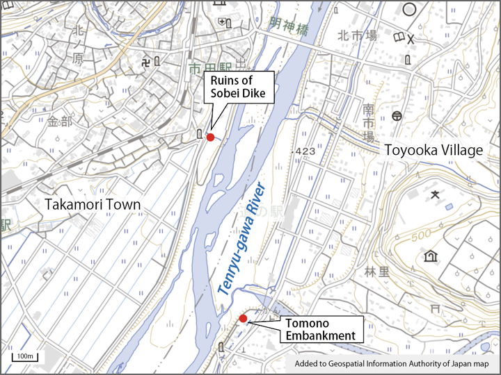
When the Sobei dike was built, the opposite bank was Hayashi Village. A little further downstream was the village of Tomono Village. (Both are now Toyooka Village.)
The torrent that changed direction due to the Sobei dike often caused the embankment in Tomono Village to overflow.
According to the Toyooka Village History (published in 1975), water rebounding from the Sobei dike flowed toward the Tomono Village, often causing the dike to be washed out before the fall harvest. The damage was concentrated in the Tomono area.
'The Sobei dike, which stood firm in the river and did not waver in the face of the waves, may have looked divine from the Ichida side, but from the Tomono side it must have looked like a devil" (p.1226 of the volume 2).
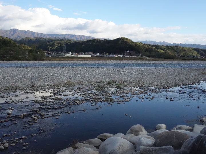
The Tenryu River seen from the Takamori side. Toyooka Village can be seen on the other side.
Now, since I am writing about the “Saburoku Disaster" (the disaster in 1961) this time, let’s go see the monument of the Saburoku Disaster on the Toyooka Village side.
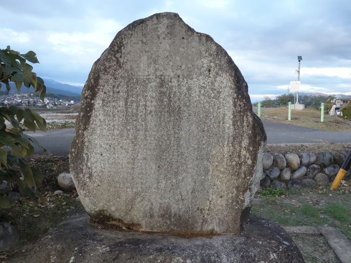
First of all, I came to the Tomono embankment. There are stone monuments near here.
Near the embankment, there is the Tomono Park, where many several monuments have been erected.

There was a reconstruction monument. The inscription shows that it was built by Tomono ward, not Toyooka Village.
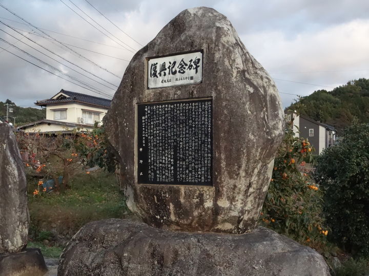
Let me transcribe it here.
“The rainfall caused by the rainy season front that began on June 25, 1961, became an unprecedented torrential downpour, and by the 28th, the rainfall amounted to 600 mm. Mountains collapsed, rivers overflowed, and the muddy waters of the raging Tenryu River rose higher than the embankment. Despite the desperate efforts of the residents of the ward to prevent disaster, the Tomono embankment, which had been in place since the Meiji era, finally broke at 5:10 a.m. on June 28. The collapse of the embankment of the Mibusawa River, the flooding of the Abu River, and countless mountain collapses resulted in the loss and burial of houses and arable land, and the unprecedented loss of two precious human lives. Roads were cut off, communications were disrupted, lights went out, and the days were filled with darkness and fear. The devastation was truly beyond description.
However, with the implementation of the Disaster Relief Law by the national government and the establishment of a rescue system by the prefectural and village authorities, the people of the district were motivated to recovery, and on July 5 of the same year, a recovery committee was formed and took the first steps.
In the two years since then, with the guidance of related organizations, the outstanding skills of the contractors, and the strenuous efforts and cooperation of the ward residents, we have been able to complete a modern reconstruction that is a complete change before the disaster.
This monument is erected to commemorate this unprecedented disaster and to pray that such a disaster will never happen again.
April, 1972, Good Day, Tomono Ward"
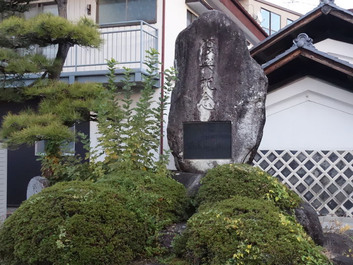
There are other stone monuments in the park.
This monument honors the 'Kaikon-gumi’.
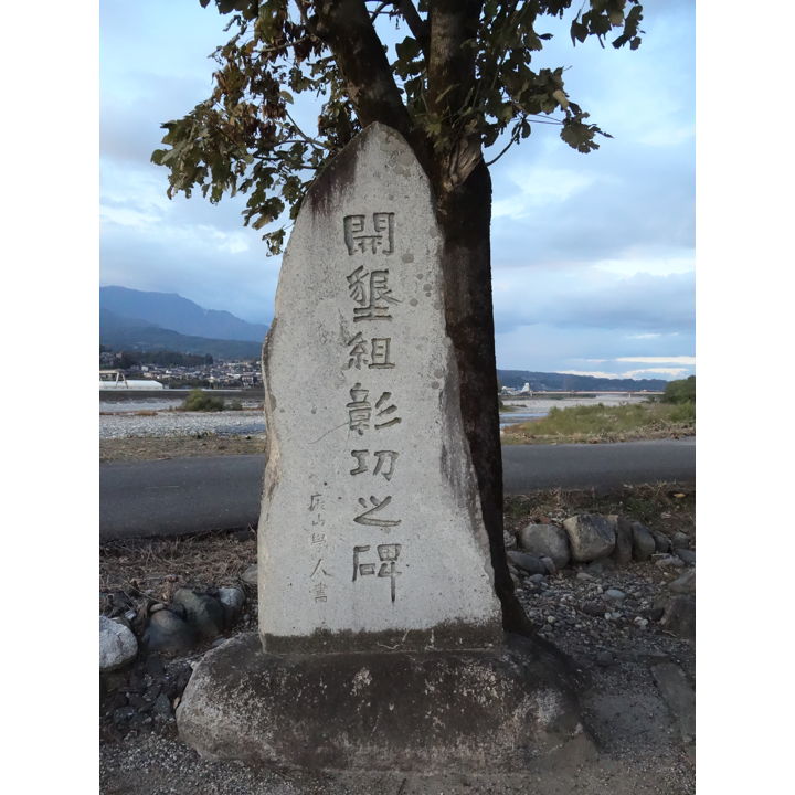
The Kaikon-gumi was formed in 1884 under the leadership of Chifuru Matsuo to rebuild the Tomono Dike and cultivate farmland. 33 people participated in the group’s activities, but the leader, Chifuru Matsuo, died in 1892 at the age of 39. The group continued to build dike, make annual repairs, and reclamate farmland, and was disbanded in 1909 when the project was considered complete.
This monument was erected at the time of the dissolution of the group.
This is the monument to honor Chifuru Matsuo standing in the same park. This monument was built in 1901.
The Tomono Dike, which was completed by the Kaikon-gumi, was washed away by a flood in 1961. The current embankment was constructed in the subsequent reconstruction project.
Let’s move to a different location.
I was told that there is a reconstruction monument on the grounds of the Toyooka Village Community Center, so I checked it out.
The inscription is inscribed on the front of the monument, so I transcribed it.
“In June 1961, a torrential downpour from the rainy season front hit the Ina Valley, killing 3 people and injuring 24, and completely or partially destroying 68 houses and 165 hectares of fields, with total damage amounting to 1.6 billion yen.
However, with the implementation of the Disaster Relief Law, the guidance and assistance of all concerned organizations, and the unyielding efforts of all villagers over a period of four years, the difficult reconstruction project was finally completed, and the devastated area was restored.
This monument is erected to commemorate the recovery from the great disaster and to pray that such a disaster will never happen again.
April 1965, Toyooka Village"
The pine tree on the left side of the monument seems to have been planted as a disaster memorial tree.
This monument was erected in 1965, and at that time here was the Toyooka Village Office.
The gatepost of the village office still remains.
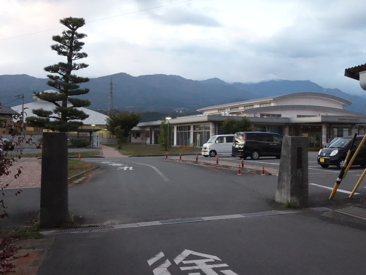
The building at the back of the photo is the library on the left and the community center on the right. On the right, although not shown in the photo, is the Toyooka Village History and Folklore Museum. It was too late in the evening to see inside.
As mentioned in a previous article, the GSI has opened a website called “Natural Disaster Lore Monument (written in Japanese)" since 2020.
Among the stone monuments related to the “Saburoku Disaster" listed there, I was able to check Takamori Town and Toyooka Village by myself.
There are similar stone monuments in other cities, towns, and villages in Ina Village, but for now, this article will be the end of the list.
[Reference]
“Toyooka Village History, Vol. 2" (Toyooka Village History Compilation Committee, ed. 1975)