Pop up card : a church in Namibia
I am making pop-up cards of the buildings in Namibian now.
My plan was to make a few cards and then update the main site, but it doesn’t make much progress because I’m lazy.
So I decided to update the main site when only one card was done.
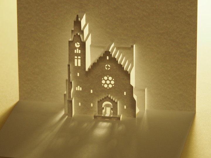
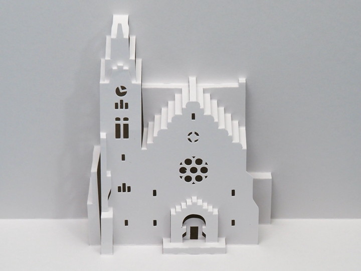
This is the updated pop-up card.
The model is a Christ Church in Windhoek, the capital of Namibia.

Namibia was a German colony from 1884 until World War I.
At the end of the 19th century, the German Empire designated the area that is now Namibia as “German Southwest Africa".
At that time, Namibia was inhabited mainly by pastoralists such as the Nama, Herero, and Damara, and by agro-pastoralists such as the Ovambo.
From the 1890s, German settlers were sent to the area, and they enclosed the land and turned it into farms. In 1897-98, a cattle plague broke out, and the Herero community, which depended on cattle for its livelihood, suffered a major blow, losing more than 90% of its cattle.
A vaccine was developed at the time, but the Germans used the vaccine in favor of chiefs who were cooperative with the colonial authorities, so the gap between those with livestock and those without widened greatly.
In 1904, the Herero rose up against the Germans, but the Germans responded by “killing every Herero". Tens of thousands of Herero were driven into the desert to starve or die of thirst.
The Nama people also rose up, but the Germans sent them to camps in the capital or to camps on Haifish Island, where they were forced to work. (Herero War).
The church on this card was built in the capital at the end of the Herero War; the foundation stone was laid in 1907 and construction completed in 1910.
You can download the pattern if you like.
[Main site]
* Chris Church, Windhoek
[Reference] (written in Japanese)
’53 Chapters to Know Namibia’ (Kazuharu Mizuno and Yoko Nagahara (eds.) / Akashi Shoten / 2016)